Template:Infobox Settlement/testcases
| ここは、Template:Infobox Settlementのサンドボックス・サブページに対応したテンプレート・テストケースです。 右のボタンをクリックするとテストケースが更新されます。 更なる情報とオプション このページに複雑なテンプレートの使用例を多く記述した場合、MediaWikiの制限によりページの終端部周辺で誤動作を起こす可能性があります。この誤動作が発生した場合、発生したページのソースに追加された「NewPP limit report」というコメントを参照してください。
また、特別:テンプレートを展開でテンプレートの使用結果を実験することも出来ます。 このページを表示する外装を変更する: |
サンプル[編集]
記入例[編集]
{{Infobox Settlement
|name  = シティ・オブ・マンチェスター
|native_name = City of Manchester
|nickname = "北の首都", "コットノポリス", "セカンド・シティ", "ウェアハウス"
|settlement_type = [[メトロポリタン・バラ|バラ]] & [[シティ・ステータス (イギリス)|シティ]]
|motto  = "Concilio Et Labore" <small>''"By wisdom and effort"''</small>
|image_skyline = Manchester montage 2012.jpg
|imagesize = 250px
|image_caption = 時計回りに、市街地遠景、[[w:Beetham Tower, Manchester|Beetham Tower]], [[w:Manchester Civil Justice Centre|Manchester Civil Justice Centre]], [[w:Midland Hotel, Manchester|Midland Hotel]], [[w:One Angel Square|One Angel Square]]及び[[w:Manchester Town Hall|Manchester Town Hall]].
|image_shield = Arms of the City of Manchester.svg
|image_map = Manchester UK locator map.svg
|mapsize = 250px
|map_caption = マンチェスターの位置
|subdivision_type = 国
|subdivision_name = {{GBR}}
|subdivision_type1 = [[イギリスのカントリー|カントリー]]
|subdivision_name1 = {{ENG}}
|subdivision_type2 = [[リージョン  (イングランド)|地域]]
|subdivision_name2 = [[ノース・ウェスト・イングランド]]
|subdivision_type3 = [[イングランドの典礼カウンティ|カウンティ]]
|subdivision_name3 = [[グレーター・マンチェスター]]
|subdivision_type4 = 自治機関
|subdivision_name4 = マンチェスター・シティ・センター
|government_type = [[都市バラ]],[[シティ・ステータス (イギリス)|シティ]]
|leader_title = 議会
|leader_name = マンチェスター・シティ・カウンシル
|leader_title1 = 市長
|leader_name1 = マーヴィス・スミスマン
|leader_title2 = [[庶民院 (イギリス)|議員]]
|leader_name2 = Paul Goggins [[労働党 (イギリス)|(労)]]<br />Sir Gerald Kaufman (労)<br />John Leech [[自由民主党 (イギリス)|(自民)]]<br />Tony Lloyd (労)<br />Graham Stringer (労)
|established_title = 定住時期
|established_date = 1世紀
|established_title2 = タウン成立
|established_date2 = 1301年
|established_title3 = シティ認定
|established_date3 = 1853年
|area_total_km2 = 115.65
|population_as_of = {{English statistics year}}
|population_total = 547627
|population_density_km2 = 3815
|population_urban = 2240230
|population_blank1_title = [[グレーター・マンチェスター|カウンティ]]
|population_blank1  = 2547700
|population_density_blank1_km2 = 1997
|population_density_blank1_sq_mi = 5172.2
|population_blank2_title = LUZ
|population_blank2  = 2539100
|population_density_blank2_km2 = 1984
|population_demonym = Mancunian
|latd = 53 |latm = 28 |lats = 0 |latNS = N
|longd = 2 |longm = 14 |longs = 0 |longEW = W
|elevation_m = 78
|elevation_ft = 256
|postal_code_type = 郵便番号
|postal_code = M
|area_code = 0161
|blank_name = 民族構成<br /><small>(2006<ref>Office for National Statistics [http://www.neighbourhood.statistics.gov.uk/dissemination/LeadTableView.do?a=7&b=276778&c=manchester&d=13&e=13&g=351271&i=1001x1003x1004&m=0&r=1&s=1224545252578&enc=1&dsFamilyId=1812]</ref>) </small>
|blank_info = '''76.7%''' 白色人種<br />3.3% 混血人種<br />10.6% 南アジア人種<br />5.3% 黒色人種<br />4.1% 東アジアその他
|blank1_name = [[ISO 3166-2:GB|ISO 3166-2]]
|blank1_info = GB-MAN
|blank2_name = ONS
|blank2_info = 00BN
|blank3_name = NUTS 3
|blank3_info = UKD31
|blank4_name = [[住民の呼称|市民呼称]]
|blank4_info = マンキュニアン<br />(Mancunian)
|website = [http://www.manchester.gov.uk/ www.manchester.gov.uk]
}}
表記例[編集]
| {{Infobox Settlement}} | {{Infobox Settlement/sandbox}} | ||||||||||||||||||||||||||||||||||||||||||||||||||||||||||||||||||||||||||||||||||||||||||||||||||||||||||||||||||||||||||||||||||||||||||||||||||||||||||||||||||||||
|---|---|---|---|---|---|---|---|---|---|---|---|---|---|---|---|---|---|---|---|---|---|---|---|---|---|---|---|---|---|---|---|---|---|---|---|---|---|---|---|---|---|---|---|---|---|---|---|---|---|---|---|---|---|---|---|---|---|---|---|---|---|---|---|---|---|---|---|---|---|---|---|---|---|---|---|---|---|---|---|---|---|---|---|---|---|---|---|---|---|---|---|---|---|---|---|---|---|---|---|---|---|---|---|---|---|---|---|---|---|---|---|---|---|---|---|---|---|---|---|---|---|---|---|---|---|---|---|---|---|---|---|---|---|---|---|---|---|---|---|---|---|---|---|---|---|---|---|---|---|---|---|---|---|---|---|---|---|---|---|---|---|---|---|---|---|---|---|
|
| ||||||||||||||||||||||||||||||||||||||||||||||||||||||||||||||||||||||||||||||||||||||||||||||||||||||||||||||||||||||||||||||||||||||||||||||||||||||||||||||||||||||
Case 0: Linares[編集]
| {{Infobox Settlement}} | {{Infobox Settlement/sandbox}} | ||||||||||||||||||||||||||||||||||||||||||||||||||||||||||||||||||||||||||||||||||||||||||||||||||||||||||||||||||||||||||||||||
|---|---|---|---|---|---|---|---|---|---|---|---|---|---|---|---|---|---|---|---|---|---|---|---|---|---|---|---|---|---|---|---|---|---|---|---|---|---|---|---|---|---|---|---|---|---|---|---|---|---|---|---|---|---|---|---|---|---|---|---|---|---|---|---|---|---|---|---|---|---|---|---|---|---|---|---|---|---|---|---|---|---|---|---|---|---|---|---|---|---|---|---|---|---|---|---|---|---|---|---|---|---|---|---|---|---|---|---|---|---|---|---|---|---|---|---|---|---|---|---|---|---|---|---|---|---|---|---|---|---|
|
| ||||||||||||||||||||||||||||||||||||||||||||||||||||||||||||||||||||||||||||||||||||||||||||||||||||||||||||||||||||||||||||||||
Case 1: Detroit[編集]
| {{Infobox Settlement}} | {{Infobox Settlement/sandbox}} | ||||||||||||||||||||||||||||||||||||||||||||||||||||||||||||||||||||||||||||||||||||||||||||||||||||||||||||||||||||||||||||||||||||||||||||||||||||||||||||||||||||||||||||||||||||
|---|---|---|---|---|---|---|---|---|---|---|---|---|---|---|---|---|---|---|---|---|---|---|---|---|---|---|---|---|---|---|---|---|---|---|---|---|---|---|---|---|---|---|---|---|---|---|---|---|---|---|---|---|---|---|---|---|---|---|---|---|---|---|---|---|---|---|---|---|---|---|---|---|---|---|---|---|---|---|---|---|---|---|---|---|---|---|---|---|---|---|---|---|---|---|---|---|---|---|---|---|---|---|---|---|---|---|---|---|---|---|---|---|---|---|---|---|---|---|---|---|---|---|---|---|---|---|---|---|---|---|---|---|---|---|---|---|---|---|---|---|---|---|---|---|---|---|---|---|---|---|---|---|---|---|---|---|---|---|---|---|---|---|---|---|---|---|---|---|---|---|---|---|---|---|---|---|---|---|---|---|---|
|
| ||||||||||||||||||||||||||||||||||||||||||||||||||||||||||||||||||||||||||||||||||||||||||||||||||||||||||||||||||||||||||||||||||||||||||||||||||||||||||||||||||||||||||||||||||||
Case 2: Ziketan Town[編集]
| {{Infobox Settlement}} | {{Infobox Settlement/sandbox}} | ||||||||||||||||||||||||||||||||||||||||||||||||||||||||||||||||||||||||||||||||
|---|---|---|---|---|---|---|---|---|---|---|---|---|---|---|---|---|---|---|---|---|---|---|---|---|---|---|---|---|---|---|---|---|---|---|---|---|---|---|---|---|---|---|---|---|---|---|---|---|---|---|---|---|---|---|---|---|---|---|---|---|---|---|---|---|---|---|---|---|---|---|---|---|---|---|---|---|---|---|---|---|---|
|
| ||||||||||||||||||||||||||||||||||||||||||||||||||||||||||||||||||||||||||||||||
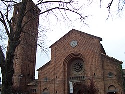
Case 3: Ponte San Giovanni[編集]
| {{Infobox Settlement}} | {{Infobox Settlement/sandbox}} | ||||||||||||||||||||||||||||||||
|---|---|---|---|---|---|---|---|---|---|---|---|---|---|---|---|---|---|---|---|---|---|---|---|---|---|---|---|---|---|---|---|---|---|
|
| ||||||||||||||||||||||||||||||||
Case 4: Gorssel[編集]
| {{Infobox Settlement}} | {{Infobox Settlement/sandbox}} | ||||||||||||||||||||||||||||||||||||||||
|---|---|---|---|---|---|---|---|---|---|---|---|---|---|---|---|---|---|---|---|---|---|---|---|---|---|---|---|---|---|---|---|---|---|---|---|---|---|---|---|---|---|
|
| ||||||||||||||||||||||||||||||||||||||||
Case 5: Herāt[編集]
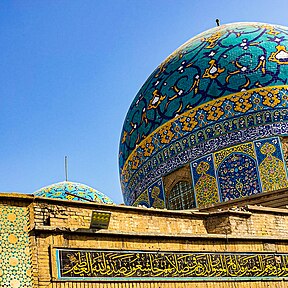
Case 6: Baghdad[編集]
| {{Infobox Settlement}} | {{Infobox Settlement/sandbox}} | ||||||||||||||||||||||||||||||||||||||||||||||||||||||||||||||||||||||||||||||||||||||||||||||||||||||||||||
|---|---|---|---|---|---|---|---|---|---|---|---|---|---|---|---|---|---|---|---|---|---|---|---|---|---|---|---|---|---|---|---|---|---|---|---|---|---|---|---|---|---|---|---|---|---|---|---|---|---|---|---|---|---|---|---|---|---|---|---|---|---|---|---|---|---|---|---|---|---|---|---|---|---|---|---|---|---|---|---|---|---|---|---|---|---|---|---|---|---|---|---|---|---|---|---|---|---|---|---|---|---|---|---|---|---|---|---|---|---|
|
| ||||||||||||||||||||||||||||||||||||||||||||||||||||||||||||||||||||||||||||||||||||||||||||||||||||||||||||
Case 7: Sequim, Washington[編集]
Test multiple pushpin maps
| {{Infobox Settlement}} | {{Infobox Settlement/sandbox}} | ||||||||||||||||||||||||||||||||||||||||||||||||||||||||||||||||||||||||||||||||||||||||||||||||||||||||
|---|---|---|---|---|---|---|---|---|---|---|---|---|---|---|---|---|---|---|---|---|---|---|---|---|---|---|---|---|---|---|---|---|---|---|---|---|---|---|---|---|---|---|---|---|---|---|---|---|---|---|---|---|---|---|---|---|---|---|---|---|---|---|---|---|---|---|---|---|---|---|---|---|---|---|---|---|---|---|---|---|---|---|---|---|---|---|---|---|---|---|---|---|---|---|---|---|---|---|---|---|---|---|---|---|---|
|
| ||||||||||||||||||||||||||||||||||||||||||||||||||||||||||||||||||||||||||||||||||||||||||||||||||||||||
脚注
これらの脚注は記事で表示させることは可能ですが、この一覧はこのページでのみ表示されます。
- ^ Office for National Statistics [1]
- ^ “Municipality of Linares” (スペイン語). 2011年1月1日閲覧。
- ^ a b c “National Statistics Institute” (スペイン語). 2010年1月16日閲覧。
- ^ “Chile Time”. WorldTimeZones.org. 2007年9月11日時点のオリジナルよりアーカイブ。2007年5月5日閲覧。
- ^ “Chile Summer Time”. WorldTimeZones.org. 2007年9月11日時点のオリジナルよりアーカイブ。2007年5月5日閲覧。
- ^ “Detroit – Definition and More from the Free Merriam-Webster Dictionary”. Merriam-webster.com (2007年4月25日). 2010年7月1日閲覧。
- ^ a b c "Detroit". Geographic Names Information System. U.S. Geological Survey. 2009年7月27日閲覧。.
- ^ “2021 U.S. Gazetteer Files”. United States Census Bureau. 2021年11月12日閲覧。
- ^ “QuickFacts: Detroit city, Michigan”. United States Census Bureau. 2021年8月22日閲覧。
- ^ “2020 Population and Housing State Data”. United States Census Bureau. 2021年8月22日閲覧。
- ^ “Archived copy”. 2017年3月12日時点のオリジナルよりアーカイブ。2018年1月25日閲覧。
- ^ “Hadith - Book of Tribulations - Sunan Ibn Majah - Sunnah.com - Sayings and Teachings of Prophet Muhammad (صلى الله عليه و سلم)”. sunnah.com. 2020年11月12日時点のオリジナルよりアーカイブ。2020年12月24日閲覧。
- ^ “Estimated Population of Afghanistan 2021-22”. National Statistic and Information Authority (NSIA) (2021年4月). 2021年6月24日時点のオリジナルよりアーカイブ。2021年6月21日閲覧。
- ^ “Baghdad (Madinat al-Salam)”. Islamic Arts & Architecture (2011年9月13日). 2016年9月16日時点のオリジナルよりアーカイブ。2016年8月23日閲覧。
- ^ Central Statistics Organization Iraq. “Population Projection 2015-2018”. 2020年11月26日時点のオリジナルよりアーカイブ。2020年8月31日閲覧。
- ^ “City Council - Current Members”. City of Sequim. 2019年7月19日閲覧。
- ^ “2019 U.S. Gazetteer Files”. United States Census Bureau. 2020年8月7日閲覧。
- ^ "City and Town Population Totals: 2010-2019". Census.gov. 2022年2月16日. 2023年2月24日閲覧。
- ^ "U.S. Census Bureau QuickFacts: Sequim city, Washington". Census.gov. 2023年. 2023年2月24日閲覧。
- ^ “US Board on Geographic Names”. United States Geological Survey (2007年10月25日). 2012年2月12日時点のオリジナルよりアーカイブ。2008年1月31日閲覧。


