
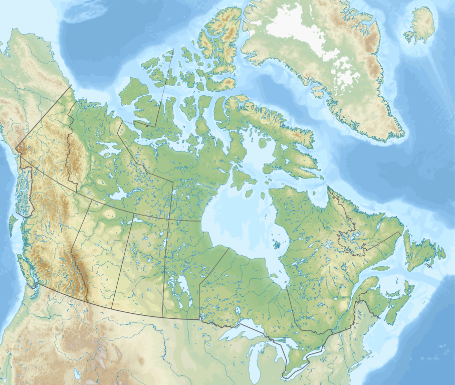
ファイル:Canada relief map 2.svg

この SVG ファイルのこの PNG プレビューのサイズ: 709 × 600 ピクセル. その他の解像度: 284 × 240 ピクセル | 568 × 480 ピクセル | 908 × 768 ピクセル | 1,211 × 1,024 ピクセル | 2,422 × 2,048 ピクセル | 1,114 × 942 ピクセル。
元のファイル (SVG ファイル、1,114 × 942 ピクセル、ファイルサイズ: 1.47メガバイト)
ウィキメディア・コモンズのファイルページにある説明を、以下に表示します。
|
概要
| 解説 | |
| 日付 | |
| 原典 |
投稿者自身による著作物.
|
| 作者 | MapGrid |
| その他のバージョン |
|
| SVG 開発 |


Map Info
| Projection: | Lambert conformal conic |
|---|---|
| Datum: | WGS84 |
| Central Meridian: | 95.000000°W |
| Latitude of Origin: | 60.000000°N |
| Standard Parallel #1: | 49.000000°N |
| Standard Parallel #2: | 77.000000°N |
| x (%)= | 201.7818903*(((tan(pi*(90-$1)/360))*(((1+0.08181919084*sin(pi*$1/180))/(1-0.08181919084*sin(pi*$1/180)))^0.04090959542))^0.9007900864)*sin(0.01572175288*($2+95))+43.98563734
|
|---|---|
| y (%)= | 238.6252927*(((tan(pi*(90-$1)/360))*(((1+0.08181919084*sin(pi*$1/180))/(1-0.08181919084*sin(pi*$1/180)))^0.04090959542))^0.9007900864)*cos(0.01572175288*($2+95))-15.81495465
|
| $1: | latitude in degrees (positive for all locations in Canada). |
| $2: | longitude in degrees (negative for all locations in Canada). |
| x (%): | x coordinate expressed as percentage of image width (measured from left edge). |
| y (%): | y coordinate expressed as percentage of image height (measured from top edge). |
| x (px) | y (px) | x (%) | y (%) | Latitude | Longitude | |
|---|---|---|---|---|---|---|
| Top Left Corner: | 0.000 | 0.000 | 0.00 | 0.00 | 68.220310°N | 176.138684°W |
| Top Right Corner: | 1114.000 | 0.000 | 100.00 | 0.00 | 62.238635°N | 9.994317°W |
| Bottom Right Corner: | 1114.000 | 942.000 | 100.00 | 100.00 | 34.831244°N | 61.953430°W |
| Bottom Left Corner: | 0.000 | 942.000 | 0.00 | 100.00 | 37.392537°N | 121.850536°W |
| Centre: | 557.000 | 471.000 | 50.00 | 50.00 | 63.068962°N | 88.152750°W |
| Origin: | 490.000 | 541.000 | 43.99 | 57.43 | 60.000000°N | 95.000000°W |
| North Pole: | 490.000 | -148.977 | 43.99 | -15.81 | 90.000000°N | ⸻ |
| Thechàl Dhâl: | 67.523 | 368.241 | 6.06 | 39.09 | 61.022873°N | 138.564925°W |
-R-121.85053574/37.39253661/-9.99431686/62.23863537r -JL-95.00000000/60.00000000/49.00000000/77.00000000/29.70666667i |
ライセンス
この作品の著作権者である私は、この作品を以下のライセンスで提供します。
このファイルはクリエイティブ・コモンズ 表示-継承 4.0 国際ライセンスのもとに利用を許諾されています。
- あなたは以下の条件に従う場合に限り、自由に
- 共有 – 本作品を複製、頒布、展示、実演できます。
- 再構成 – 二次的著作物を作成できます。
- あなたの従うべき条件は以下の通りです。
- 表示 – あなたは適切なクレジットを表示し、ライセンスへのリンクを提供し、変更があったらその旨を示さなければなりません。これらは合理的であればどのような方法で行っても構いませんが、許諾者があなたやあなたの利用行為を支持していると示唆するような方法は除きます。
- 継承 – もしあなたがこの作品をリミックスしたり、改変したり、加工した場合には、あなたはあなたの貢献部分を元の作品とこれと同一または互換性があるライセンスの下に頒布しなければなりません。
ファイルの履歴
過去の版のファイルを表示するには、その版の日時をクリックしてください。
| 日付と時刻 | サムネイル | 寸法 | 利用者 | コメント | |
|---|---|---|---|---|---|
| 現在の版 | 2020年12月29日 (火) 17:44 | | 1,114 × 942 (1.47メガバイト) | MapGrid | added an international boundary line between Canada and St Pierre & Miquelon |
| 2020年12月25日 (金) 19:03 |  | 1,114 × 942 (1.47メガバイト) | MapGrid | Christmas Day edition... more rivers | |
| 2020年11月15日 (日) 18:50 |  | 1,114 × 942 (1.47メガバイト) | MapGrid | Uploaded own work with UploadWizard |
ファイルの使用状況
以下の 38 ページがこのファイルを使用しています:
- アトリン湖
- アロー航空1285便墜落事故
- アンティコスティ島
- ウィニペグ
- ウッズ湖
- エドモントン
- オタワ
- オーラビク国立公園
- カンポベロ島
- キャッスルマウンテン
- キール・ピーク
- クイーン・モード湾 (カナダ)
- クッティニルパーク国立公園
- クリー川 (サスカチュワン州)
- クロンダイク (ユーコン準州)
- グレムリン (恐竜)
- グレーシャー国立公園
- ケベック・シティー
- ケベック地震 (2010年)
- サスカトゥーン
- シャーロットタウン
- トール山
- ナナイモ
- バンクーバー (ブリティッシュコロンビア州)
- ビクトリア (ブリティッシュコロンビア州)
- ブルース・ペニンシュラ国立公園
- ブルース原子力発電所
- プライス山 (ブリティッシュコロンビア州)
- ヘクター山 (カナダ)
- ベイカー湖 (ヌナブト準州)
- ホワイトホース (ユーコン準州)
- モントリオール
- レインディア湖
- レジャイナ
- ロイヤルモントリオールゴルフクラブ
- ローガン山
- モジュール:Location map/data/Canada
- モジュール:Location map/data/Canada/doc
グローバルなファイル使用状況
以下に挙げる他のウィキがこの画像を使っています:
- azb.wikipedia.org での使用状況
- ban.wikipedia.org での使用状況
- Taman Nasional Jasper
- Taman Nasional Banff
- Taman Nasional Glétsér (Kanada)
- Taman Nasional Cagar Palemahan Nahanni
- Taman Nasional miwah Cagar Palemahan Kluane
- Taman Nasional Wood Buffalo
- Taman Nasional Gros Morne
- Taman Nasional Aulavik
- Taman Nasional Auyuittuq
- Taman Nasional Grasslands
- Taman Nasional Cagar Palemahan Pagunungan Mealy
- Taman Nasional Samenanjung Bruce
- Taman Nasional Dataran Duur Cape Breton
- Taman Nasional Nusa Élk
- Taman Nasional Forillon
- Taman Nasional Kapuloan Celuk Georgian
- Taman Nasional Ivvavik
- Taman Nasional Cagar Palemahan Kapuloan Celuk
- Taman Nasional Cagar Palemahan Gwaii Haanas miwah Situs Tetamian Haida
- Taman Nasional Kootenay
- Taman Nasional Yoho
- Taman Nasional Sirmilik
- Taman Nasional Cagar Palemahan Lingkeh Pasifik
- Taman Nasional Danu Waterton
- Taman Nasional Cagar Palemahan Thaidene Nëné
- Taman Nasional Kejimkujik
- Taman Nasional La Mauricie
- Taman Nasional Cagar Palemahan Kapuloan Mingan
- Taman Nasional Gunung Revelstoke
- Taman Nasional Cagar Palemahan Náts'ihch'oh
- Taman Nasional Nusa Rajaputra Edward
- Taman Nasional Pukaskwa
- Taman Nasional Qausuittuq
- Taman Nasional Gunung Riding
- Taman Nasional Térra Nova
- Taman Nasional Thousand Islands
- Taman Nasional Pagunungan Torngat
- Taman Nasional Tuktut Nogait
- Lapangan BMO
- bg.wikipedia.org での使用状況
このファイルのグローバル使用状況を表示する。