クンダ (エストニア)
表示
クンダ | |||
|---|---|---|---|
|
町 | |||
| Kunda | |||
|
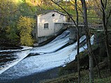
右から、セメント工場、マンション、古いセメント工場跡、パルプ工場、水力発電施設 | |||
| |||
| 国 |
| ||
| 県 |
| ||
| 創立 | 1938年5月1日 | ||
| 政府 | |||
| • 議会多数派 | Kaido Veski (エストニア改革党) | ||
| 面積 | |||
| • 合計 | 9.85 km2 | ||
| 人口 (2017) | |||
| • 合計 | 3,125人 | ||
| • 順位 | 37位 | ||
| • 密度 | 320人/km2 | ||
| 等時帯 | UTC+2 (EET) | ||
| • 夏時間 | UTC+3 (EEST) | ||
| ウェブサイト | www.kunda.ee | ||
クンダ(Kunda)はエストニアのヴィル・ニグラ区にある町。フィンランド湾に面している。パルプ工場(AS Estonian Cell)、セメント工場、港がある。
歴史
[編集]エストニアの先史時代における最古の狩猟採集民集団(紀元前6500年)の生活の痕跡がクンダから見つかっている。この居住地はクンダ文化と名付けられた。
1938年5月1日に公式に自治権を与えられた。
Rutja飛行場施設はクンダの西13km(8.1マイル)に位置し、ソビエトのエストニア占領中にソビエトによって使用された。それ以降、放棄された。
姉妹都市
[編集]気候
[編集]| クンダ (平均 1991–2020、最高・最低 1849-現在)の気候 | |||||||||||||
|---|---|---|---|---|---|---|---|---|---|---|---|---|---|
| 月 | 1月 | 2月 | 3月 | 4月 | 5月 | 6月 | 7月 | 8月 | 9月 | 10月 | 11月 | 12月 | 年 |
| 最高気温記録 °C (°F) | 9.6 (49.3) |
11.1 (52) |
15.8 (60.4) |
27.6 (81.7) |
33.1 (91.6) |
30.9 (87.6) |
33.4 (92.1) |
34.4 (93.9) |
29.0 (84.2) |
21.2 (70.2) |
13.7 (56.7) |
11.8 (53.2) |
34.4 (93.9) |
| 平均最高気温 °C (°F) | −1 (30) |
−1.2 (29.8) |
2.6 (36.7) |
8.8 (47.8) |
14.7 (58.5) |
18.9 (66) |
21.8 (71.2) |
20.9 (69.6) |
16.1 (61) |
9.5 (49.1) |
4.0 (39.2) |
0.9 (33.6) |
9.7 (49.5) |
| 日平均気温 °C (°F) | −3.3 (26.1) |
−4.0 (24.8) |
−0.8 (30.6) |
4.4 (39.9) |
9.8 (49.6) |
14.4 (57.9) |
17.5 (63.5) |
16.5 (61.7) |
12.2 (54) |
6.7 (44.1) |
1.9 (35.4) |
−1.1 (30) |
6.2 (43.2) |
| 平均最低気温 °C (°F) | −5.7 (21.7) |
−6.7 (19.9) |
−4 (25) |
0.8 (33.4) |
5.3 (41.5) |
10.1 (50.2) |
13.2 (55.8) |
12.4 (54.3) |
8.6 (47.5) |
4.0 (39.2) |
−0.2 (31.6) |
−3.2 (26.2) |
2.9 (37.2) |
| 最低気温記録 °C (°F) | −33.1 (−27.6) |
−34.9 (−30.8) |
−27.7 (−17.9) |
−19 (−2) |
−5.3 (22.5) |
−0.2 (31.6) |
2.9 (37.2) |
2.7 (36.9) |
−3.4 (25.9) |
−10.6 (12.9) |
−19.7 (−3.5) |
−34.9 (−30.8) |
−34.9 (−30.8) |
| 降水量 mm (inch) | 38 (1.5) |
29 (1.14) |
27 (1.06) |
29 (1.14) |
41 (1.61) |
68 (2.68) |
61 (2.4) |
76 (2.99) |
54 (2.13) |
61 (2.4) |
52 (2.05) |
38 (1.5) |
573 (22.56) |
| 平均降水日数 (≥1.0 mm) | 9 | 6 | 7 | 7 | 6 | 8 | 9 | 11 | 11 | 11 | 11 | 10 | 105 |
| % 湿度 | 87 | 85 | 80 | 75 | 72 | 76 | 78 | 80 | 81 | 83 | 86 | 86 | 81 |
| 出典:Estonian Weather Service (precipitation days, 1971–2000)[2][3][4][5][6] | |||||||||||||
脚注
[編集]- ^ “International co-operation of Gdynia”. Gdynia.pl. 2016年10月19日時点のオリジナルよりアーカイブ。2016年10月19日閲覧。
- ^ “Climate normals-Temperature”. Estonian Weather Service. 24 February 2021閲覧。
- ^ “Climate normals-Precipitation”. Estonian Weather Service. 24 February 2021閲覧。
- ^ “Climate normals-Humidity”. Estonian Weather Service. 24 February 2021閲覧。
- ^ “Rekordid” (Estonian). Estonian Weather Service. 19 March 2021閲覧。
- ^ “Kliimanormid-Sademed, õhuniiskus” (エストニア語). Estonian Weather Service. 22 February 2012時点のオリジナルよりアーカイブ。24 February 2021閲覧。


