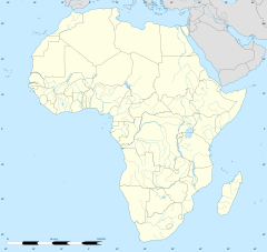
マシンゴ
表示
| マシンゴ Masvingo | |
|---|---|

| |
| 位置 | |
| 座標 : 南緯20度03分45秒 東経30度49分25秒 / 南緯20.06250度 東経30.82361度 | |
| 行政 | |
| 国 | |
| 州 | マシンゴ州 |
| 地区 | マシンゴ地区 |
| 市 | マシンゴ |
| 地理 | |
| 面積 | |
| 市域 | 38 km2 |
| 標高 | 1,075 m |
| 人口 | |
| 人口 | (2013年現在) |
| 市域 | 72,527人 |
| その他 | |
| 等時帯 | 中央アフリカ時間 (UTC+2) |
マシンゴ(英: Masvingo)はジンバブエの都市である。マシンゴ州の州都である。
歴史
[編集]旧称はフォートビクトリア(Fort Victoria)で1982年まで使われていた。
気候
[編集]| マシンゴ (1961–1990, extremes 1951–present)の気候 | |||||||||||||
|---|---|---|---|---|---|---|---|---|---|---|---|---|---|
| 月 | 1月 | 2月 | 3月 | 4月 | 5月 | 6月 | 7月 | 8月 | 9月 | 10月 | 11月 | 12月 | 年 |
| 最高気温記録 °C (°F) | 38.9 (102) |
39.0 (102.2) |
37.2 (99) |
35.1 (95.2) |
34.0 (93.2) |
31.3 (88.3) |
31.2 (88.2) |
34.9 (94.8) |
38.5 (101.3) |
39.5 (103.1) |
39.0 (102.2) |
39.2 (102.6) |
39.5 (103.1) |
| 平均最高気温 °C (°F) | 28.1 (82.6) |
27.4 (81.3) |
26.9 (80.4) |
25.9 (78.6) |
24.1 (75.4) |
21.5 (70.7) |
21.6 (70.9) |
24.4 (75.9) |
27.4 (81.3) |
29.2 (84.6) |
28.7 (83.7) |
28.0 (82.4) |
26.1 (79) |
| 日平均気温 °C (°F) | 22.9 (73.2) |
22.2 (72) |
21.4 (70.5) |
19.4 (66.9) |
16.4 (61.5) |
13.9 (57) |
13.6 (56.5) |
16.2 (61.2) |
19.6 (67.3) |
21.8 (71.2) |
22.9 (73.2) |
22.7 (72.9) |
19.4 (66.9) |
| 平均最低気温 °C (°F) | 17.2 (63) |
16.9 (62.4) |
15.4 (59.7) |
12.7 (54.9) |
8.7 (47.7) |
5.8 (42.4) |
5.4 (41.7) |
7.7 (45.9) |
11.4 (52.5) |
14.8 (58.6) |
16.1 (61) |
17.1 (62.8) |
12.4 (54.3) |
| 最低気温記録 °C (°F) | 9.7 (49.5) |
10.0 (50) |
8.1 (46.6) |
2.4 (36.3) |
0.0 (32) |
−4.6 (23.7) |
−3.6 (25.5) |
−0.3 (31.5) |
2.5 (36.5) |
3.2 (37.8) |
6.3 (43.3) |
8.3 (46.9) |
−4.6 (23.7) |
| 雨量 mm (inch) | 128.7 (5.067) |
107.2 (4.22) |
65.6 (2.583) |
27.9 (1.098) |
12.8 (0.504) |
5.7 (0.224) |
2.7 (0.106) |
6.4 (0.252) |
10.4 (0.409) |
29.6 (1.165) |
77.2 (3.039) |
140.2 (5.52) |
614.4 (24.189) |
| 平均降雨日数 | 10 | 8 | 6 | 3 | 2 | 2 | 1 | 1 | 1 | 3 | 7 | 10 | 54 |
| % 湿度 | 70 | 74 | 71 | 73 | 67 | 65 | 61 | 53 | 47 | 54 | 66 | 71 | 64 |
| 平均月間日照時間 | 248.0 | 207.2 | 244.9 | 243.0 | 266.6 | 249.0 | 263.5 | 285.2 | 279.0 | 260.4 | 228.0 | 217.0 | 2,991.8 |
| 平均日照時間 | 8.0 | 7.4 | 7.9 | 8.1 | 8.6 | 8.3 | 8.5 | 9.2 | 9.3 | 8.4 | 7.6 | 7.0 | 8.2 |
| 出典1:World Meteorological Organization,[1] NOAA (sun and mean temperature, 1961–1990),[2] | |||||||||||||
| 出典2:Deutscher Wetterdienst (humidity, 1968–1974),[3] Meteo Climat (record highs and lows)[4] | |||||||||||||
交通
[編集]空港
[編集]道路
[編集]教育
[編集]姉妹都市
[編集]脚注
[編集]- ^ “World Weather Information Service – Masvingo”. World Meteorological Organization. 13 May 2016閲覧。
- ^ “Masvingo Kutsaga Climate Normals 1961–1990”. National Oceanic and Atmospheric Administration. 10 June 2016閲覧。
- ^ “Klimatafel von Masvingo (Fort Victoria) / Simbabwe” (ドイツ語). Baseline climate means (1961–1990) from stations all over the world. Deutscher Wetterdienst. 10 June 2016閲覧。
- ^ “Station Masvingo” (フランス語). Meteo Climat. 10 June 2016閲覧。


