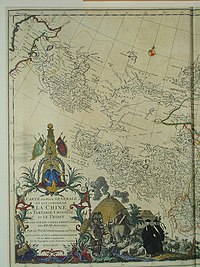
ファイル:CEM-44-La-Chine-la-Tartarie-Chinoise-et-le-Thibet-1734-Amur-2572.jpg

ページのコンテンツが他言語でサポートされていません。

元のファイル(2,492 × 1,872 ピクセル、ファイルサイズ: 1.85メガバイト、MIME タイプ: image/jpeg)

解説
Français : Carte la plus generale et qui comprend la Chine, la Tartarie Chinoise, et le Thibet. Dressee sur les cartes particuliers des RR PP Jesuites, par le Sr. d'Anville..., qui ya joint le pays compris entre Kashgar et la mar Caspienne, tire des geographes et des historiens orientaux
English: A most general map, including China, Chinese Tartary, and Tibet, based on individual maps of the Jesuit fathers. The map gives 1734 as the year, but the modern HKUST publishers say 1737
English: Fragment: Amur River area
"D’Anville’s maps of China were based on a survey of the Chinese empire that was ordered by the emperor in 1708 and carried out by the Chinese, but under the supervision of Jesuit priests resident in China. The detail about the interior of China was far superior to any previous Western map or atlas. D’Anville’s work remained a standard Western source for the geography of China and adjacent regions until well into the 19th century, when it finally was superseded by more accurate maps." — (World Digital Library)
日付 1734, according to the map itself (although the modern publishers say 1737)
原典
English: An antique map from the Special Collection "China in Maps" of the Hong Kong University of Science and Technology Library, reproduced by the HKUST Library in the book "China in European Maps", Hong Kong, 2003. ISBN 962-86403-9-9.
中文:一幅古代的地图从香港科技大学图书馆 ( 地圖中國 - 圖書館特藏展). 在书"China in European Maps", 香港, 2003. ISBN 962-86403-9-9.
Русский: Старинная карта из специальной коллекции Библиотеки Гонконгского научно-технического университета. Опубликована этой библиотекой в книге "China in European Maps" (Китай на европейских картах), Гонконг, 2003. ISBN 962-86403-9-9, тиражом 1000 экз. См. также каталог выставки, Special Collection "China in Maps".
Plate 44
作者
ダンヴィユ  (1697–1782)  wikidata:Q733907 s:en:Author:Jean Baptiste Bourguignon d'Anville q:it:Jean-Baptiste Bourguignon d'Anville
 
ダンヴィユ
別名
ジャン=バティスト・ブルギニョン・ダンヴィル
説明 フランスの 地理学者および地図製作者
生年月日・没年月日 1697年7月11日 ウィキデータを編集 1782年1月28日 ウィキデータを編集
出生地・死没地 パリ パリ
活動拠点
典拠管理
creator QS:P170,Q733907
許可
(ファイルの再利用)
Author died more than 70 years ago - public domain
その他のバージョン

Entire map:

Two halves:

Fragments:


Public domain

この著作物は、著作権の保護期間が著作者の死後100年以下である国・地域においてパブリックドメインの状態にあります。


この著作物がアメリカ合衆国においてパブリックドメインの状態にあることを示すために、アメリカ合衆国のPDタグも貼る必要があります。

注釈
InfoField
この画像には注釈がついています: コモンズで注釈を見る

キャプション

このファイルの内容を1行で記述してください

このファイルに描写されている項目

題材

be3c5de3b93b58765dce33c9cf98f92df8eb8e0b

1,942,549 バイト

1,872 ピクセル

2,492 ピクセル

ファイルの履歴

過去の版のファイルを表示するには、その版の日時をクリックしてください。

日付と時刻サムネイル寸法利用者コメント
現在の版2010年6月7日 (月) 01:072010年6月7日 (月) 01:07時点における版のサムネイル2,492 × 1,872 (1.85メガバイト)Ras67losslessly cropped with Jpegcrop
2009年3月22日 (日) 13:322009年3月22日 (日) 13:32時点における版のサムネイル2,560 × 1,920 (2.07メガバイト)Vmenkov{{Information |Description={{fr|Carte la plus generale et qui comprend la Chine, la Tartarie Chinoise, et le Thibet. Dressee sur les cartes particuliers des RR PP Jesuites, par le Sr. d'Anville..., qui ya joint le pays compris entre Kashgar et la mar Casp

グローバルなファイル使用状況

以下に挙げる他のウィキがこの画像を使っています:

このファイルのグローバル使用状況を表示する。

メタデータ