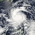
ファイル:Utor Aug 11 2013 0515Z.jpg

このプレビューのサイズ: 480 × 600 ピクセル。 その他の解像度: 192 × 240 ピクセル | 384 × 480 ピクセル | 614 × 768 ピクセル | 819 × 1,024 ピクセル | 1,638 × 2,048 ピクセル | 6,400 × 8,000 ピクセル。
元のファイル (6,400 × 8,000 ピクセル、ファイルサイズ: 12.4メガバイト、MIME タイプ: image/jpeg)
ファイルの履歴
過去の版のファイルを表示するには、その版の日時をクリックしてください。
| 日付と時刻 | サムネイル | 寸法 | 利用者 | コメント | |
|---|---|---|---|---|---|
| 現在の版 | 2015年7月26日 (日) 02:11 |  | 6,400 × 8,000 (12.4メガバイト) | Supportstorm | Reverted to version as of 13:20, 16 August 2013 |
| 2015年7月17日 (金) 23:05 |  | 7,200 × 9,400 (8.7メガバイト) | Nino Marakot | Even of your cropped image, this is i want i said. Stop replacing Supportstorm's Gallery picture. Reverted as of 18:27, 11 August 2013 | |
| 2013年8月16日 (金) 13:20 |  | 6,400 × 8,000 (12.4メガバイト) | Meow | This is directly cropped from the TIFF file with 95% quality. It corrects the centre and ratio, as well as it removes the border lines. | |
| 2013年8月11日 (日) 21:55 |  | 7,200 × 7,200 (10.75メガバイト) | HurricaneSpin | Crop | |
| 2013年8月11日 (日) 18:27 |  | 7,200 × 9,400 (8.7メガバイト) | Supportstorm | Gallery version | |
| 2013年8月11日 (日) 07:18 |  | 8,000 × 8,000 (11.45メガバイト) | HurricaneSpin | Radiance correction (EOSDIS) | |
| 2013年8月11日 (日) 07:12 |  | 8,000 × 8,000 (13.39メガバイト) | HurricaneSpin | {{Information |Description ={{en|1=Typhoon Utor in east of the Philippines on August 11, 2013.}} |Source =[http://rapidfire.sci.gsfc.nasa.gov/realtime] |Author =NASA/MODIS Rapid Response System |Date =2013-08-11 |Permission... |
ファイルの使用状況
以下のページがこのファイルを使用しています:
グローバルなファイル使用状況
以下に挙げる他のウィキがこの画像を使っています:
- de.wikipedia.org での使用状況
- en.wikipedia.org での使用状況
- es.wikipedia.org での使用状況
- fr.wikipedia.org での使用状況
- ko.wikipedia.org での使用状況
- nl.wikipedia.org での使用状況
- pt.wikipedia.org での使用状況
- simple.wikipedia.org での使用状況
- th.wikipedia.org での使用状況
- tl.wikipedia.org での使用状況
- vi.wikipedia.org での使用状況
- zh.wikipedia.org での使用状況


