
ファイル:Limpopo.jpg
このプレビューのサイズ: 800 × 526 ピクセル。 その他の解像度: 320 × 210 ピクセル | 640 × 421 ピクセル | 1,024 × 673 ピクセル | 1,280 × 841 ピクセル | 1,681 × 1,105 ピクセル。
元のファイル (1,681 × 1,105 ピクセル、ファイルサイズ: 533キロバイト、MIME タイプ: image/jpeg)
ウィキメディア・コモンズのファイルページにある説明を、以下に表示します。
|
概要
| Creator | Department of Defense. American Forces Information Service. Defense Visual Information Center. 1994 | |||||||||||||||||||
| タイトル |
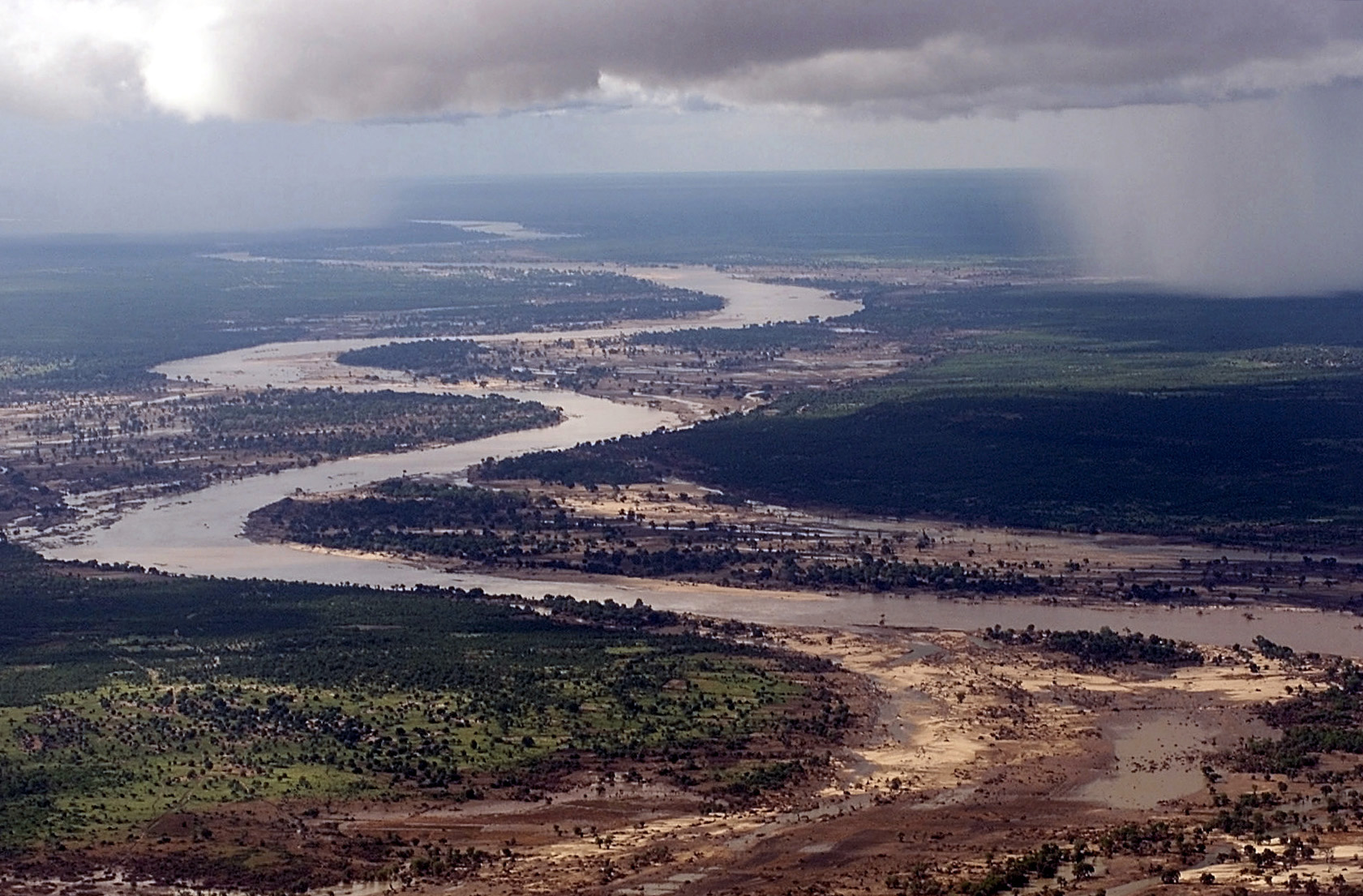
Aerial view, extreme long shot, looking down as the Limpopo River winds its way through Southern Mozambique, where it recently crested its banks and sent floodwaters rushing through towns and farmland, forcing people from their homes and wreaking havoc with the countries infrastructure. Even though waters have receded over the past week, heavy rains seen in the distance, continue to threaten the region with more flooding. C-130 aircraft (not shown), assigned to the 37th Airlift Squadron at Ramstein Air Base, Germany, fly daily Keen Sage aerial surveillance missions over Mozambique to help find stranded flood victims and survey flood levels and damage caused by the flooding in Southern... |
|||||||||||||||||||
| 解説 |
The original finding aid described this photograph as: [Complete] Scene Caption: Aerial view, extreme long shot, looking down as the Limpopo River winds its way through Southern Mozambique, where it recently crested its banks and sent floodwaters rushing through towns and farmland, forcing people from their homes and wreaking havoc with the countries infrastructure. Even though waters have receded over the past week, heavy rains seen in the distance, continue to threaten the region with more flooding. C-130 aircraft (not shown), assigned to the 37th Airlift Squadron at Ramstein Air Base, Germany, fly daily Keen Sage aerial surveillance missions over Mozambique to help find stranded flood victims and survey flood levels and damage caused by the flooding in Southern Africa. The 37th Airlift Squadron C-130 aircraft, are deployed to Hoedspruit Air Force Base, South Africa, as part of the United States Operation Atlas Response, humanitarian relief efforts. Subject Operation/Series: ATLAS RESPONSE Base: Hoedspruit Air Force Base Country: South Africa (ZAF) Scene Camera Operator: TSGT Cary Humphries Release Status: Released to Public |
|||||||||||||||||||
| 日付 | 2000年3月10日 | |||||||||||||||||||
| コレクション |
|
|||||||||||||||||||
| 情報源/撮影者 |
|
|||||||||||||||||||
| 許可 (ファイルの再利用) |
|
|||||||||||||||||||
| Standardized rights statement |
|
|||||||||||||||||||

ファイルの履歴
過去の版のファイルを表示するには、その版の日時をクリックしてください。
| 日付と時刻 | サムネイル | 寸法 | 利用者 | コメント | |
|---|---|---|---|---|---|
| 現在の版 | 2009年8月26日 (水) 20:45 | | 1,681 × 1,105 (533キロバイト) | BetacommandBot | move approved by: User:Angr This image was moved from File:DF-SD-01-00934.jpg Category:Aerial photographs of Mozambique Category:Limpopo River {{Information| |Description={{en|Aerial view, extreme long shot, looking down as the Limpopo |
ファイルの使用状況
グローバルなファイル使用状況
以下に挙げる他のウィキがこの画像を使っています:
- af.wikipedia.org での使用状況
- ar.wikipedia.org での使用状況
- arz.wikipedia.org での使用状況
- ast.wikipedia.org での使用状況
- as.wikipedia.org での使用状況
- azb.wikipedia.org での使用状況
- az.wikipedia.org での使用状況
- ba.wikipedia.org での使用状況
- be-tarask.wikipedia.org での使用状況
- beta.wikiversity.org での使用状況
- be.wikipedia.org での使用状況
- bg.wikipedia.org での使用状況
- bh.wikipedia.org での使用状況
- bn.wikipedia.org での使用状況
- br.wikipedia.org での使用状況
- br.wiktionary.org での使用状況
- ca.wikipedia.org での使用状況
- ceb.wikipedia.org での使用状況
- ckb.wiktionary.org での使用状況
- cs.wikipedia.org での使用状況
- cy.wikipedia.org での使用状況
- de.wikipedia.org での使用状況
- el.wikipedia.org での使用状況
- en.wikipedia.org での使用状況
- en.wikiquote.org での使用状況
- en.wikiversity.org での使用状況
- en.wiktionary.org での使用状況
- eo.wikipedia.org での使用状況
このファイルのグローバル使用状況を表示する。