
ファイル:Ionian Islands.svg

この SVG ファイルのこの PNG プレビューのサイズ: 532 × 547 ピクセル. その他の解像度: 233 × 240 ピクセル | 467 × 480 ピクセル | 747 × 768 ピクセル | 996 × 1,024 ピクセル | 1,992 × 2,048 ピクセル。
元のファイル (SVG ファイル、532 × 547 ピクセル、ファイルサイズ: 281キロバイト)
ウィキメディア・コモンズのファイルページにある説明を、以下に表示します。
|

|
This map has been uploaded by Electionworld from en.wikipedia.org to enable the |
概要
| 解説 |
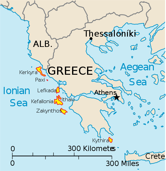
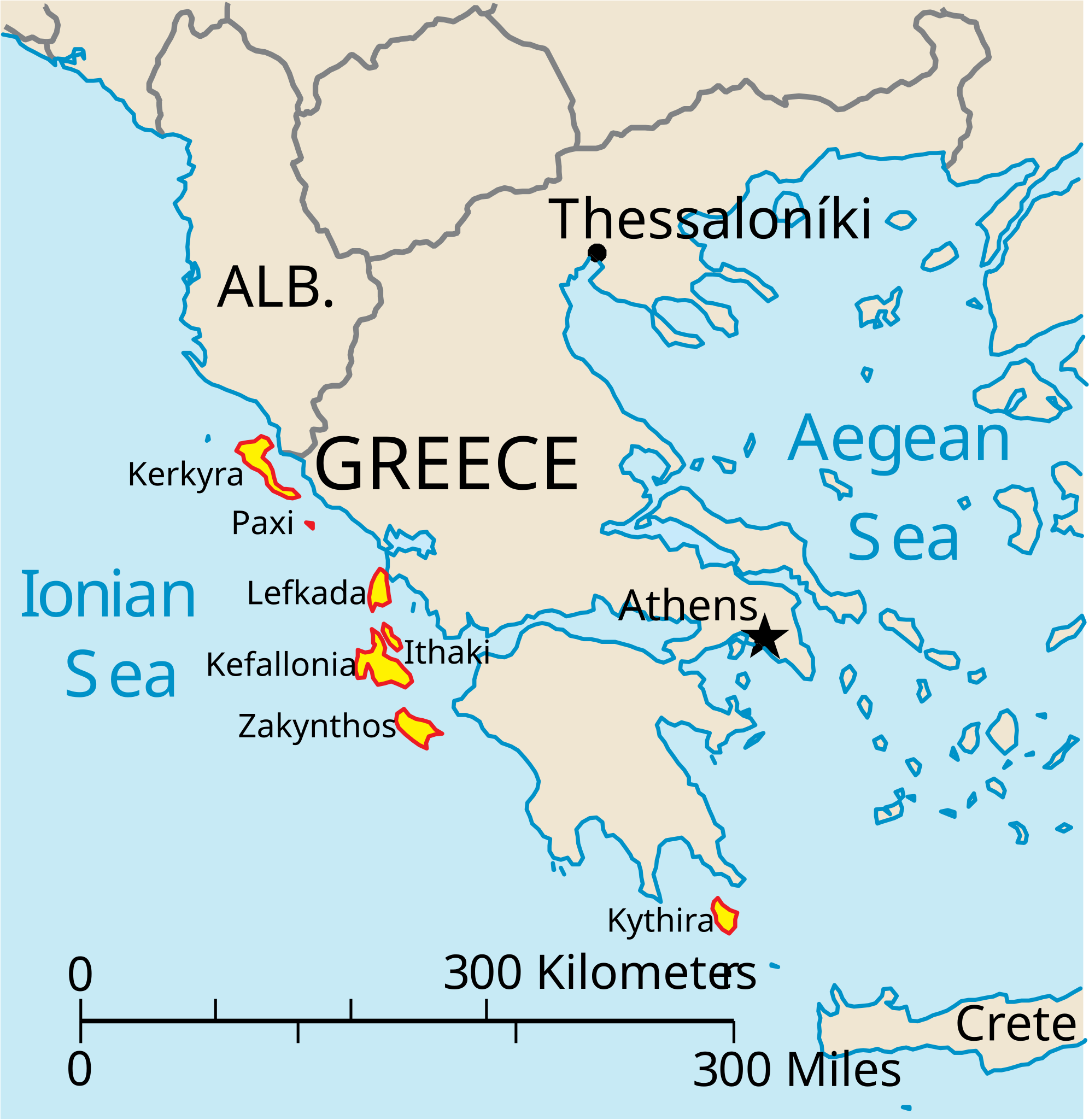
English: Map of the Ionian Islands off Greece. |
| 日付 | |
| 原典 | 投稿者自身による著作物, Original vector data taken from the 2006 CIA World Factbook map of Europe. All modifications were made by me, and are free for anyone to use for any purpose. |
| 作者 | Electionworld |
| その他のバージョン |
Version en français : |
ライセンス
|
|
 |
ファイルの履歴
過去の版のファイルを表示するには、その版の日時をクリックしてください。
| 日付と時刻 | サムネイル | 寸法 | 利用者 | コメント | |
|---|---|---|---|---|---|
| 現在の版 | 2010年4月4日 (日) 14:39 | | 532 × 547 (281キロバイト) | Kmusser | rm Macedonia label, not important to the map and avoids POV issue |
| 2006年12月20日 (水) 20:17 |  | 532 × 547 (258キロバイト) | Electionworld | {{ew|en|IMeowbot}} == Summary == Map of the Ionian Islands off Greece. Original vector data taken from the 2006 CIA World Factbook map of Europe. All modifications were made by me, and are free for anyone to use for any purpose. == Licensing == {{PD-US |
ファイルの使用状況
以下の 4 ページがこのファイルを使用しています:
グローバルなファイル使用状況
以下に挙げる他のウィキがこの画像を使っています:
- ar.wikipedia.org での使用状況
- ast.wikipedia.org での使用状況
- be.wikipedia.org での使用状況
- bg.wikipedia.org での使用状況
- ceb.wikipedia.org での使用状況
- ce.wikipedia.org での使用状況
- cy.wikipedia.org での使用状況
- da.wikipedia.org での使用状況
- de.wikipedia.org での使用状況
- en.wikipedia.org での使用状況
- et.wikipedia.org での使用状況
- fa.wikipedia.org での使用状況
- fi.wikipedia.org での使用状況
- fr.wikipedia.org での使用状況
- he.wikipedia.org での使用状況
- hr.wikipedia.org での使用状況
- hu.wikipedia.org での使用状況
- hyw.wikipedia.org での使用状況
- id.wikipedia.org での使用状況
- it.wikipedia.org での使用状況
このファイルのグローバル使用状況を表示する。