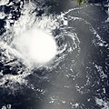
ファイル:Ike 2008-09-12 1705Z.jpg

このプレビューのサイズ: 800 × 600 ピクセル。 その他の解像度: 320 × 240 ピクセル | 640 × 480 ピクセル | 1,024 × 768 ピクセル | 1,280 × 960 ピクセル | 2,560 × 1,920 ピクセル | 5,400 × 4,050 ピクセル。
元のファイル (5,400 × 4,050 ピクセル、ファイルサイズ: 4.57メガバイト、MIME タイプ: image/jpeg)
ファイルの履歴
過去の版のファイルを表示するには、その版の日時をクリックしてください。
| 日付と時刻 | サムネイル | 寸法 | 利用者 | コメント | |
|---|---|---|---|---|---|
| 現在の版 | 2008年9月18日 (木) 17:20 |  | 5,400 × 4,050 (4.57メガバイト) | Ramisses | OOps! Wrong image. |
| 2008年9月18日 (木) 17:12 |  | 4,400 × 4,400 (3.96メガバイト) | Ramisses | {{Information |Description=Hurricane Ike over Gulf of Mexico. Hurricane Ike was a strong Category 2 storm when the Moderate Resolution Imaging Spectroradiometer (MODIS) on NASA’s Terra satellite captured this image at 12:05 p.m. C |
ファイルの使用状況
このファイルを使用しているページはありません。
グローバルなファイル使用状況
以下に挙げる他のウィキがこの画像を使っています:
- de.wikipedia.org での使用状況
- en.wikipedia.org での使用状況
- User talk:Bladeswin
- User talk:AySz88
- User talk:Fableheroesguild
- User talk:Typhoonchaser
- User talk:Ajm81
- User talk:WmE
- User talk:Juan andrés
- User talk:Jamie C
- User talk:Sarsaparilla39
- User talk:Ev-Man
- User talk:Pobbie Rarr
- User talk:Dr Denim
- User talk:WeatherVane
- User:Bob rulz/Hurricane Herald
- User talk:Hurricane-Inu
- User talk:Maverick423
- User:WindRunner/WPTC newsletters
- User talk:Verrai/Archive11/Archive10
- User talk:Hmich176/Archive 3
- User talk:Patricknoddynewaccount
- User talk:Appleworm
- User talk:TheNobleSith
- Wikipedia:WikiProject Tropical cyclones/Newsletter/Archive 21
- User talk:Sd31415/October 2008
- User talk:Yellow Evan/Archive 1
- User talk:Iune/Archive 3
- User talk:Cyclonebiskit/Archive2
- User:Yellow Evan/Arcive 2
- User talk:AstroHurricane001/Archive 25
- User talk:Nightstallion/τ
- User talk:Robomaeyhem/Archive 6
- User talk:The Grid/Archive 4
- User talk:IrfanFaiz/Archive/Archive No.2
- User:Darren23/Ike
- User talk:Icelandic Hurricane/Recent Archive
- fr.wikipedia.org での使用状況


