
ファイル:Enderby Land, Antarctica.jpg

元のファイル (1,750 × 1,300 ピクセル、ファイルサイズ: 465キロバイト、MIME タイプ: image/jpeg)
ウィキメディア・コモンズのファイルページにある説明を、以下に表示します。
|
概要
| 解説 |
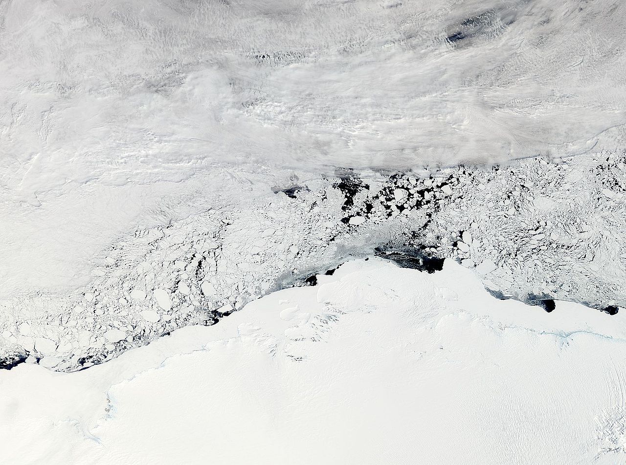
NASA image acquired November 3, 2011 The Moderate Resolution Imaging Spectroradiometer (MODIS) instrument on NASA's Aqua satellite captured this image of Enderby Land, Antarctica on November 3, 2011 at 11:20 UTC (7:20 a.m. EDT). The ice and snow appear bright white at the bottom of the image. Clouds grace the top of the image, and sea ice floats in William Scoresby Bay. Enderby Land is an Antarctic land mass that extends from Shinnan Glacier to William Scoresby Bay. Discovered in 1831, it was named after the Enderby Brothers of London. Operation Ice Bridge is exploring Antarctic ice, and more information can be found at www.nasa.gov/icebridge. Image Credit: NASA Goddard MODIS Rapid Response Team NASA Goddard Space Flight Center enables NASA’s mission through four scientific endeavors: Earth Science, Heliophysics, Solar System Exploration, and Astrophysics. Goddard plays a leading role in NASA’s accomplishments by contributing compelling scientific knowledge to advance the Agency’s mission. |
| 日付 | |
| 原典 |
NASA Satellite Sees Enderby Land, Antarctica
|
| 作者 | NASA Goddard Space Flight Center from Greenbelt, MD, USA |
ライセンス
- あなたは以下の条件に従う場合に限り、自由に
- 共有 – 本作品を複製、頒布、展示、実演できます。
- 再構成 – 二次的著作物を作成できます。
- あなたの従うべき条件は以下の通りです。
- 表示 – あなたは適切なクレジットを表示し、ライセンスへのリンクを提供し、変更があったらその旨を示さなければなりません。これらは合理的であればどのような方法で行っても構いませんが、許諾者があなたやあなたの利用行為を支持していると示唆するような方法は除きます。
| このファイルはアメリカ航空宇宙局(NASA)によって作成されたものです。NASAの著作権の方針では、特記事項が無い場合、NASAの資料はパブリックドメインとなります。 (詳しくはTemplate:PD-USGov、NASAの著作権の方針について(英語)又はジェット推進研究所(JPL)の画像使用に関するガイドライン(英語)をご覧ください。) |
||
 |
注意事項:
|
| 当初、Flickrに投稿されたこの画像は、November 8, 2011に管理者又は画像査読者のFile Upload Bot (Magnus Manske)によって査読され、その時点で、Flickr上で記載されたライセンスの下で利用可能であることが確認されました。 |
ファイルの履歴
過去の版のファイルを表示するには、その版の日時をクリックしてください。
| 日付と時刻 | サムネイル | 寸法 | 利用者 | コメント | |
|---|---|---|---|---|---|
| 現在の版 | 2011年11月8日 (火) 03:34 | | 1,750 × 1,300 (465キロバイト) | File Upload Bot (Magnus Manske) | {{Information |Description=NASA image acquired November 3, 2011 The Moderate Resolution Imaging Spectroradiometer (MODIS) instrument on NASA's Aqua satellite captured this image of Enderby Land, Antarctica on November 3, 2011 at 11:20 UTC (7:20 a.m. EDT) |
ファイルの使用状況
以下のページがこのファイルを使用しています:
グローバルなファイル使用状況
以下に挙げる他のウィキがこの画像を使っています:
- ar.wikipedia.org での使用状況
- arz.wikipedia.org での使用状況
- bg.wikipedia.org での使用状況
- ca.wikipedia.org での使用状況
- ceb.wikipedia.org での使用状況
- ce.wikipedia.org での使用状況
- de.wikipedia.org での使用状況
- en.wikipedia.org での使用状況
- eo.wikipedia.org での使用状況
- eu.wikipedia.org での使用状況
- he.wikipedia.org での使用状況
- ארץ אנדרבי
- הרי טולה
- תבנית:הרי טולה
- הרי נייפייר
- תבנית:הרי נייפייר
- הר אלקינס
- הר דנהאם (אנטארקטיקה)
- הר המפסון
- הר קייזר
- הר ריידר
- הר קינג (אנטארקטיקה, הרי טולה)
- הר סוקק
- רכס פיקוק (אנטארקטיקה)
- הר הארדי (אנטארקטיקה)
- הר אולדפילד (אנטארקטיקה)
- פסגת פיתגורס
- הר סטורר
- הר ריסר-לארסן
- הר פורטאוס
- הר ברטלט (אנטארקטיקה, ארץ אנדרבי)
- הר הארווי (אנטארקטיקה)
- נונאטאקי יאנג
- הר מילר (ארץ אנדרבי)
- הר מוריסון (ארץ אנדרבי)
- הר בסט
- נונאטאקי הארווי
- הר דאנג'י
- הר דגרפלדט
- הר רודס (אנטארקטיקה)
- הר בונד (אנטארקטיקה)
- hi.wikipedia.org での使用状況
- hy.wikipedia.org での使用状況
- it.wikipedia.org での使用状況
- mk.wikipedia.org での使用状況
- nl.wikipedia.org での使用状況
- nn.wikipedia.org での使用状況
- pl.wikipedia.org での使用状況
このファイルのグローバル使用状況を表示する。