
ファイル:Caithness UK location map.svg

この SVG ファイルのこの PNG プレビューのサイズ: 519 × 599 ピクセル. その他の解像度: 208 × 240 ピクセル | 416 × 480 ピクセル | 665 × 768 ピクセル | 887 × 1,024 ピクセル | 1,773 × 2,048 ピクセル | 1,233 × 1,424 ピクセル。
元のファイル (SVG ファイル、1,233 × 1,424 ピクセル、ファイルサイズ: 1.29メガバイト)
ウィキメディア・コモンズのファイルページにある説明を、以下に表示します。
|
| 解説 |
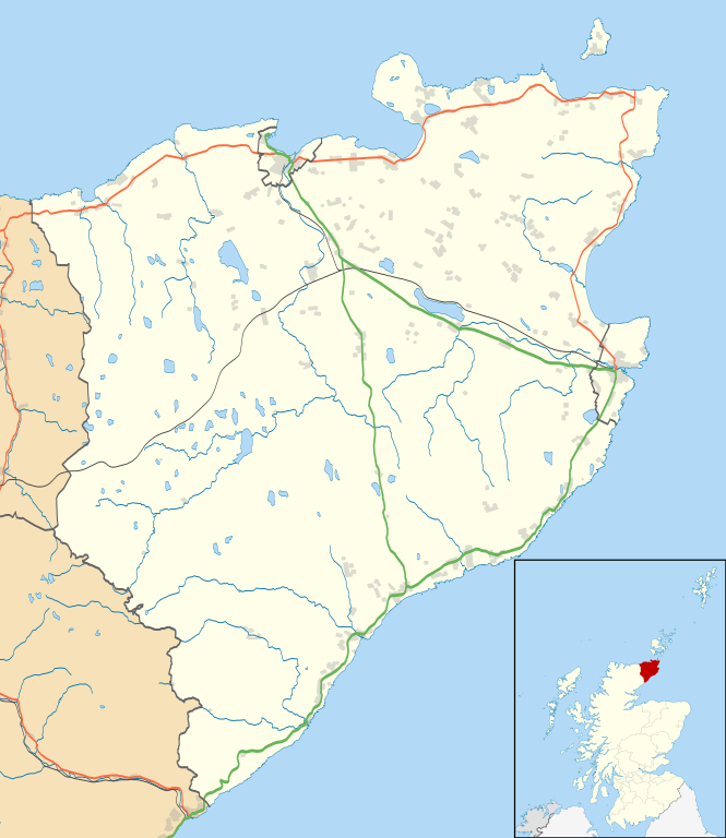
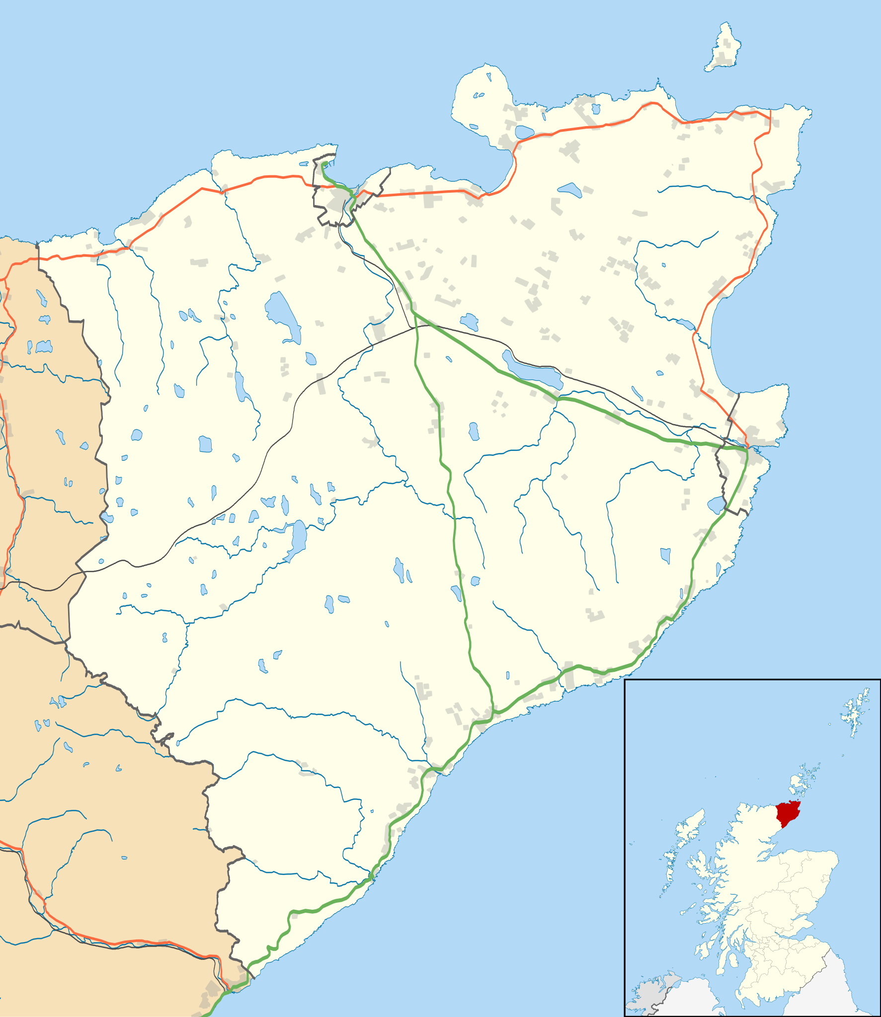
Blank map of the Caithness ward management area, UK in 2011, with the following information shown:
Equirectangular map projection on WGS 84 datum, with N/S stretched 180% Geographic limits:
|
| 日付 | |
| 原典 |
|
| 作者 | Nilfanion, created using Ordnance Survey data |
| 許可 (ファイルの再利用) |
このファイルはクリエイティブ・コモンズ 表示-継承 3.0 非移植ライセンスのもとに利用を許諾されています。 帰属: Contains Ordnance Survey data © Crown copyright and database right
|
| その他のバージョン | File:Caithness UK blank map.svg - Blank map |
ファイルの履歴
過去の版のファイルを表示するには、その版の日時をクリックしてください。
| 日付と時刻 | サムネイル | 寸法 | 利用者 | コメント | |
|---|---|---|---|---|---|
| 現在の版 | 2011年2月10日 (木) 11:11 | | 1,233 × 1,424 (1.29メガバイト) | Nilfanion | {{Information |Description=Blank map of the Caithness ward management area, UK in 2011, with the following information shown: *Ward boundaries *Coastline, lakes and rivers *Roads and railways *Urban areas Equirectangular map projection on |
ファイルの使用状況
以下の 4 ページがこのファイルを使用しています:
グローバルなファイル使用状況
以下に挙げる他のウィキがこの画像を使っています:
- ar.wikipedia.org での使用状況
- ceb.wikipedia.org での使用状況
- en.wikipedia.org での使用状況
- Castle of Mey
- Thurso
- Halkirk
- Latheronwheel
- Castletown, Highland
- Haster
- Dunnet
- Latheron
- Caithness General Hospital
- Georgemas
- Reay
- Watten, Highland
- Altnabreac
- Achreamie
- Ackergill
- Skarfskerry
- Lybster
- Nybster
- Fresgoe
- Dunbeath
- Scrabster
- Ackergill Tower
- Bilbster
- Borgue, Highland
- Staxigoe
- Brabsterdorran
- Braemore
- Broubster
- Ulbster
- Bower, Highland
- Gillock
- Freswick
- Thrumster, Caithness
- Ham, Caithness
- Huna, Caithness
- Whaligoe
- Auckengill
- Achvarasdal
- Achingills
- Bruan
- Buldoo
- Balnabruich
- Papigoe
- Houstry
- Keiss
- Swiney
- Dorrery
このファイルのグローバル使用状況を表示する。