
ファイル:Younghusband PekingToYarkand Map.jpg
このプレビューのサイズ: 800 × 307 ピクセル。 その他の解像度: 320 × 123 ピクセル | 640 × 245 ピクセル | 1,024 × 392 ピクセル | 2,346 × 899 ピクセル。
元のファイル (2,346 × 899 ピクセル、ファイルサイズ: 660キロバイト、MIME タイプ: image/jpeg)
ウィキメディア・コモンズのファイルページにある説明を、以下に表示します。
|
概要
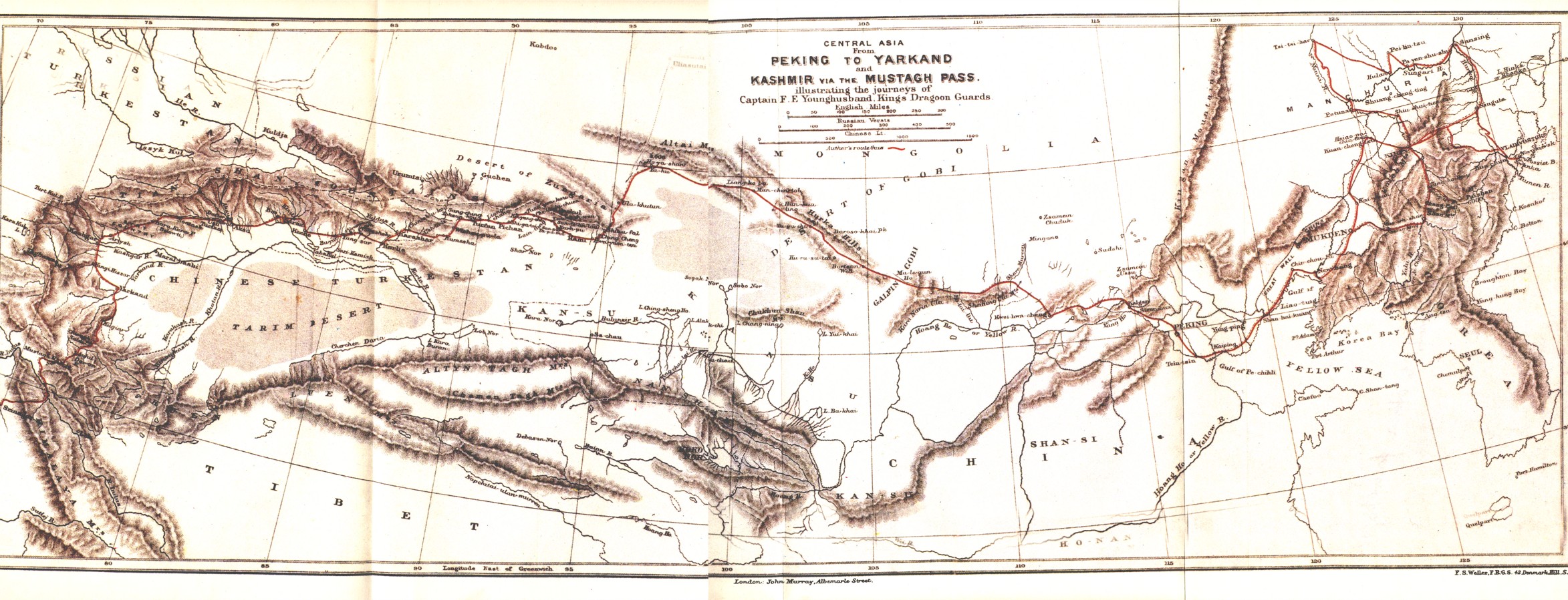
| 解説 | A map showing the route of Frank E Younghusband on his trip from Beijing to Kashmir. |
| 日付 | |
| 原典 | The Heart of a Continent, A narrative of travels in Manchuria, across the Gobie Desart, Through the Himalayas, the Pamirs, And Chitral, 1884 - 1894. |
| 作者 | John Murray |
ライセンス
|
この著作物は、著作権の保護期間が著作者の死後70年以下である国・地域においてパブリックドメインの状態にあります。
| |
| このファイルは著作権法の既知の制約(隣接権や関連する権利を含む)から自由であると特定されています。 | |
| 注釈 | この画像には注釈がついています: コモンズで注釈を見る |
ファイルの履歴
過去の版のファイルを表示するには、その版の日時をクリックしてください。
| 日付と時刻 | サムネイル | 寸法 | 利用者 | コメント | |
|---|---|---|---|---|---|
| 現在の版 | 2008年12月24日 (水) 20:33 | 2,346 × 899 (660キロバイト) | Keithonearth | {{Information |Description=A map showing the route of Frank E Younghusband on his trip from Beijing to Kashmir. |Source=The Heart of a Continent, A narrative of travels in Manchuria, across the Gobie Desart, Through the Himalayas, the Pamirs, And Chitral, |
ファイルの使用状況
以下のページがこのファイルを使用しています:
グローバルなファイル使用状況
以下に挙げる他のウィキがこの画像を使っています:
- az.wikipedia.org での使用状況
- bg.wikipedia.org での使用状況
- de.wikipedia.org での使用状況
- en.wikipedia.org での使用状況
- incubator.wikimedia.org での使用状況
- it.wikipedia.org での使用状況
- no.wikipedia.org での使用状況
- ro.wikipedia.org での使用状況
- ru.wikipedia.org での使用状況