
ファイル:Newriverwatershed-1-.jpg

このプレビューのサイズ: 464 × 599 ピクセル。 その他の解像度: 186 × 240 ピクセル | 372 × 480 ピクセル | 595 × 768 ピクセル | 793 × 1,024 ピクセル | 1,415 × 1,826 ピクセル。
元のファイル (1,415 × 1,826 ピクセル、ファイルサイズ: 511キロバイト、MIME タイプ: image/jpeg)
ウィキメディア・コモンズのファイルページにある説明を、以下に表示します。
|
概要
| 解説 |
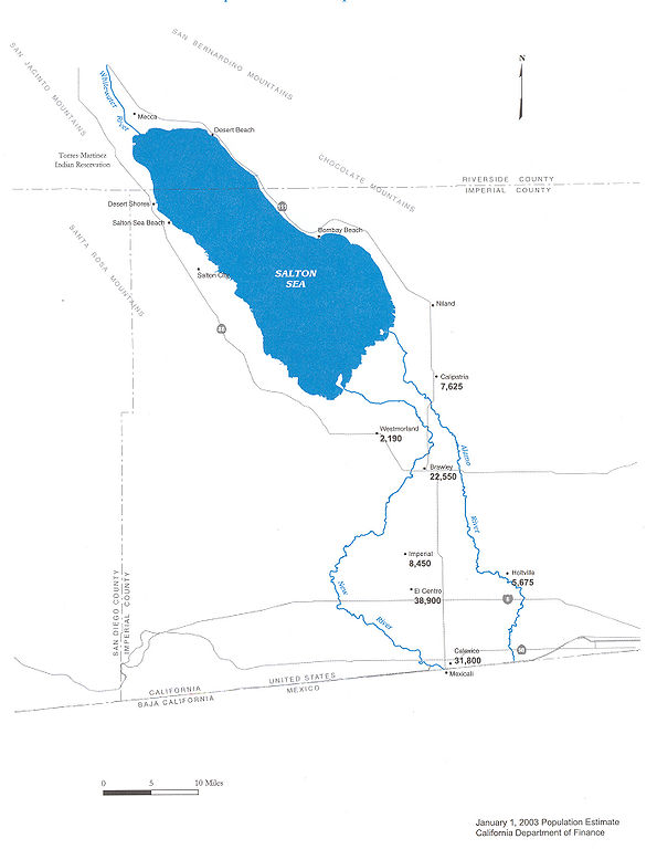
Map of the New River — in Imperial County, Southern California.
|
| 日付 | |
| 原典 | Department of Water Resources |
| 作者 | DWR |
| 許可 (ファイルの再利用) |
Public use |


ライセンス

|
この作品の著作権者は、あらゆる人に対し、無制約の再配布、商用利用及び改変を含むあらゆる目的でこの作品を利用することを認めます。
注意
|
ファイルの履歴
過去の版のファイルを表示するには、その版の日時をクリックしてください。
| 日付と時刻 | サムネイル | 寸法 | 利用者 | コメント | |
|---|---|---|---|---|---|
| 現在の版 | 2006年5月20日 (土) 09:29 | | 1,415 × 1,826 (511キロバイト) | Cnrc | {{Information| |Description=From Mexicali to the Salton Sea, Communities Are at Risk Surface water in the New River is contaminated with metals, pesticides, VOC's, and bacteria. Pathogenic viruses have also been reported in the New River. Human exposur |
ファイルの使用状況
以下のページがこのファイルを使用しています:
グローバルなファイル使用状況
以下に挙げる他のウィキがこの画像を使っています:
- ar.wikipedia.org での使用状況
- arz.wikipedia.org での使用状況
- ceb.wikipedia.org での使用状況
- de.wikipedia.org での使用状況
- en.wikipedia.org での使用状況
- eo.wikipedia.org での使用状況
- es.wikipedia.org での使用状況
- fr.wikipedia.org での使用状況
- he.wikipedia.org での使用状況
- ml.wikipedia.org での使用状況
- pt.wikipedia.org での使用状況
- ru.wikipedia.org での使用状況
- simple.wikipedia.org での使用状況
- www.wikidata.org での使用状況