
ファイル:PlanoMontevideoSitioGrande.JPG
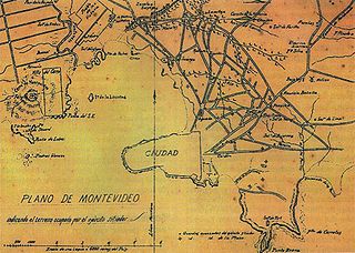
このプレビューのサイズ: 800 × 569 ピクセル。 その他の解像度: 320 × 228 ピクセル | 640 × 455 ピクセル | 924 × 657 ピクセル。
元のファイル (924 × 657 ピクセル、ファイルサイズ: 147キロバイト、MIME タイプ: image/jpeg)
ウィキメディア・コモンズのファイルページにある説明を、以下に表示します。
|
概要
| 解説 |
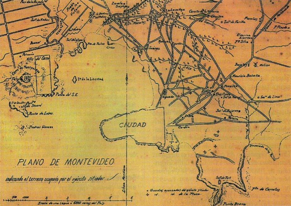
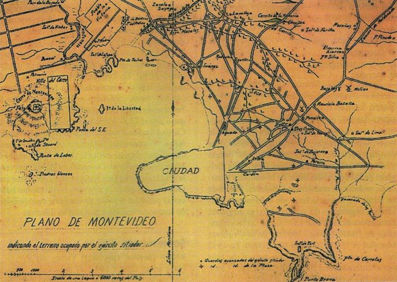
English: Former map of Montevideo (Uruguay) and surrounding towns (now converted into neighborhoods of the city), developed during the called Guerra Grande (Great War, 1843 - 1851), where the demarcation area occupied by the siege army of Montevideo.
Español: Mapa antiguo de Montevideo y pueblos aledaños (Pueblo de la Victoria, actual barrio de La Teja, y el hoy también barrio de Villa del Cerro) donde se indica el territorio ocupado por el ejército sitiador de Montevideo en el transcurso de la Guerra Grande. |
|||
| 日付 | Entre 1843 y 1851 (Período temporal de duración de la Guerra Grande) | |||
| 原典 | Digitalizado del libro Gran Enciclopedia del Uruguay | |||
| 作者 | 不明 | |||
| その他のバージョン |
|

ライセンス
|
この著作物は、著作権の保護期間が著作者の死後70年以下である国・地域においてパブリックドメインの状態にあります。
| |
| このファイルは著作権法の既知の制約(隣接権や関連する権利を含む)から自由であると特定されています。 | |
ファイルの履歴
過去の版のファイルを表示するには、その版の日時をクリックしてください。
| 日付と時刻 | サムネイル | 寸法 | 利用者 | コメント | |
|---|---|---|---|---|---|
| 現在の版 | 2008年7月17日 (木) 22:15 | | 924 × 657 (147キロバイト) | Uruguayo-92 | {{Information |Description={{en|1=Former map of Montevideo (Uruguay) and surrounding towns (now converted into neighborhoods of the city), developed during the called ''Guerra Grande'' (Great War, 1843 - 1851), where the demarcation area occupied by the s |
ファイルの使用状況
このファイルを使用しているページはありません。
グローバルなファイル使用状況
以下に挙げる他のウィキがこの画像を使っています:
- de.wikipedia.org での使用状況
- en.wikipedia.org での使用状況
- es.wikipedia.org での使用状況
- ru.wikipedia.org での使用状況