
ファイル:UTC hue4map USA-IN.svg

この SVG ファイルのこの PNG プレビューのサイズ: 391 × 599 ピクセル. その他の解像度: 156 × 240 ピクセル | 313 × 480 ピクセル | 501 × 768 ピクセル | 668 × 1,024 ピクセル | 1,337 × 2,048 ピクセル | 2,887 × 4,423 ピクセル。
元のファイル (SVG ファイル、2,887 × 4,423 ピクセル、ファイルサイズ: 61キロバイト)
ウィキメディア・コモンズのファイルページにある説明を、以下に表示します。
|
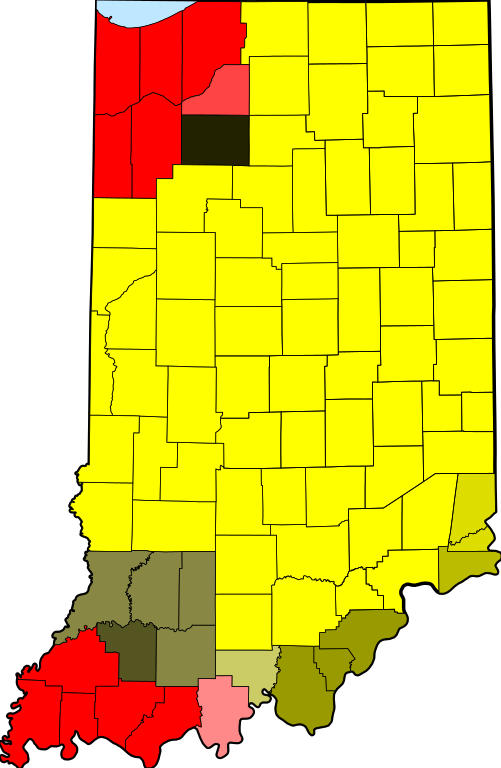
| 解説 | tz database zones for the US state of Indiana |
| 日付 | (UTC) |
| 原典 | |
| 作者 |
|
| この画像には画像編集が施されています。原本に対してデジタル的な変更が行われました。
|
この作品の著作権者である私は、この作品を以下のライセンスで提供します。
| この著作物の著作権者である私は、この著作物における権利を放棄しパブリックドメインとします。これは全世界で適用されます。 一部の国では、これが法的に可能ではない場合があります。その場合は、次のように宣言します。 私は、あらゆる人に対して、法により必要とされている条件を除き、如何なる条件も課すことなく、あらゆる目的のためにこの著作物を使用する権利を与えます。 |
元のアップロードログ
This image is a derivative work of the following images:
- File:Map_of_Indiana_highlighting_Adams_County.svg licensed with PD-self
- 2006-02-12T12:34:48Z David Benbennick 2887x4423 (56998 Bytes) {{subst:User:Dbenbenn/clm|county=Adams County|state=Indiana|type=county}}
Uploaded with derivativeFX
ファイルの履歴
過去の版のファイルを表示するには、その版の日時をクリックしてください。
| 日付と時刻 | サムネイル | 寸法 | 利用者 | コメント | |
|---|---|---|---|---|---|
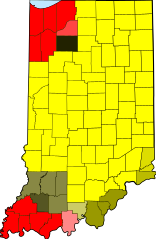
| 現在の版 | 2013年12月14日 (土) 18:22 | | 2,887 × 4,423 (61キロバイト) | Rcsprinter123 | Lake Michigan blue |
| 2013年4月23日 (火) 13:41 |  | 2,887 × 4,423 (57キロバイト) | Nyttend | From the beginning, this map has shown the tz database's zones, making any division erroneous | |
| 2013年4月21日 (日) 01:40 |  | 2,887 × 4,423 (57キロバイト) | TimeZoneEditor | Reverted to version as of 03:49, 31 May 2012 | |
| 2012年8月16日 (木) 16:05 |  | 2,887 × 4,423 (57キロバイト) | Nyttend backup | From the beginning, this map has shown the tz database's zones, and the database doesn't make a distinction for the two sides of the 1961 line. | |
| 2012年5月31日 (木) 03:49 |  | 2,887 × 4,423 (57キロバイト) | TimeZoneEditor | Reverted to version as of 02:16, 31 May 2012, The IANA version is named "IANA" and located at File:UTC hue4map USA-IN IANA.svg | |
| 2012年5月31日 (木) 03:14 |  | 2,887 × 4,423 (57キロバイト) | Nyttend | No reason to upload a map of a different subject at this name; maps showing different things should be uploaded with different filenames | |
| 2012年5月31日 (木) 02:16 |  | 2,887 × 4,423 (57キロバイト) | TimeZoneEditor | This is not an IANA specific map. | |
| 2012年1月24日 (火) 06:11 |  | 2,887 × 4,423 (57キロバイト) | Nyttend | This map shows the tz database's zones, and the database doesn't make a distinction for the two sides of the 1961 line. | |
| 2012年1月24日 (火) 06:09 |  | 2,887 × 4,423 (58キロバイト) | MarcusBritish | Match yellows per request at Wiki Graphic Lab. | |
| 2011年10月9日 (日) 10:39 |  | 2,887 × 4,423 (57キロバイト) | TZ master | change colors to better show 1961 divide |
ファイルの使用状況
以下のページがこのファイルを使用しています:
グローバルなファイル使用状況
以下に挙げる他のウィキがこの画像を使っています:
- bn.wikipedia.org での使用状況
- ceb.wikipedia.org での使用状況
- el.wikipedia.org での使用状況
- en.wikipedia.org での使用状況
- es.wikipedia.org での使用状況
- fa.wikipedia.org での使用状況
- fr.wikipedia.org での使用状況
- id.wikipedia.org での使用状況
- ilo.wikipedia.org での使用状況
- sco.wikipedia.org での使用状況
- ur.wikipedia.org での使用状況
- zh.wikipedia.org での使用状況