
ファイル:USACE Great Salt Plains Dam.jpg
このプレビューのサイズ: 800 × 528 ピクセル。 その他の解像度: 320 × 211 ピクセル | 640 × 422 ピクセル | 1,024 × 676 ピクセル | 1,500 × 990 ピクセル。
元のファイル (1,500 × 990 ピクセル、ファイルサイズ: 206キロバイト、MIME タイプ: image/jpeg)
ウィキメディア・コモンズのファイルページにある説明を、以下に表示します。
|
| 解説 |
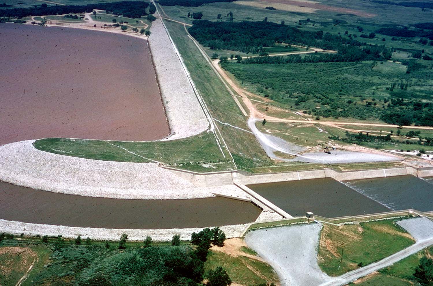
English: Aerial view of Great Salt Plains Lake Dam on the Salt Fork Arkansas River in Alfalfa County, Oklahoma, USA. The dam was constructed by the U.S. Army Corps of Engineers for flood control and water storage. The Great Salt Plains State Park surrounds the dam. View is to the northwest.
Coordinates: 36°44′54.15″N 98°8′20.64″W / 36.748375°N 98.1390667°W |
|||
| 場所 | Alfalfa County, Oklahoma, USA | |||
| 日付 | ||||
| 原典 |
U.S. Army Corps of Engineers Digital Visual Library Image page Image description page Digital Visual Library home page |
|||
| 作者 | Cheryl Payton, U.S. Army Corps of Engineers | |||
| 許可 (ファイルの再利用) |
|
ファイルの履歴
過去の版のファイルを表示するには、その版の日時をクリックしてください。
| 日付と時刻 | サムネイル | 寸法 | 利用者 | コメント | |
|---|---|---|---|---|---|
| 現在の版 | 2007年5月6日 (日) 16:35 | | 1,500 × 990 (206キロバイト) | DanMS | {{Information | Description = {{en|Aerial view of Great Salt Plains Lake Dam on the Salt Fork Arkansas River in Alfalfa County, Oklahoma, USA. The dam was constructed by the U.S. Army Corps of Engineers for flood control and water storage. The Great Sa |
ファイルの使用状況
以下のページがこのファイルを使用しています:
グローバルなファイル使用状況
以下に挙げる他のウィキがこの画像を使っています:
- en.wikipedia.org での使用状況
- es.wikipedia.org での使用状況
- www.wikidata.org での使用状況