
ファイル:Two Harbors Minnesota aerial view.jpg
このプレビューのサイズ: 800 × 560 ピクセル。 その他の解像度: 320 × 224 ピクセル | 640 × 448 ピクセル | 1,024 × 717 ピクセル | 1,280 × 896 ピクセル | 1,500 × 1,050 ピクセル。
元のファイル (1,500 × 1,050 ピクセル、ファイルサイズ: 674キロバイト、MIME タイプ: image/jpeg)
ウィキメディア・コモンズのファイルページにある説明を、以下に表示します。
|
| 解説 |
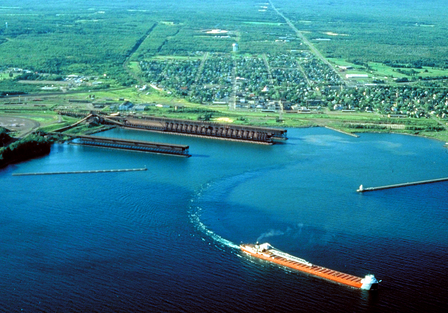
English: Aerial view of Two Harbors, Minnesota, on the north shore of Lake Superior. Taken sometime before March, 2007 and appears to be from the 1990s or early 2000s. As depicted in the photo, a Great lakes freighter is departing the harbor. |
|||
| 日付 | not specified or unknown. The photo was originally uploaded on 30 March 2007, though judging by the view and visuals of the photo and its bright and old fashioned visuals, the photo date appears to be sometime in the mid-late 1990s or early-2000s. Photo date is before 2007, but it was likely taken sometime in the 1990s or early 2000s. | |||
| 原典 |
U.S. Army Corps of Engineers Digital Visual Library Image page Image description page Digital Visual Library home page |
|||
| 作者 | U.S. Army Corps of Engineers, photographer not specified or unknown | |||
| 許可 (ファイルの再利用) |
|
|||
| 場所 | Two Harbors, Lake County, Minnesota, USA |
| カメラの位置 | | 以下のサービスでこの位置を確認する: オープンストリートマップ |
|---|
ファイルの履歴
過去の版のファイルを表示するには、その版の日時をクリックしてください。
| 日付と時刻 | サムネイル | 寸法 | 利用者 | コメント | |
|---|---|---|---|---|---|
| 現在の版 | 2007年3月30日 (金) 03:30 | | 1,500 × 1,050 (674キロバイト) | DanMS | {{Information | Description = {{en|Aerial view of Two Harbors, Minnesota, on the north shore of Lake Superior. A Great lakes freighter is departing the harbor.}} | Source = U.S. Army Corps of Engineers Digital Visual Library<br />[http://images |
ファイルの使用状況
以下のページがこのファイルを使用しています:
グローバルなファイル使用状況
以下に挙げる他のウィキがこの画像を使っています:
- ar.wikipedia.org での使用状況
- arz.wikipedia.org での使用状況
- azb.wikipedia.org での使用状況
- ca.wikipedia.org での使用状況
- ceb.wikipedia.org での使用状況
- ce.wikipedia.org での使用状況
- de.wikipedia.org での使用状況
- en.wikipedia.org での使用状況
- en.wikivoyage.org での使用状況
- es.wikipedia.org での使用状況
- eu.wikipedia.org での使用状況
- fa.wikipedia.org での使用状況
- fr.wikipedia.org での使用状況
- he.wikipedia.org での使用状況
- ht.wikipedia.org での使用状況
- hu.wikipedia.org での使用状況
- lld.wikipedia.org での使用状況
- pl.wikipedia.org での使用状況
- pt.wikipedia.org での使用状況
- ru.wikipedia.org での使用状況
- sh.wikipedia.org での使用状況
- sr.wikipedia.org での使用状況
- sv.wikipedia.org での使用状況
- tt.wikipedia.org での使用状況
- uk.wikipedia.org での使用状況
- uz.wikipedia.org での使用状況
- vi.wikipedia.org での使用状況
- www.wikidata.org での使用状況
- zh-min-nan.wikipedia.org での使用状況
- zh.wikipedia.org での使用状況