
ファイル:Tremont Street Subway.jpg
このプレビューのサイズ: 800 × 556 ピクセル。 その他の解像度: 320 × 222 ピクセル | 640 × 444 ピクセル | 1,024 × 711 ピクセル | 1,152 × 800 ピクセル。
元のファイル (1,152 × 800 ピクセル、ファイルサイズ: 587キロバイト、MIME タイプ: image/jpeg)
ウィキメディア・コモンズのファイルページにある説明を、以下に表示します。
|
| 解説 |
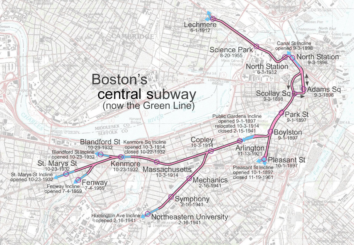
English: Tremont Street Subway in Boston, Massachusetts
Corrections:
|
| 日付 | |
| 原典 | 投稿者自身による著作物 |
| 作者 | User:SPUI |
| この著作物は、著作者であるSPUIによって権利が放棄され、パブリックドメインとされました。これは全世界で適用されます。 一部の国では、これが法的に可能ではない場合があります。その場合は、次のように宣言します。 |
ファイルの履歴
過去の版のファイルを表示するには、その版の日時をクリックしてください。
| 日付と時刻 | サムネイル | 寸法 | 利用者 | コメント | |
|---|---|---|---|---|---|
| 現在の版 | 2020年6月13日 (土) 05:21 | | 1,152 × 800 (587キロバイト) | Dicklyon | Relabel for the full scope: central subway, not just Tremont Street subway |
| 2005年5月13日 (金) 06:03 |  | 1,152 × 800 (311キロバイト) | SPUI~commonswiki | {{spuimap}} Tremont Street Subway, Boston category:Boston subwaycategory:railroad maps |
ファイルの使用状況
以下の 4 ページがこのファイルを使用しています:
グローバルなファイル使用状況
以下に挙げる他のウィキがこの画像を使っています:
- de.wikipedia.org での使用状況
- en.wikipedia.org での使用状況
- fr.wikipedia.org での使用状況
- www.wikidata.org での使用状況