
ファイル:Teterboro airport diagram.svg

この SVG ファイルのこの PNG プレビューのサイズ: 391 × 600 ピクセル. その他の解像度: 156 × 240 ピクセル | 313 × 480 ピクセル | 500 × 768 ピクセル | 667 × 1,024 ピクセル | 1,335 × 2,048 ピクセル | 500 × 767 ピクセル。
元のファイル (SVG ファイル、500 × 767 ピクセル、ファイルサイズ: 581キロバイト)
ウィキメディア・コモンズのファイルページにある説明を、以下に表示します。
|
| 解説 |
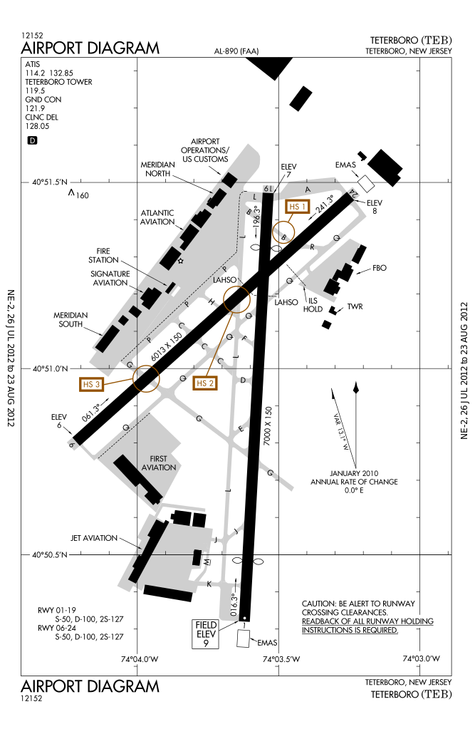
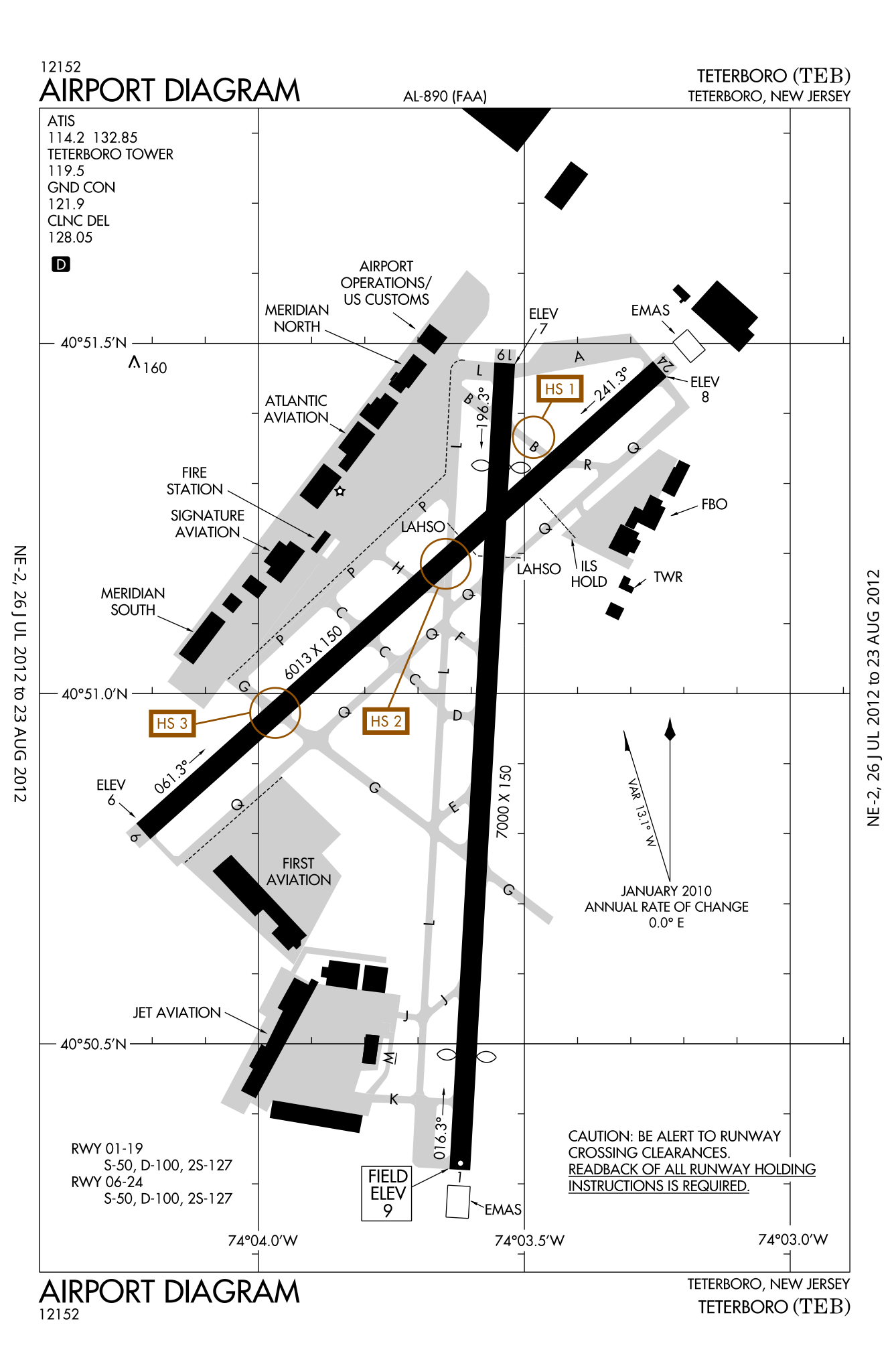
English: FAA airport diagram for Teterboro Airport (TEB) in Teterboro, New Jersey, United States |
|||
| 日付 | Effective 2012-07-26 to 2012-08-23 | |||
| 原典 |
[1] Note that this URL changes every 28 days; the airport article should contain a link to the current FAA diagram. |
|||
| 作者 | Produced by the National Aeronautical Charting Office (NACO), a department of the Federal Aviation Administration (FAA) | |||
| 許可 (ファイルの再利用) |
|

ファイルの履歴
過去の版のファイルを表示するには、その版の日時をクリックしてください。
| 日付と時刻 | サムネイル | 寸法 | 利用者 | コメント | |
|---|---|---|---|---|---|
| 現在の版 | 2012年7月31日 (火) 05:23 | | 500 × 767 (581キロバイト) | Renamed user KdYpUvMgT | size |
| 2012年7月31日 (火) 05:14 |  | 387 × 594 (581キロバイト) | Renamed user KdYpUvMgT | {{Information |Description ={{en|1=FAA airport diagram for Teterboro Airport (TEB) in Teterboro, New Jersey, United States}} |Source =[http://aeronav.faa.gov/d-tpp/1208/00890AD.PDF]<br />Note that this URL changes [... |
ファイルの使用状況
以下のページがこのファイルを使用しています:
グローバルなファイル使用状況
以下に挙げる他のウィキがこの画像を使っています:
- en.wikipedia.org での使用状況
- id.wikipedia.org での使用状況
- it.wikipedia.org での使用状況
- no.wikipedia.org での使用状況
- ur.wikipedia.org での使用状況