
ファイル:St Lucie Inlet aerial view.jpg
このプレビューのサイズ: 800 × 504 ピクセル。 その他の解像度: 320 × 202 ピクセル | 640 × 403 ピクセル | 1,024 × 645 ピクセル | 1,500 × 945 ピクセル。
元のファイル (1,500 × 945 ピクセル、ファイルサイズ: 120キロバイト、MIME タイプ: image/jpeg)
ウィキメディア・コモンズのファイルページにある説明を、以下に表示します。
|
| 解説 |
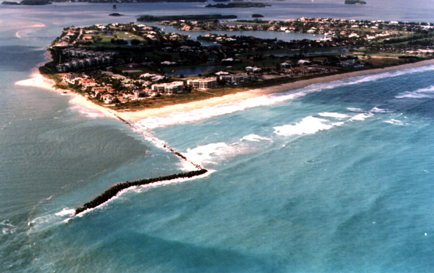
English: Aerial view of Sailfish Point and the St. Lucie Inlet in Martin County, Florida, USA. The inlet is an entrance from the Atlantic Ocean to the Indian River Lagoon and the St. Lucie River. View is to the northwest from over the Atlantic Ocean.
Coordinates: 27°9′58″N 80°9′24″W / 27.16611°N 80.15667°W |
|||
| 場所 | マーティン郡 | |||
| 日付 | not specified or unknown | |||
| 原典 |
U.S. Army Corps of Engineers Digital Visual Library Image page Image description page Digital Visual Library home page |
|||
| 作者 | Tony Santana, U.S. Army Corps of Engineers | |||
| 許可 (ファイルの再利用) |
|
ファイルの履歴
過去の版のファイルを表示するには、その版の日時をクリックしてください。
| 日付と時刻 | サムネイル | 寸法 | 利用者 | コメント | |
|---|---|---|---|---|---|
| 現在の版 | 2007年4月27日 (金) 03:20 | | 1,500 × 945 (120キロバイト) | DanMS | {{Information | Description = {{en|Aerial view of St. Lucie Inlet in Martin County, Florida, USA. The inlet is an entrance from the Atlantic Ocean to the Indian River Lagoon and the city of Port St. Lucie. View is to the northwest from over the Atlanti |
ファイルの使用状況
以下のページがこのファイルを使用しています:
グローバルなファイル使用状況
以下に挙げる他のウィキがこの画像を使っています:
- ar.wikipedia.org での使用状況
- ca.wikipedia.org での使用状況
- ceb.wikipedia.org での使用状況
- ce.wikipedia.org での使用状況
- en.wikipedia.org での使用状況
- es.wikipedia.org での使用状況
- eu.wikipedia.org での使用状況
- fa.wikipedia.org での使用状況
- fr.wikipedia.org での使用状況
- it.wikipedia.org での使用状況
- lld.wikipedia.org での使用状況
- pl.wikipedia.org での使用状況
- pt.wikipedia.org での使用状況
- ru.wikipedia.org での使用状況
- sr.wikipedia.org での使用状況
- tr.wikipedia.org での使用状況
- tt.wikipedia.org での使用状況
- uk.wikipedia.org での使用状況
- uz.wikipedia.org での使用状況
- www.wikidata.org での使用状況
- zh-min-nan.wikipedia.org での使用状況