
ファイル:Pizzigano.jpg
このプレビューのサイズ: 800 × 505 ピクセル。 その他の解像度: 320 × 202 ピクセル | 640 × 404 ピクセル | 1,024 × 646 ピクセル | 1,280 × 808 ピクセル | 2,560 × 1,616 ピクセル | 4,360 × 2,752 ピクセル。
元のファイル (4,360 × 2,752 ピクセル、ファイルサイズ: 3.35メガバイト、MIME タイプ: image/jpeg)
ウィキメディア・コモンズのファイルページにある説明を、以下に表示します。
|
概要
| 解説 |
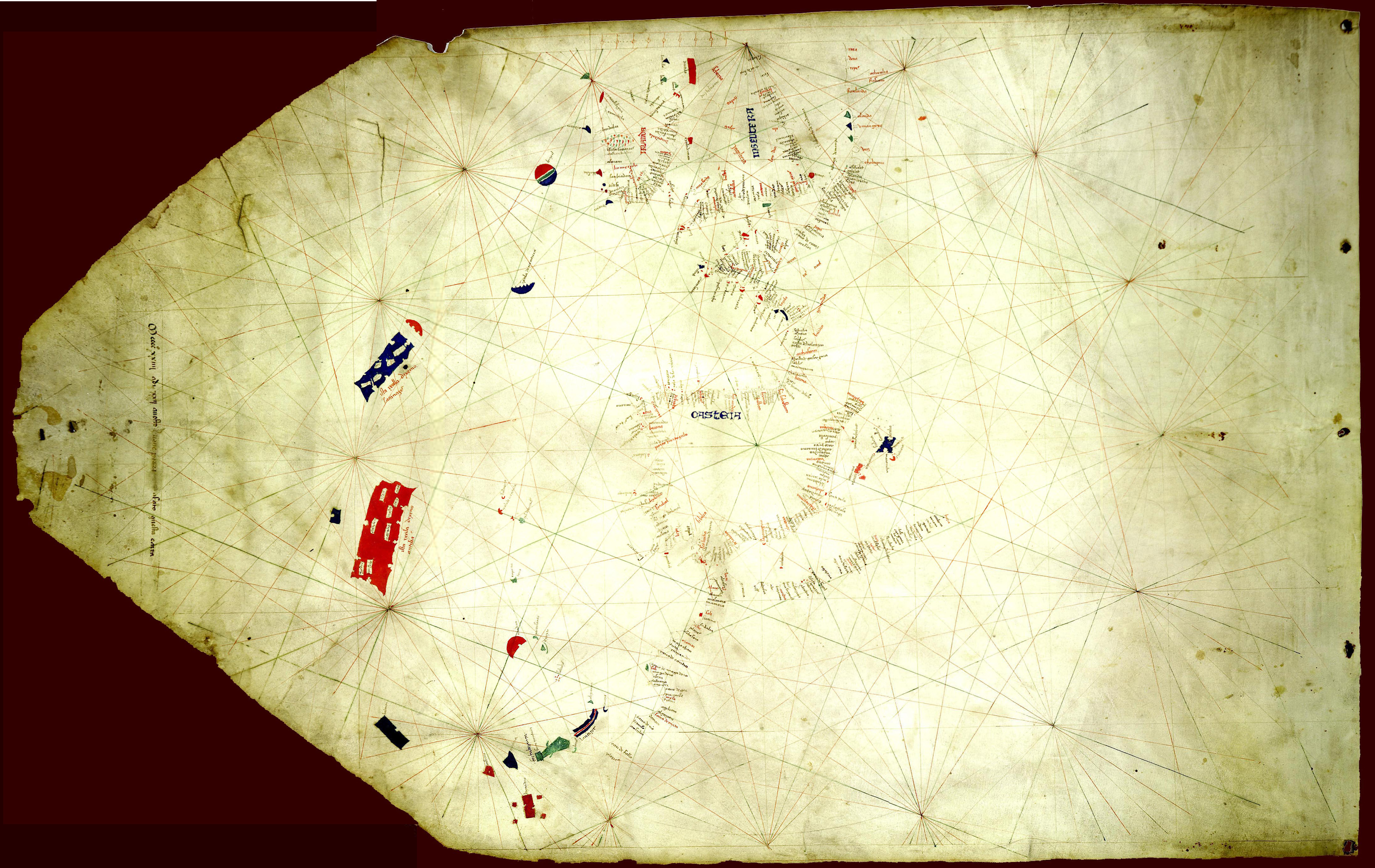
English: The Pizzigano map, also known as the Pizzigano chart is an Italian portolan chart dated 1424. It contains islands in the North Atlantic Ocean in the west of Spain and Portugal including Portuguese discoveries and legendary islands such as Antillia. The cartographer may have been the Venetian Zuane Pizigano, possibly a descendant of a 14th century family of mapmakes one of whom authored another well known map also called the Pizziagano map in Parma in 1367 |
| 日付 | |
| 原典 | University of Minnesota Libraries 8 gemonteerde screenshots. 投稿者自身による著作物 |
| 作者 | Pizzigiano, Zuane & XpoferenS |
| その他のバージョン | このファイルの派生的著作物: Pizzigano 1424 map (Antilia islands detail).JPG |
.JPG)
ライセンス
| この著作物の著作権者である私は、この著作物における権利を放棄しパブリックドメインとします。これは全世界で適用されます。 一部の国では、これが法的に可能ではない場合があります。その場合は、次のように宣言します。 私は、あらゆる人に対して、法により必要とされている条件を除き、如何なる条件も課すことなく、あらゆる目的のためにこの著作物を使用する権利を与えます。 |
ファイルの履歴
過去の版のファイルを表示するには、その版の日時をクリックしてください。
| 日付と時刻 | サムネイル | 寸法 | 利用者 | コメント | |
|---|---|---|---|---|---|
| 現在の版 | 2014年11月20日 (木) 09:37 | | 4,360 × 2,752 (3.35メガバイト) | Joop Rotte | Meer detail door hogere resolutie |
| 2011年6月9日 (木) 14:39 |  | 1,140 × 725 (190キロバイト) | Walrasiad | Larger version of 1424 Pizzigano chart | |
| 2009年5月30日 (土) 20:14 |  | 500 × 318 (34キロバイト) | XpoferenS | {{Information |Description={{en|1=The Pizzigano map, also known as the Pizzigano chart is an Italian portolan chart dated 1424. It contains islands in the North Atlantic Ocean in the west of Spain and Portugal including Portuguese discoveries and legendar |
ファイルの使用状況
以下のページがこのファイルを使用しています:
グローバルなファイル使用状況
以下に挙げる他のウィキがこの画像を使っています:
- ca.wikipedia.org での使用状況
- de.wikipedia.org での使用状況
- en.wikipedia.org での使用状況
- es.wikipedia.org での使用状況
- fr.wikipedia.org での使用状況
- it.wikipedia.org での使用状況
- pt.wikipedia.org での使用状況
- ru.wikipedia.org での使用状況
- uk.wikipedia.org での使用状況
- www.wikidata.org での使用状況