
ファイル:PA-Delaware-wedge.png
このプレビューのサイズ: 394 × 599 ピクセル。 その他の解像度: 158 × 240 ピクセル | 316 × 480 ピクセル | 659 × 1,002 ピクセル。
元のファイル (659 × 1,002 ピクセル、ファイルサイズ: 470キロバイト、MIME タイプ: image/png)
ウィキメディア・コモンズのファイルページにある説明を、以下に表示します。
|
概要
| 解説 |
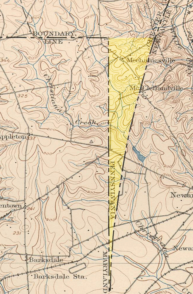
English: An 1898 United States Geological Survey view of the Elkton, Maryland quadrangle, showing the "wedge" area between Delaware and Maryland. This wedge of land, resulting from surveying oddities in colonial times, was the space left between the North Line--Maryland's eastern border--and the Twelve-Mile Circle--Delaware's western border. The land now belongs to Delaware, but, in this 1898 map, was considered a part of Pennsylvania. (The yellow highlight is an addition to the original map.) |
| 原典 | United States Geological Survey |
| 作者 |
ライセンス
このファイルは、アメリカ合衆国の連邦政府と雇用関係にある公務員がその職務上作成したアメリカ合衆国政府の著作物であり、アメリカ合衆国の著作権法上パブリックドメインに属します (17 U.S.C. §105)。
注意:このライセンスは、アメリカ合衆国政府の著作物についてのみ効力を有します。アメリカ合衆国の各州、郡、その他の地方自治体が作成した著作物に対しては適用できません。
|
 | |
| このファイルは著作権法の既知の制約(隣接権や関連する権利を含む)から自由であると特定されています。 | ||
ファイルの履歴
過去の版のファイルを表示するには、その版の日時をクリックしてください。
| 日付と時刻 | サムネイル | 寸法 | 利用者 | コメント | |
|---|---|---|---|---|---|
| 現在の版 | 2008年4月29日 (火) 02:18 | | 659 × 1,002 (470キロバイト) | Captadam | {{Information |Description=An 1898 United States Geological Survey view of the Elkton, Maryland quadrangle, showing the "wedge" area between Delaware and Maryland. This wedge of land, resulting from surveying oddities in colonial times, was the space left |
ファイルの使用状況
以下のページがこのファイルを使用しています:
グローバルなファイル使用状況
以下に挙げる他のウィキがこの画像を使っています:
- en.wikipedia.org での使用状況