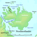
ファイル:Nordaustlandet labelled.png
Nordaustlandet_labelled.png (524 × 528 ピクセル、ファイルサイズ: 119キロバイト、MIME タイプ: image/png)
ファイルの履歴
過去の版のファイルを表示するには、その版の日時をクリックしてください。
| 日付と時刻 | サムネイル | 寸法 | 利用者 | コメント | |
|---|---|---|---|---|---|
| 現在の版 | 2006年7月29日 (土) 02:47 |  | 524 × 528 (119キロバイト) | TheGrappler | Remove cursor |
| 2006年7月29日 (土) 01:08 |  | 524 × 528 (119キロバイト) | TheGrappler | Correct spelling | |
| 2006年7月29日 (土) 00:40 |  | 524 × 528 (119キロバイト) | TheGrappler | == Summary == {{English}} Map detailing the marine features of Spitsbergen in the Svalbard archipelago. Settlements and mountains are indicated and labelled. See also Image:Spitsbergen mountains and marine features labelled.png. Locations were labell |
ファイルの使用状況
以下のページがこのファイルを使用しています:
グローバルなファイル使用状況
以下に挙げる他のウィキがこの画像を使っています:
- af.wikipedia.org での使用状況
- ast.wikipedia.org での使用状況
- az.wikipedia.org での使用状況
- ca.wikipedia.org での使用状況
- ceb.wikipedia.org での使用状況
- cs.wikipedia.org での使用状況
- cy.wikipedia.org での使用状況
- da.wikipedia.org での使用状況
- de.wikipedia.org での使用状況
- el.wikipedia.org での使用状況
- en.wikipedia.org での使用状況
- Nordaustlandet
- Wahlenbergfjorden
- Austfonna
- Wilhelm Island
- Hinlopen Strait
- Sjuøyane
- Vestfonna
- Augusta Bay (Nordaustlandet)
- Whalers Bay (Svalbard)
- Gustav Adolf Land
- Gustav V Land
- Bråsvellbreen
- Leighbreen
- Orvin Land
- Duvefjorden
- Rijpfjorden
- Etonbreen
- Prins Oscars Land
- Nordkappsundet
- Nordkapp (Nordaustlandet)
- Adlersparrefjorden
- Finn Malmgren Fjord
- Glenhalvøya
- Murchisonfjorden
このファイルのグローバル使用状況を表示する。

