ファイル:NOAA Saint Paul Island elliott4.jpg

このプレビューのサイズ: 420 × 600 ピクセル。 その他の解像度: 168 × 240 ピクセル | 336 × 480 ピクセル | 538 × 768 ピクセル | 1,148 × 1,639 ピクセル。
元のファイル (1,148 × 1,639 ピクセル、ファイルサイズ: 494キロバイト、MIME タイプ: image/jpeg)
ファイルの履歴
過去の版のファイルを表示するには、その版の日時をクリックしてください。
| 日付と時刻 | サムネイル | 寸法 | 利用者 | コメント | |
|---|---|---|---|---|---|
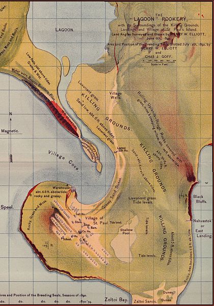
| 現在の版 | 2005年7月23日 (土) 14:54 |  | 1,148 × 1,639 (494キロバイト) | Harmil~commonswiki | Elliot's Old Saint Paul Island Map, a map of seal breeding grounds near Saint Paul Village. Survey and drawing by Henry W. Elliot, acquired from NOAA: :http://response.restoration.noaa.gov/pribilof/elliott/elliott.htm Stitched together from four scans |
ファイルの使用状況
以下のページがこのファイルを使用しています:
グローバルなファイル使用状況
以下に挙げる他のウィキがこの画像を使っています:
- ar.wikipedia.org での使用状況
- ca.wikipedia.org での使用状況
- en.wikipedia.org での使用状況
- eo.wikipedia.org での使用状況
- zh.wikipedia.org での使用状況

