
ファイル:Missouri-Floyd Rivers Sioux City Iowa.jpg
このプレビューのサイズ: 800 × 533 ピクセル。 その他の解像度: 320 × 213 ピクセル | 640 × 427 ピクセル | 1,024 × 683 ピクセル | 1,500 × 1,000 ピクセル。
元のファイル (1,500 × 1,000 ピクセル、ファイルサイズ: 711キロバイト、MIME タイプ: image/jpeg)
ウィキメディア・コモンズのファイルページにある説明を、以下に表示します。
|
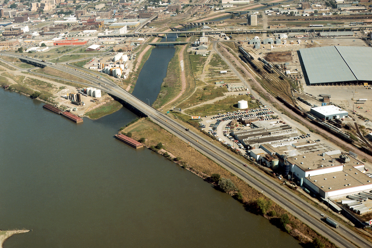
| 解説 | Aerial view of Sioux City, Iowa, USA, at the confluence of the Missouri and Floyd Rivers. Interstate-29 crosses the mouth of the Floyd River. | |||
| 場所 | Sioux City, Iowa, USA 42°28′58.75″N 96°23′29.44″W / 42.4829861°N 96.3915111°W |
|||
| 日付 | not specified | |||
| 原典 |
U.S. Army Corps of Engineers Digital Visual Library Image page Image description page Digital Visual Library home page |
|||
| 作者 | Robert Etzel, U.S. Army Corps of Engineers | |||
| 許可 (ファイルの再利用) |
|
ファイルの履歴
過去の版のファイルを表示するには、その版の日時をクリックしてください。
| 日付と時刻 | サムネイル | 寸法 | 利用者 | コメント | |
|---|---|---|---|---|---|
| 現在の版 | 2007年3月19日 (月) 04:23 | | 1,500 × 1,000 (711キロバイト) | DanMS | {{Information | Description = Aerial view of Sioux City, Iowa, USA, at the confluence of the Missouri and Floyd Rivers. Interstate-29 crosses the mouth of the Floyd River. | Source = U.S. Army Corps of Engineers Digital Visual Library<br />[http://im |
ファイルの使用状況
以下のページがこのファイルを使用しています:
グローバルなファイル使用状況
以下に挙げる他のウィキがこの画像を使っています:
- arz.wikipedia.org での使用状況
- ast.wikipedia.org での使用状況
- ceb.wikipedia.org での使用状況
- de.wikipedia.org での使用状況
- en.wikipedia.org での使用状況
- es.wikipedia.org での使用状況
- fa.wikipedia.org での使用状況
- fr.wikipedia.org での使用状況
- gl.wikipedia.org での使用状況
- incubator.wikimedia.org での使用状況
- mr.wikipedia.org での使用状況
- pt.wikipedia.org での使用状況
- ru.wikipedia.org での使用状況
- ta.wikipedia.org での使用状況
- uk.wikipedia.org での使用状況
- www.wikidata.org での使用状況