
ファイル:Mississippi Yazoo Delta.jpg
このプレビューのサイズ: 456 × 599 ピクセル。 その他の解像度: 183 × 240 ピクセル | 365 × 480 ピクセル | 936 × 1,229 ピクセル。
元のファイル (936 × 1,229 ピクセル、ファイルサイズ: 206キロバイト、MIME タイプ: image/jpeg)
ウィキメディア・コモンズのファイルページにある説明を、以下に表示します。
|
Also see here for an annotated image found on this NPR story.
概要
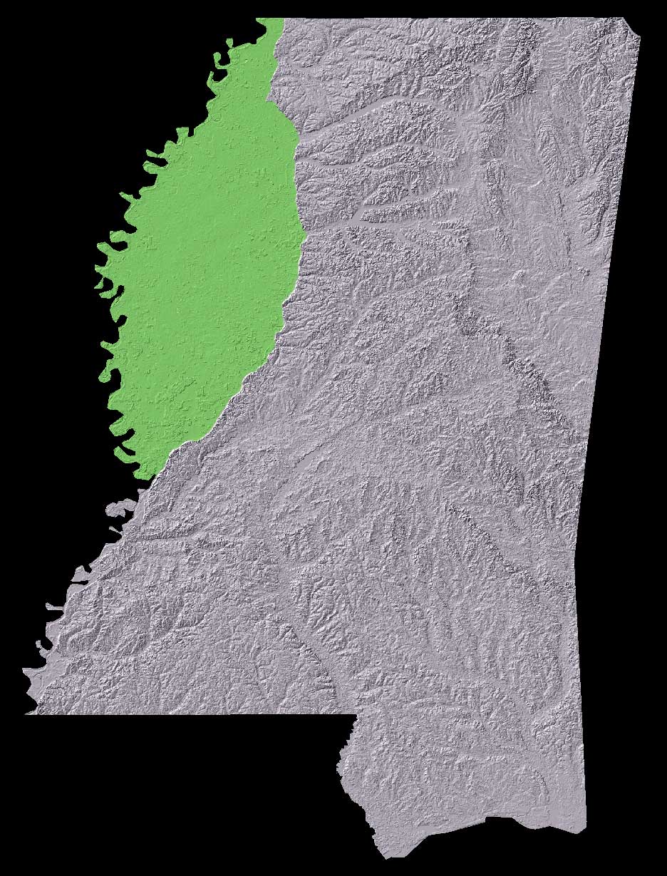
The Mississippi Delta region lies in the very fertile flood plain between the Yazoo and Mississippi Rivers, and is commonly considered to be bounded by Memphis, Tennessee in the north, and Vicksburg, Mississippi in the south.
ライセンス
data source: The National Map, USGS
このファイルは、アメリカ合衆国の連邦政府と雇用関係にある公務員がその職務上作成したアメリカ合衆国政府の著作物であり、アメリカ合衆国の著作権法上パブリックドメインに属します (17 U.S.C. §105)。
注意:このライセンスは、アメリカ合衆国政府の著作物についてのみ効力を有します。アメリカ合衆国の各州、郡、その他の地方自治体が作成した著作物に対しては適用できません。
|
 | |
| このファイルは著作権法の既知の制約(隣接権や関連する権利を含む)から自由であると特定されています。 | ||
ファイルの履歴
過去の版のファイルを表示するには、その版の日時をクリックしてください。
| 日付と時刻 | サムネイル | 寸法 | 利用者 | コメント | |
|---|---|---|---|---|---|
| 現在の版 | 2006年4月17日 (月) 15:18 | | 936 × 1,229 (206キロバイト) | Vercingetorix~commonswiki | Also see [http://www.npr.org/programs/atc/features/2005/jun/delta/mississippi_delta.jpg here] for an annotated image found on [http://www.npr.org/templates/story/story.php?storyId=4675562 this NPR story]. == Summary == The Mississippi Delta region li |
ファイルの使用状況
以下のページがこのファイルを使用しています:
グローバルなファイル使用状況
以下に挙げる他のウィキがこの画像を使っています:
- ar.wikipedia.org での使用状況
- de.wikipedia.org での使用状況
- en.wikipedia.org での使用状況
- eo.wikipedia.org での使用状況
- es.wikipedia.org での使用状況
- it.wikipedia.org での使用状況
- ms.wikipedia.org での使用状況
- no.wikipedia.org での使用状況
- pl.wikipedia.org での使用状況
- ru.wikipedia.org での使用状況
- simple.wikipedia.org での使用状況
- uk.wikipedia.org での使用状況
- www.wikidata.org での使用状況