
ファイル:Map of federal subjects of Russia (2022), disputed Crimea and Donbass.svg

この SVG ファイルのこの PNG プレビューのサイズ: 512 × 282 ピクセル. その他の解像度: 320 × 176 ピクセル | 640 × 353 ピクセル | 1,024 × 564 ピクセル | 1,280 × 705 ピクセル | 2,560 × 1,410 ピクセル。
元のファイル (SVG ファイル、512 × 282 ピクセル、ファイルサイズ: 827キロバイト)
ウィキメディア・コモンズのファイルページにある説明を、以下に表示します。
|
,_disputed_Crimea_and_Donbass.svg?uselang=ja)
,_disputed_Crimea_and_Donbass.svg?uselang=ja)
,_disputed_Crimea_and_Donbass.svg?uselang=ja&action=history)
,_disputed_Crimea_and_Donbass.svg)

|
The boundaries on this map show the de facto situation. This is just one of several different views on the subject (see COM:NPOV). |
概要
| 解説 |
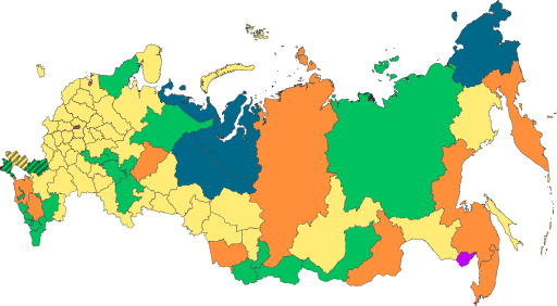
English: Copy of File:Map of federal subjects of Russia (2022).svg with disputed annexed Ukrainian territories indicated with diagonal stripes |
| 日付 | |
| 原典 |
このファイルの派生元: Map of federal subjects of Russia 2014, disputed Crimea.svg |
| 作者 | Mzajac, Ltbubbas |
.svg)
ライセンス
| This map is ineligible for copyright and therefore in the public domain, because it consists entirely of information that is common property and contains no original authorship. For more information, see Commons:Threshold of originality § Maps.
|
ファイルの履歴
過去の版のファイルを表示するには、その版の日時をクリックしてください。
| 日付と時刻 | サムネイル | 寸法 | 利用者 | コメント | |
|---|---|---|---|---|---|
| 現在の版 | 2022年10月4日 (火) 19:48 | | 512 × 282 (827キロバイト) | Techso01 | Uploaded a work by Mzajac, Ltbubbas from {{derived from|Map of federal subjects of Russia (2014), disputed Crimea.svg}} with UploadWizard |
ファイルの使用状況
以下のページがこのファイルを使用しています:
グローバルなファイル使用状況
以下に挙げる他のウィキがこの画像を使っています:
- ab.wikipedia.org での使用状況
- ar.wikipedia.org での使用状況
- ast.wikipedia.org での使用状況
- be.wikipedia.org での使用状況
- cs.wikipedia.org での使用状況
- de.wikipedia.org での使用状況
- en.wikipedia.org での使用状況
- es.wikipedia.org での使用状況
- fa.wikipedia.org での使用状況
- fr.wikipedia.org での使用状況
- is.wikipedia.org での使用状況
- it.wikipedia.org での使用状況
- ko.wikipedia.org での使用状況
- la.wikipedia.org での使用状況
- lez.wikipedia.org での使用状況
- lld.wikipedia.org での使用状況
- lt.wikipedia.org での使用状況
- lv.wikipedia.org での使用状況
- mi.wikipedia.org での使用状況
- oc.wikipedia.org での使用状況
- pt.wikipedia.org での使用状況
- ru.wikipedia.org での使用状況
- sl.wikipedia.org での使用状況
- sr.wikipedia.org での使用状況
- th.wikipedia.org での使用状況
- tly.wikipedia.org での使用状況
- tum.wikipedia.org での使用状況
- uk.wikipedia.org での使用状況
- uz.wikipedia.org での使用状況
- vi.wikipedia.org での使用状況
- vls.wikipedia.org での使用状況
- zh.wikipedia.org での使用状況
このファイルのグローバル使用状況を表示する。
,_disputed_Crimea_and_Donbass.svg)
,_disputed_Crimea_and_Donbass.svg)