
ファイル:Map of Burzenland, 1959.jpg
このプレビューのサイズ: 367 × 599 ピクセル。 その他の解像度: 147 × 240 ピクセル | 294 × 480 ピクセル | 470 × 768 ピクセル | 1,270 × 2,073 ピクセル。
元のファイル (1,270 × 2,073 ピクセル、ファイルサイズ: 1.99メガバイト、MIME タイプ: image/jpeg)
ウィキメディア・コモンズのファイルページにある説明を、以下に表示します。
|
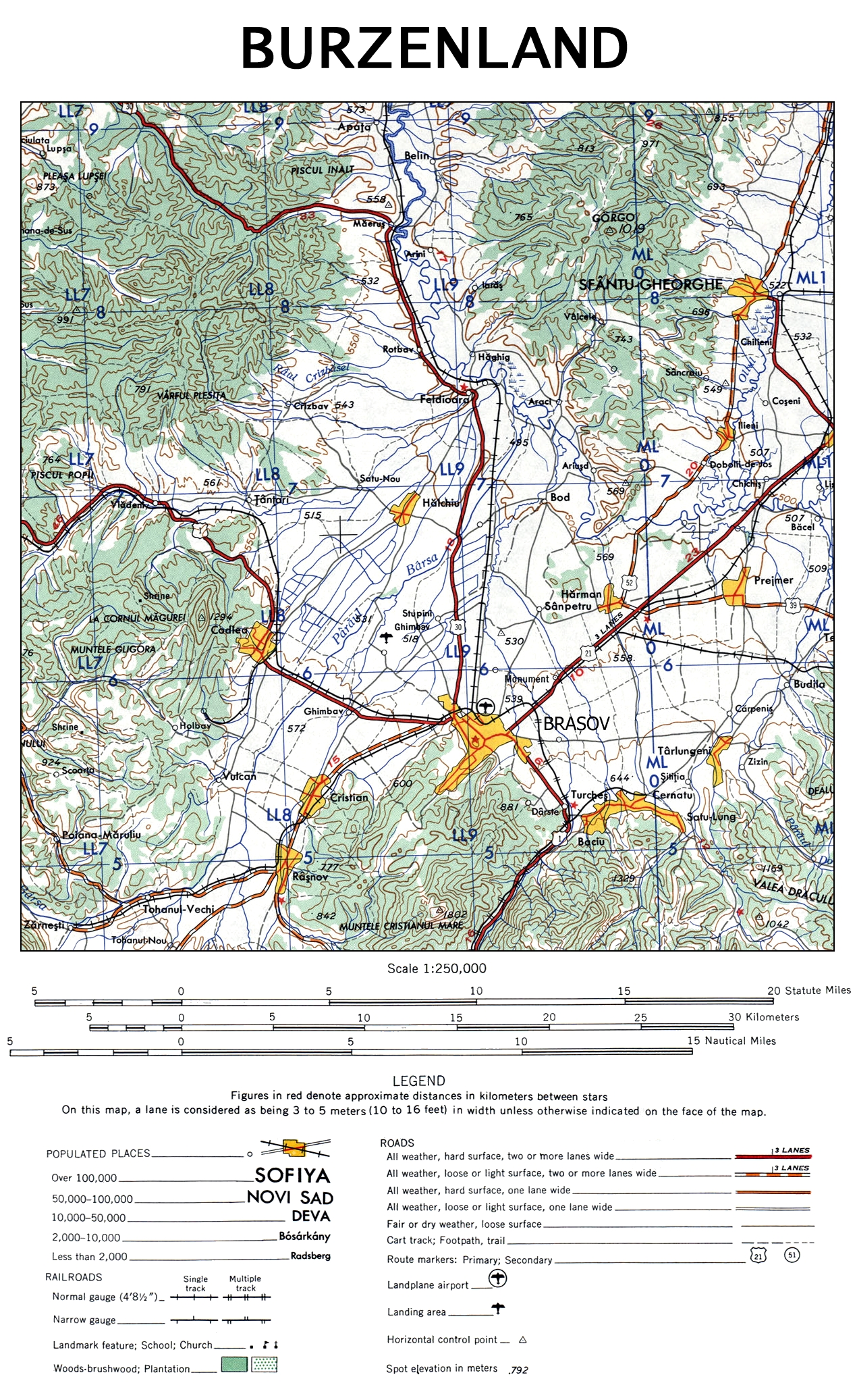
| 解説 | The map of Burzenland, Romania. |
| 日付 | |
| 原典 | University of Texas Libraries |
| 作者 | US Army Map Service, Corps of Engineers |
| その他のバージョン |

This image or file is a work of a U.S. Army Corps of Engineers soldier or employee, taken or made as part of that person's official duties. As a work of the U.S. federal government, the image is in the public domain.
|
ファイルの履歴
過去の版のファイルを表示するには、その版の日時をクリックしてください。
| 日付と時刻 | サムネイル | 寸法 | 利用者 | コメント | |
|---|---|---|---|---|---|
| 現在の版 | 2009年11月12日 (木) 21:48 | | 1,270 × 2,073 (1.99メガバイト) | Alex:D | {{Information |Description= The map of Burzenland, Romania. |Source= [http://www.lib.utexas.edu/maps/ams/western_europe/ University of Texas Libraries] |Date= 1959 |Author= US Army Map Service, Corps of Engineers |Permission= |other_versions={{ExtractedFr |
ファイルの使用状況
以下のページがこのファイルを使用しています:
グローバルなファイル使用状況
以下に挙げる他のウィキがこの画像を使っています:
- ca.wikipedia.org での使用状況
- cs.wikipedia.org での使用状況
- da.wikipedia.org での使用状況
- de.wikipedia.org での使用状況
- en.wikipedia.org での使用状況
- es.wikipedia.org での使用状況
- fr.wikipedia.org での使用状況
- hu.wikipedia.org での使用状況
- it.wikipedia.org での使用状況
- pl.wikipedia.org での使用状況
- ru.wikipedia.org での使用状況
- sk.wikipedia.org での使用状況
- zh.wikipedia.org での使用状況