
ファイル:Helen Reef.png
このプレビューのサイズ: 359 × 598 ピクセル。 その他の解像度: 144 × 240 ピクセル | 288 × 480 ピクセル | 892 × 1,487 ピクセル。
元のファイル (892 × 1,487 ピクセル、ファイルサイズ: 90キロバイト、MIME タイプ: image/png)
ウィキメディア・コモンズのファイルページにある説明を、以下に表示します。
|
概要
| 解説 |
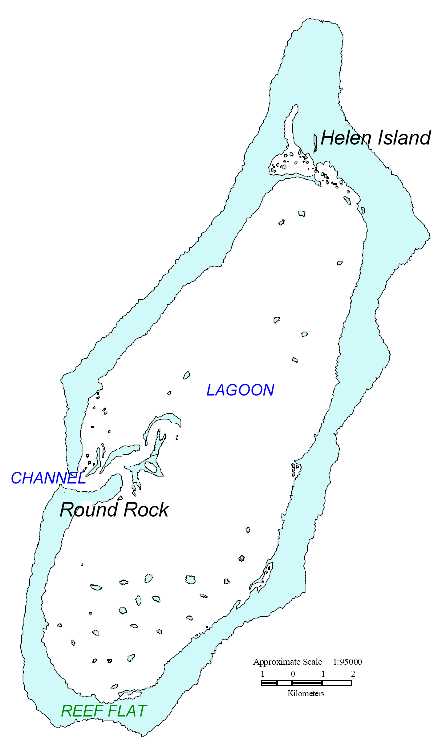
English: Map of Helen Reef, Palau. Based on map from U.S. Minerals Management Service. |
| 日付 | |
| 原典 | original source: http://tobi.gmu.edu/thisisnow/Helen%20Reef%202000%20Monitoring%20Expedition.pdf, processed by Ratzer. |
| 作者 | U.S. Minerals Management Service |
ライセンス
| This article or image contains material based on a work of a Minerals Management Service employee, created as part of that person's official duties. As a work of the U.S. federal government, such work is in the public domain in the United States. See MMS Disclaimer. |  |
元のアップロードログ
| date/time | username | Dimensions | File Size | edit summary |
|---|---|---|---|---|
| 11:46, 17 July 2006 | Ratzer | 892×1487 | 90 KB | base map from U.S. Minerals Management Service, Mapping and Boundary Branch (as explained on page http://cas.gmu.edu/~tobi/thisisnow/Helen%20Reef%202000%20Monitoring%20Expedition.pdf), processed by me |
ファイルの履歴
過去の版のファイルを表示するには、その版の日時をクリックしてください。
| 日付と時刻 | サムネイル | 寸法 | 利用者 | コメント | |
|---|---|---|---|---|---|
| 現在の版 | 2008年5月2日 (金) 10:04 | | 892 × 1,487 (90キロバイト) | Telim tor | == Information == {{Information |Description=Map of Helen Reef, Palau. Based on map from U.S. Minerals Management Service Boundary Branch |Source=original source: http://cas.gmu.edu/~tobi/thisisnow/Helen%20Reef%202000%20Monitoring%20Expedition.pdf Proce |
ファイルの使用状況
以下のページがこのファイルを使用しています:
グローバルなファイル使用状況
以下に挙げる他のウィキがこの画像を使っています:
- az.wikipedia.org での使用状況
- ca.wikipedia.org での使用状況
- de.wikipedia.org での使用状況
- en.wikipedia.org での使用状況
- es.wikipedia.org での使用状況
- lt.wikipedia.org での使用状況
- mk.wikipedia.org での使用状況
- nl.wikipedia.org での使用状況
- ru.wikipedia.org での使用状況
- www.wikidata.org での使用状況