
ファイル:Han Dynasty Plain map.PNG
このプレビューのサイズ: 800 × 352 ピクセル。 その他の解像度: 320 × 141 ピクセル | 640 × 282 ピクセル | 1,427 × 628 ピクセル。
元のファイル (1,427 × 628 ピクセル、ファイルサイズ: 48キロバイト、MIME タイプ: image/png)
ウィキメディア・コモンズのファイルページにある説明を、以下に表示します。
|
概要
| 解説 |
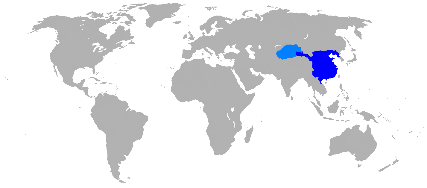
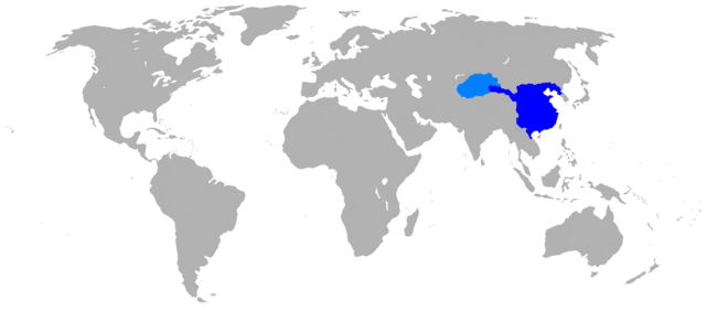
English: Map of Han Dynasty in 2 CE.
|
| 日付 | |
| 原典 | Self Made, copied map from page 63 of the book Mapping History: World History (London: Cartographica, 2007), by Dr. Ian Barnes. ISBN 978-1-84573-323-0 |
| 作者 | User:Historian of the arab people |
ライセンス
| この著作物の著作権者である私は、この著作物における権利を放棄しパブリックドメインとします。これは全世界で適用されます。 一部の国では、これが法的に可能ではない場合があります。その場合は、次のように宣言します。 私は、あらゆる人に対して、法により必要とされている条件を除き、如何なる条件も課すことなく、あらゆる目的のためにこの著作物を使用する権利を与えます。 |
ファイルの履歴
過去の版のファイルを表示するには、その版の日時をクリックしてください。
| 日付と時刻 | サムネイル | 寸法 | 利用者 | コメント | |
|---|---|---|---|---|---|
| 現在の版 | 2016年4月26日 (火) 14:37 | | 1,427 × 628 (48キロバイト) | Garam | Clear (* ref: File:China Han Dynasty 1.jpg and File:Hangunhyeon.PNG) |
| 2008年10月29日 (水) 23:58 |  | 1,427 × 628 (59キロバイト) | Historian of the arab people | {{Information |Description={{en|1=Map of Han dynasty, 2 AD Darkest blue is the commandaries and principalities of the Han Empire, light blue is the Tarim Basin protectorate}} |Source=Self Made, copied map from page 63 of the book, "MAPPING HISTORY WORLD H |
ファイルの使用状況
このファイルを使用しているページはありません。
グローバルなファイル使用状況
以下に挙げる他のウィキがこの画像を使っています:
- ar.wikipedia.org での使用状況
- as.wikipedia.org での使用状況
- azb.wikipedia.org での使用状況
- de.wikipedia.org での使用状況
- en.wikipedia.org での使用状況
- et.wikipedia.org での使用状況
- fi.wikipedia.org での使用状況
- fo.wikipedia.org での使用状況
- he.wikipedia.org での使用状況
- id.wikipedia.org での使用状況
- pnb.wikipedia.org での使用状況
- sco.wikipedia.org での使用状況
- ur.wikipedia.org での使用状況