
ファイル:Granite Railway map section.png
Granite_Railway_map_section.png (461 × 510 ピクセル、ファイルサイズ: 65キロバイト、MIME タイプ: image/png)
ウィキメディア・コモンズのファイルページにある説明を、以下に表示します。
|
Transwiki approved by: w:en:User:Dmcdevit
This image was copied from wikipedia:en. The original description was:
概要
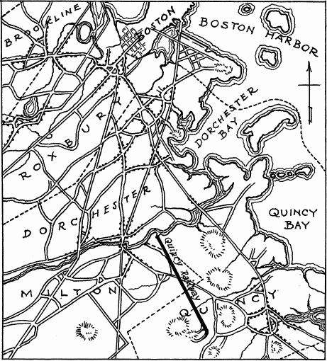
This is a portion of the Granite Railway map.png at wiki commons, which is a cropped version of the digital image in the Library of Congress. It is exempt from copyright law because it is a United States Government drawing.
TITLE: Granite Railway, Pine Hill Quarry to Neponset River, Quincy, Norfolk County, MA. CALL NUMBER: HABS, MASS,11-QUI,4-. COLLECTION: Historic American Buildings Survey (Library of Congress). REPOSITORY: Library of Congress, Prints and Photograph Division, Washington, D.C. 20540 USA. CARD #: MA0848.

|
This file comes from the Historic American Buildings Survey (HABS), Historic American Engineering Record (HAER) or Historic American Landscapes Survey (HALS). These are programs of the National Park Service established for the purpose of documenting historic places. Records consist of measured drawings, archival photographs, and written reports.
|
| This image or media file contains material based on a work of a National Park Service employee, created as part of that person's official duties. As a work of the U.S. federal government, such work is in the public domain in the United States. See the NPS website and NPS copyright policy for more information. |
ライセンス
このファイルは、アメリカ合衆国の連邦政府と雇用関係にある公務員がその職務上作成したアメリカ合衆国政府の著作物であり、アメリカ合衆国の著作権法上パブリックドメインに属します (17 U.S.C. §105)。
注意:このライセンスは、アメリカ合衆国政府の著作物についてのみ効力を有します。アメリカ合衆国の各州、郡、その他の地方自治体が作成した著作物に対しては適用できません。
|
 | |
| このファイルは著作権法の既知の制約(隣接権や関連する権利を含む)から自由であると特定されています。 | ||
元のアップロードログ
| date/time | username | resolution | size | edit summary |
|---|---|---|---|---|
| 03:34, 8 April 2006 | w:en:User:SPUI | 461×510 | 65 KB | remove caption... it wasn't the first railroad in the U.S. |
| 09:09, 23 February 2006 | w:en:User:Metarhyme | 536×631 | 55 KB | Portion of Granite Railway map.png at wikimedia commons |
Image description page history
| link | date/time | username | edit summary |
|---|---|---|---|
| http://en.wikipedia.org/w/index.php?title=Image:Granite_Railway_map_section.png&redirect=no&oldid=47505903 | 02:40, 9 September 2007 | w:en:User:Dmcdevit | |
| http://en.wikipedia.org/w/index.php?title=Image:Granite_Railway_map_section.png&redirect=no&oldid=47505903 | 03:34, 8 April 2006 | w:en:User:SPUI | |
| http://en.wikipedia.org/w/index.php?title=Image:Granite_Railway_map_section.png&redirect=no&oldid=40989462 | 08:53, 24 February 2006 | w:en:User:Metarhyme | |
| http://en.wikipedia.org/w/index.php?title=Image:Granite_Railway_map_section.png&redirect=no&oldid=40837249 | 09:09, 23 February 2006 | w:en:User:Metarhyme | (Portion of Granite Railway map.png at wikimedia commons) |
ファイルの履歴
過去の版のファイルを表示するには、その版の日時をクリックしてください。
| 日付と時刻 | サムネイル | 寸法 | 利用者 | コメント | |
|---|---|---|---|---|---|
| 現在の版 | 2007年9月10日 (月) 16:36 | | 461 × 510 (65キロバイト) | BetacommandBot | Transwiki approved by: w:en:User:Dmcdevit This image was copied from wikipedia:en. The original description was: == Summary == This is a portion of the [http://commons.wikimedia.org/wiki/Image:Granite_Railway_map.png Granite_Railway_map.png] at wiki |
ファイルの使用状況
以下のページがこのファイルを使用しています:
グローバルなファイル使用状況
以下に挙げる他のウィキがこの画像を使っています:
- en.wikipedia.org での使用状況