
ファイル:Fils Hasental-Plochingen-Landsat7 WW texted.jpg
このプレビューのサイズ: 800 × 588 ピクセル。 その他の解像度: 320 × 235 ピクセル | 640 × 471 ピクセル | 1,024 × 753 ピクセル | 1,280 × 941 ピクセル | 1,500 × 1,103 ピクセル。
元のファイル (1,500 × 1,103 ピクセル、ファイルサイズ: 1.86メガバイト、MIME タイプ: image/jpeg)
ウィキメディア・コモンズのファイルページにある説明を、以下に表示します。
|
| 解説 |
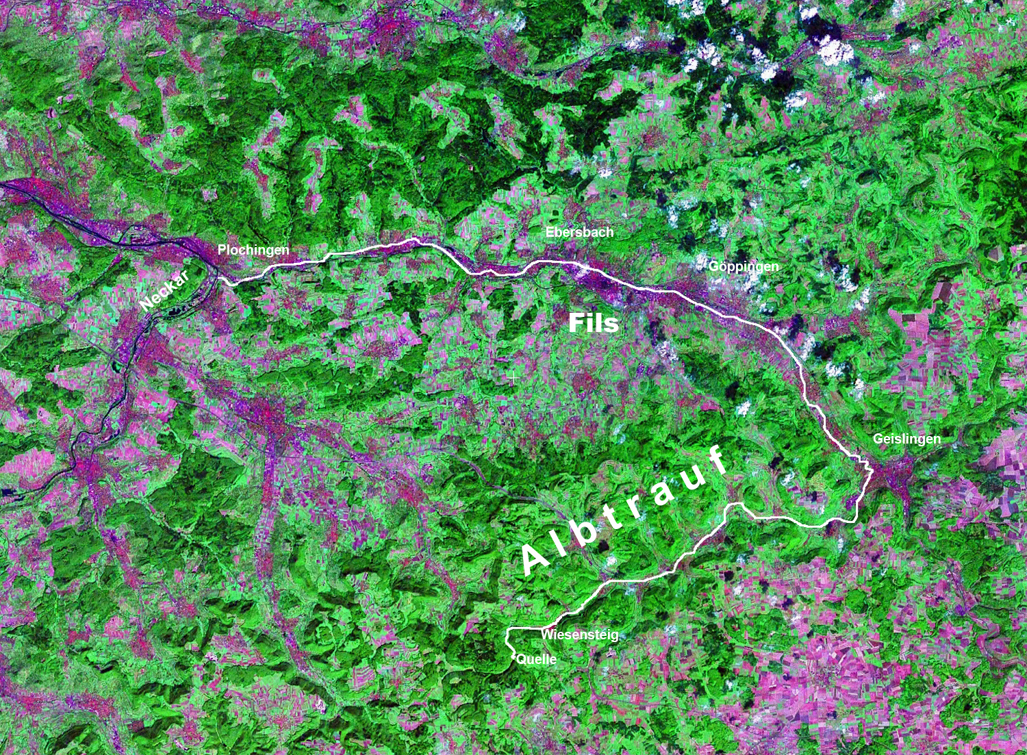
Landsat7 NASA-WorldWind image, GeoCover 2000 (s==>n, 4 km) Deutsch: Verlauf der Fils von der Quelle auf der Schwäbischen Alb bis zur Mündung in den Neckar bei Plochingen
|
| 日付 | |
| 原典 | NASA, WorldWind |
| 作者 | 写真: NASA |
| 許可 (ファイルの再利用) |
NASA PD-WorldWind |
| この画像は、Blue Marble、MODIS、Landsat、SRTM、USGS、GLOBEなどのパブリックドメイン・レイヤーを使用したNASAの地球儀ソフトウェア「World Wind」のスクリーンショットであるため、パブリックドメインの状態にあります。
|
 |
ファイルの履歴
過去の版のファイルを表示するには、その版の日時をクリックしてください。
| 日付と時刻 | サムネイル | 寸法 | 利用者 | コメント | |
|---|---|---|---|---|---|
| 現在の版 | 2007年7月30日 (月) 21:38 | | 1,500 × 1,103 (1.86メガバイト) | Ustill | {{Information|Landsat7 NASA-WorldWind image, GeoCover 2000 (s==>n, 4 km) |Description ={{de|Verlauf der Fils von der Quelle auf der Schwäbischen Alb bis zur Mündung in den Neckar bei Plochingen {{en|River Fils, [[:en:Swabian_Alb |
ファイルの使用状況
以下のページがこのファイルを使用しています:
グローバルなファイル使用状況
以下に挙げる他のウィキがこの画像を使っています:
- als.wikipedia.org での使用状況
- da.wikipedia.org での使用状況
- fa.wikipedia.org での使用状況
- it.wikipedia.org での使用状況
- no.wikipedia.org での使用状況