
ファイル:Black Rock Desert volcanic field.jpg
このプレビューのサイズ: 800 × 530 ピクセル。 その他の解像度: 320 × 212 ピクセル | 640 × 424 ピクセル | 1,024 × 679 ピクセル。
元のファイル (1,024 × 679 ピクセル、ファイルサイズ: 365キロバイト、MIME タイプ: image/jpeg)
ウィキメディア・コモンズのファイルページにある説明を、以下に表示します。
|
概要
| 解説 |
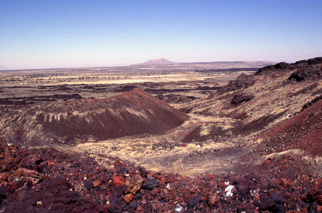
English: The Black Rock Desert volcanic field — in Millard County, Utah.
|
|||
| 日付 | ||||
| 原典 | Black Rock Desert at the Wayback Machine | |||
| 作者 | Lee Siebert (Smithsonian Institution) | |||
| 許可 (ファイルの再利用) |
|
ファイルの履歴
過去の版のファイルを表示するには、その版の日時をクリックしてください。
| 日付と時刻 | サムネイル | 寸法 | 利用者 | コメント | |
|---|---|---|---|---|---|
| 現在の版 | 2021年3月21日 (日) 16:20 | | 1,024 × 679 (365キロバイト) | Jstuby | higher resolution |
| 2011年1月29日 (土) 01:15 |  | 640 × 424 (56キロバイト) | Michael Metzger | {{Information |Description ={{en|1=The Black Rock Desert volcanic field consists of a cluster of closely spaced small volcanic fields of Pleistocene-to-Holocene age in the Black Rock and Sevier deserts. This view shows Utah's youngest known lava flow, |
ファイルの使用状況
以下のページがこのファイルを使用しています:
グローバルなファイル使用状況
以下に挙げる他のウィキがこの画像を使っています:
- cs.wikipedia.org での使用状況
- de.wikipedia.org での使用状況
- en.wikipedia.org での使用状況
- eu.wikipedia.org での使用状況
- no.wikipedia.org での使用状況
- pt.wikipedia.org での使用状況
- www.wikidata.org での使用状況