
ファイル:American Revolutionary War Cobleskill and Cherry Valley.jpg
このプレビューのサイズ: 800 × 531 ピクセル。 その他の解像度: 320 × 212 ピクセル | 640 × 425 ピクセル | 1,024 × 679 ピクセル | 1,280 × 849 ピクセル | 2,086 × 1,384 ピクセル。
元のファイル (2,086 × 1,384 ピクセル、ファイルサイズ: 543キロバイト、MIME タイプ: image/jpeg)
ウィキメディア・コモンズのファイルページにある説明を、以下に表示します。
|
概要
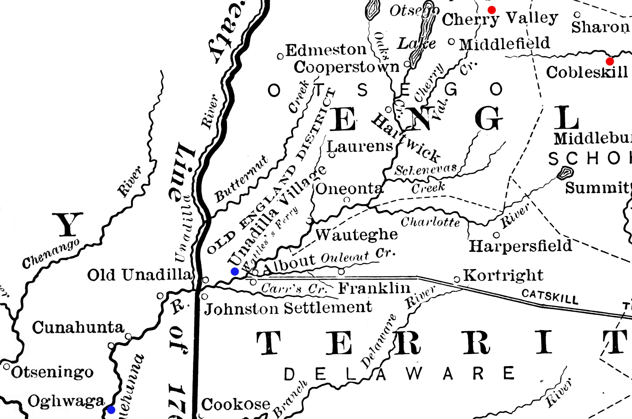
| 解説 | Detail from a map showing a portion of New York's western frontier with the Iroquois. The New York communities of Cherry Valley and Cobleskill, the scenes of military actions in the American Revolutionary War in 1778, are highlighted in red. The Indian villages of Unadilla and Unaquaga (spelled "Oghwaga" on the map), which were destroyed in raids in 1778, are highlighted in blue. |
| 日付 | 出版:1901年 |
| 原典 | Derived from File:Frontier of NY in Revolution.png |
| 作者 | Image author not specified; book author Francis Whiting Halsey (1815-1919) |
ライセンス
このファイルはアメリカ合衆国においてパブリックドメインの状態にあります。これは多くの場合、最初の公表が1929年1月1日以前であるために著作権が消滅したアメリカ合衆国の著作物に適用されます。より詳細な説明については、このページをご覧ください。
|
 | |
 |
このファイルはアメリカ合衆国以外ではパブリックドメインの状態にはない可能性があり、この点は、特に、カナダ、中華人民共和国(香港・マカオを除く)、ドイツ、メキシコ及びスイスのようにアメリカ合衆国の著作物の著作権の保護期間について相互主義を採用していない国・地域で当てはまります。作者や公表年は必要な情報であり、条件とされるべきものです。詳細についてはWikipedia:Public domain及びWikipedia:Copyrightsをご覧ください。
|
ファイルの履歴
過去の版のファイルを表示するには、その版の日時をクリックしてください。
| 日付と時刻 | サムネイル | 寸法 | 利用者 | コメント | |
|---|---|---|---|---|---|
| 現在の版 | 2012年2月14日 (火) 13:48 | | 2,086 × 1,384 (543キロバイト) | Magicpiano | bigger markers |
| 2012年1月29日 (日) 03:18 |  | 2,086 × 1,384 (543キロバイト) | Magicpiano | {{Information |Description=Detail from a map showing a portion of New York's western frontier with the Iroquois. The New York communities of Cherry Valley and Cobleskill, the scenes of mi |
ファイルの使用状況
グローバルなファイル使用状況
以下に挙げる他のウィキがこの画像を使っています:
- en.wikipedia.org での使用状況
- nl.wikipedia.org での使用状況
- www.wikidata.org での使用状況