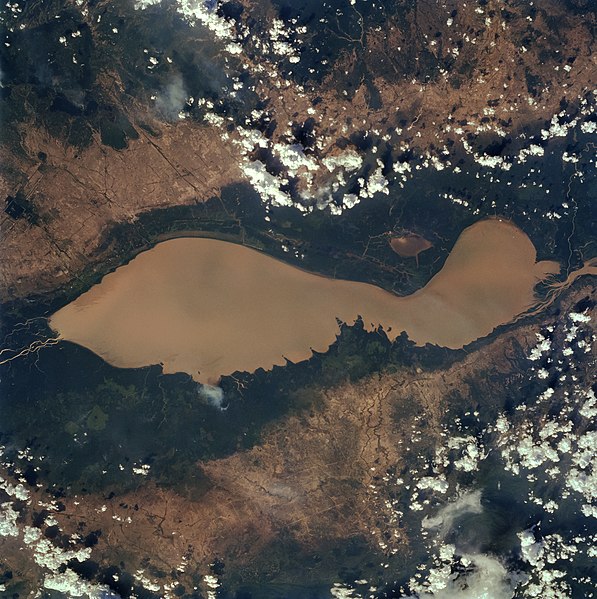
ファイル:Tonlesap.jpg
表示

このプレビューのサイズ: 597 × 599 ピクセル。 その他の解像度: 239 × 240 ピクセル | 478 × 480 ピクセル | 765 × 768 ピクセル | 1,020 × 1,024 ピクセル | 2,039 × 2,048 ピクセル | 4,079 × 4,096 ピクセル。
元のファイル (4,079 × 4,096 ピクセル、ファイルサイズ: 17.17メガバイト、MIME タイプ: image/jpeg)
ファイルの履歴
過去の版のファイルを表示するには、その版の日時をクリックしてください。
| 日付と時刻 | サムネイル | 寸法 | 利用者 | コメント | |
|---|---|---|---|---|---|
| 現在の版 | 2022年4月4日 (月) 10:40 |  | 4,079 × 4,096 (17.17メガバイト) | Tiouraren | larger version |
| 2015年7月15日 (水) 06:48 |  | 902 × 695 (293キロバイト) | Wikirictor | i re-sized it, enhanced its quality and rotated it in order to have north on top. | |
| 2006年6月18日 (日) 05:04 |  | 637 × 640 (53キロバイト) | Georgio~commonswiki | {{Information |Description=Earth Sciences and Image Analysis, NASA-Johnson Space Center. 16 Apr. 2004. "Earth from Space - Image Information." |Source=http://earth.jsc.nasa.gov/sseop/efs/photoinfo.pl?PHOTO=STS059-84-80 |Date=16 Apr. 2004. |Author=NASA |Pe |
ファイルの使用状況
以下のページがこのファイルを使用しています:
グローバルなファイル使用状況
以下に挙げる他のウィキがこの画像を使っています:
- af.wikipedia.org での使用状況
- ar.wikipedia.org での使用状況
- az.wikipedia.org での使用状況
- bg.wikipedia.org での使用状況
- ca.wikipedia.org での使用状況
- ceb.wikipedia.org での使用状況
- cv.wikipedia.org での使用状況
- cy.wikipedia.org での使用状況
- en.wikipedia.org での使用状況
- en.wikivoyage.org での使用状況
- eo.wikipedia.org での使用状況
- es.wikipedia.org での使用状況
- eu.wikipedia.org での使用状況
- he.wikipedia.org での使用状況
- he.wikivoyage.org での使用状況
- id.wikipedia.org での使用状況
- it.wikipedia.org での使用状況
- it.wikivoyage.org での使用状況
- ka.wikipedia.org での使用状況
- km.wikipedia.org での使用状況
- ko.wikipedia.org での使用状況
- ms.wikipedia.org での使用状況
- my.wikipedia.org での使用状況
- no.wikipedia.org での使用状況
- pl.wikipedia.org での使用状況
- ru.wikipedia.org での使用状況
- sh.wikipedia.org での使用状況
- sv.wikipedia.org での使用状況
- te.wikipedia.org での使用状況
- th.wikipedia.org での使用状況
- tl.wikipedia.org での使用状況
- uk.wikipedia.org での使用状況
- ur.wikipedia.org での使用状況
- vi.wikipedia.org での使用状況
- war.wikipedia.org での使用状況
- www.wikidata.org での使用状況
- zh-yue.wikipedia.org での使用状況
- zh.wikipedia.org での使用状況


