ファイル:Sumatra 2007 earthquakes map.gif
Sumatra_2007_earthquakes_map.gif (505 × 496 ピクセル、ファイルサイズ: 30キロバイト、MIME タイプ: image/gif)
ファイルの履歴
過去の版のファイルを表示するには、その版の日時をクリックしてください。
| 日付と時刻 | サムネイル | 寸法 | 利用者 | コメント | |
|---|---|---|---|---|---|
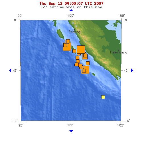
| 現在の版 | 2007年9月13日 (木) 09:53 |  | 505 × 496 (30キロバイト) | TheDJ | == Summary == '''Image:''' This map shows the location of the 3 major earthquakes and it's many aftershocks off the coast of Sumatra on September 12 and September 13, 2007. It shows a total of 27 earthquakes, 25 of them in the last 24 hours. |
ファイルの使用状況
以下のページがこのファイルを使用しています:
グローバルなファイル使用状況
以下に挙げる他のウィキがこの画像を使っています:
- de.wikipedia.org での使用状況
- en.wikipedia.org での使用状況
- id.wikipedia.org での使用状況
- wuu.wikipedia.org での使用状況
- zh.wikipedia.org での使用状況


