
ファイル:Pico de Orizaba, Mexico.JPG
このプレビューのサイズ: 800 × 532 ピクセル。 その他の解像度: 320 × 213 ピクセル | 640 × 425 ピクセル | 1,024 × 681 ピクセル | 1,280 × 851 ピクセル | 2,560 × 1,701 ピクセル | 4,288 × 2,850 ピクセル。
元のファイル (4,288 × 2,850 ピクセル、ファイルサイズ: 3.3メガバイト、MIME タイプ: image/jpeg)
ウィキメディア・コモンズのファイルページにある説明を、以下に表示します。
|
概要
| 解説 |
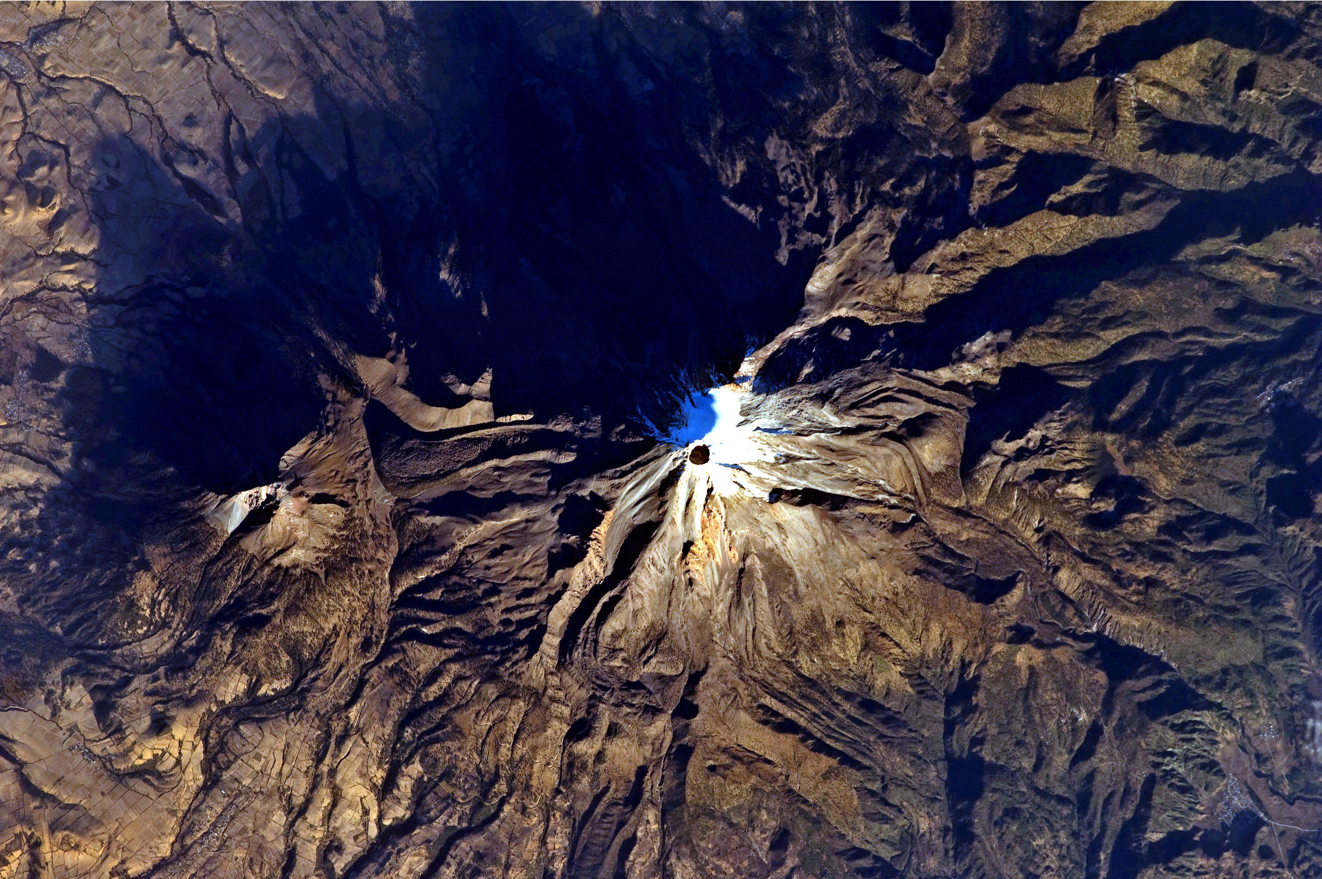
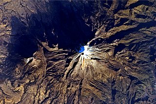
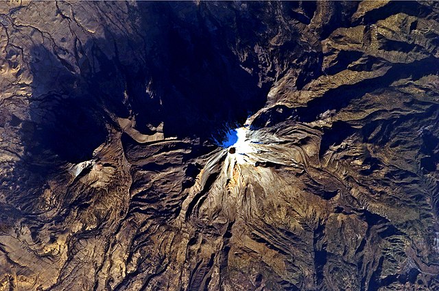
English: Shadows accentuate several features of the Pico de Orizaba, a stratovolcano, visible in this astronaut photograph from the International Space Station. The 300-meter-deep summit crater is clearly visible against surrounding ice and snow cover near image centre. Several lava flows extend down the flanks of the volcano, made readily visible by prominent cooling ridges along their sides known as flow levees. One of the most clearly visible examples is located on the south-west flank of the cone. |
| 日付 | |
| 原典 | NASA Earth Observatory |
| 作者 | ISS Expedition 26 crew |
| カメラの位置 | | 以下のサービスでこの位置を確認する: オープンストリートマップ |
|---|
| このタグは、添付された著作物の著作権状況を示すものではありません。通常の著作権タグも必要です。Commons:ライセンシングもご覧ください。 他言語での翻訳:
|
Image acquired with a Nikon D2Xs digital camera using a 400 mm lens, and is provided by the ISS Crew Earth Observations experiment and Image Science & Analysis Laboratory, Johnson Space Center.
ライセンス
| このファイルはアメリカ航空宇宙局(NASA)によって作成されたものです。NASAの著作権の方針では、特記事項が無い場合、NASAの資料はパブリックドメインとなります。 (詳しくはTemplate:PD-USGov、NASAの著作権の方針について(英語)又はジェット推進研究所(JPL)の画像使用に関するガイドライン(英語)をご覧ください。) |
||
 |
注意事項:
|
| 注釈 | この画像には注釈がついています: コモンズで注釈を見る |
ファイルの履歴
過去の版のファイルを表示するには、その版の日時をクリックしてください。
| 日付と時刻 | サムネイル | 寸法 | 利用者 | コメント | |
|---|---|---|---|---|---|
| 現在の版 | 2011年2月28日 (月) 12:05 | | 4,288 × 2,850 (3.3メガバイト) | Originalwana | {{Information |Description ={{en|1=Shadows accentuate several features of the Pico de Orizaba, a stratovolcano, visible in this astronaut photograph from the International Space Station. The 300-meter-deep summit crater is clearly visible again |
ファイルの使用状況
以下のページがこのファイルを使用しています:
グローバルなファイル使用状況
以下に挙げる他のウィキがこの画像を使っています:
- af.wikipedia.org での使用状況
- en.wikipedia.org での使用状況
- fr.wikipedia.org での使用状況
- mk.wikipedia.org での使用状況
- uk.wikipedia.org での使用状況