
ファイル:Indonesia (orthographic projection).svg

この SVG ファイルのこの PNG プレビューのサイズ: 550 × 550 ピクセル. その他の解像度: 240 × 240 ピクセル | 480 × 480 ピクセル | 768 × 768 ピクセル | 1,024 × 1,024 ピクセル | 2,048 × 2,048 ピクセル。
元のファイル (SVG ファイル、550 × 550 ピクセル、ファイルサイズ: 1.79メガバイト)
ウィキメディア・コモンズのファイルページにある説明を、以下に表示します。
|
概要
| 解説 |
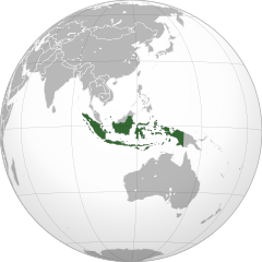
English: Orthographic map of Indonesia |
||||
| 日付 | |||||
| 原典 |
投稿者自身による著作物
|
||||
| 作者 | Addicted04 | ||||
| その他のバージョン |
このファイルの派生的著作物: BK Oceania (orthographic projection).png .svg)
|
||||
| SVG 開発 |
.svg)
.svg)
.svg)
.svg)
.svg)
.svg)
.svg)
.svg)
.svg)
.svg)
.svg)
.svg)
.svg)
.svg)
.svg)
.svg)
.svg)
.svg)
.svg)
.svg)
.svg)
.svg)
.svg)
.svg)
.svg)
.svg)
.svg)
.svg)
.svg)
.svg)
.svg)
.svg)
.svg)
.svg)
.svg)
.svg)
.svg)
.svg)
.svg)
.svg)
.svg)
.svg)
.svg)
.svg)
.svg)
.svg)
.svg)
.svg)
.svg)
.svg)
.svg)
.svg)
.svg)
.svg)
.svg)
.svg)
.svg)
.svg)
.svg)
.svg)
.svg)
.svg)
.svg)
.svg)
.svg)
.svg)
.svg)
.svg)
.svg)
.svg)
.svg)
.svg)
.svg)

.svg)

.svg)

.svg)
.svg)
.svg)
.svg)
.svg)
.svg)
.svg)


.svg)
.svg)
.svg)
.svg)
.svg)
.svg)
.svg)

.svg)
.svg)
.svg)
.svg)
.svg)
.svg)
.svg)
.svg)
.svg)
.svg)

.svg)
.svg)
.svg)
.svg)
.svg)
.svg)
.svg)
_without_national_boundaries.svg)
.svg)
.svg)
.svg)
.svg)
.svg)
.svg)

.svg)
.svg)
.png)
.svg)
.svg)
.svg)
.svg)

.svg)
.svg)
.svg)
.svg)
.svg)
.svg)
.svg)
.svg)
.svg)
.svg)
.svg)

.svg)
.svg)
.svg)
.svg)
.svg)
.svg)
.svg)
.svg)
.svg)

.svg)
.svg)

.svg)
.svg)
.svg)
.svg)
.svg)
.svg)
.svg)
.svg)
.svg)
.svg)
.svg)
.svg)
.svg)
.svg)
.svg)
.svg)
.svg)
.svg)
.svg)
.svg)
.svg)
.svg)
.svg)
.svg)
.svg)
.svg)
.svg)
_-_Crimea_disputed.svg)
.svg)
.svg)
.svg)
.svg)
.svg)
.svg)
.svg)
.svg)
.svg)
.svg)
.svg)
_political.svg)
.svg)
.svg)
.svg)
.svg)
_-_Crimea_disputed_-_no_borders.svg)
.svg)
.svg)
.svg)
.svg)
.svg)
.svg)
.svg)
.svg)
.svg)
.svg)
.svg)

.svg)
.svg)
.svg)

.png)
.svg)
.svg)
.svg)
.svg)
.svg)
.svg)
.svg)
.svg)
.svg)
.svg)
.svg)
.svg)
.svg)
.svg)
.svg)
.svg)
.svg)
.svg)
.svg)
.svg)
.svg)
.svg)
.svg)
.svg)
.svg)
.svg)
.svg)
.svg)
.svg)
.svg)
.svg)
.svg)
.svg)
.svg)
.png)
.svg)
.svg)
.svg)
_(orthographic_projection).png)
.svg?uselang=ja)
.svg?uselang=ja)
.svg?uselang=ja&action=history)
.svg)
.png)
.svg)
.svg)
ライセンス
この作品の著作権者である私は、この作品を以下のライセンスで提供します。
このファイルはクリエイティブ・コモンズ 表示-継承 3.0 非移植ライセンスのもとに利用を許諾されています。
- あなたは以下の条件に従う場合に限り、自由に
- 共有 – 本作品を複製、頒布、展示、実演できます。
- 再構成 – 二次的著作物を作成できます。
- あなたの従うべき条件は以下の通りです。
- 表示 – あなたは適切なクレジットを表示し、ライセンスへのリンクを提供し、変更があったらその旨を示さなければなりません。これらは合理的であればどのような方法で行っても構いませんが、許諾者があなたやあなたの利用行為を支持していると示唆するような方法は除きます。
- 継承 – もしあなたがこの作品をリミックスしたり、改変したり、加工した場合には、あなたはあなたの貢献部分を元の作品とこれと同一または互換性があるライセンスの下に頒布しなければなりません。

|
この文書は、フリーソフトウェア財団発行のGNUフリー文書利用許諾書 (GNU Free Documentation License) 1.2またはそれ以降のバージョンの規約に基づき、複製や再配布、改変が許可されます。不可変更部分、表紙、背表紙はありません。このライセンスの複製は、GNUフリー文書利用許諾書という章に含まれています。 |
あなたは上記のライセンスから、どれか一つ以上を選択できます。
ファイルの履歴
過去の版のファイルを表示するには、その版の日時をクリックしてください。
| 日付と時刻 | サムネイル | 寸法 | 利用者 | コメント | |
|---|---|---|---|---|---|
| 現在の版 | 2021年12月17日 (金) 10:31 | | 550 × 550 (1.79メガバイト) | Sette-quattro | newly generated image, higher geographical resolution |
| 2019年3月27日 (水) 11:06 |  | 550 × 551 (133キロバイト) | Viva Nicolás | Fix map shade | |
| 2018年10月7日 (日) 14:27 |  | 550 × 551 (133キロバイト) | JoKalliauer | Reverted to version as of 04:57, 5 September 2018 (UTC) | |
| 2018年9月7日 (金) 15:02 |  | 550 × 551 (159キロバイト) | JoKalliauer | added colourshading again | |
| 2018年9月5日 (水) 04:57 |  | 550 × 551 (417キロバイト) | Hddty | fix some unnecessary line in Australia | |
| 2018年8月25日 (土) 04:37 |  | 512 × 513 (185キロバイト) | Gunkarta | Correction, including Riau Island Province (Natuna Islands) | |
| 2009年11月7日 (土) 21:46 |  | 550 × 551 (414キロバイト) | Addicted04 | {{Information |Description={{en|1=Orthographic map of Indonesia}} |Source={{own}}{{Inkscape}}{{GFDL-GMT|migration=redundant}} |Author=Addicted04 |Date=2009-11-07 |Permission= |other_versions= }} [[Category:Maps with or |
ファイルの使用状況
以下の 3 ページがこのファイルを使用しています:
グローバルなファイル使用状況
以下に挙げる他のウィキがこの画像を使っています:
- ace.wikipedia.org での使用状況
- als.wikipedia.org での使用状況
- ami.wikipedia.org での使用状況
- ang.wikipedia.org での使用状況
- an.wikipedia.org での使用状況
- ar.wikipedia.org での使用状況
- إندونيسيا
- بوابة:العالم الإسلامي/دولة مختارة/أرشيف
- بوابة:العالم الإسلامي/دولة مختارة/12
- قائمة الدول ذات السيادة والأقاليم التابعة في آسيا
- قرار مجلس الأمن التابع للأمم المتحدة رقم 86
- مستخدم:جار الله/قائمة صور مقالات العلاقات الثنائية
- العلاقات الأنغولية الإندونيسية
- العلاقات الإندونيسية الكورية الجنوبية
- العلاقات الإريترية الإندونيسية
- العلاقات الإندونيسية السويسرية
- العلاقات الألمانية الإندونيسية
- العلاقات الإندونيسية الليختنشتانية
- العلاقات الإندونيسية البوليفية
- العلاقات الإندونيسية الموزمبيقية
- العلاقات الألبانية الإندونيسية
- العلاقات الإندونيسية البلجيكية
- العلاقات الإثيوبية الإندونيسية
- العلاقات الإندونيسية البيلاروسية
- العلاقات الإندونيسية الطاجيكستانية
- العلاقات الإندونيسية الروسية
- العلاقات الإندونيسية الرومانية
- العلاقات الأرجنتينية الإندونيسية
- العلاقات الإندونيسية الغامبية
- العلاقات الإندونيسية القبرصية
- العلاقات الإندونيسية السيراليونية
- العلاقات الإندونيسية النيبالية
- العلاقات الإندونيسية الليبيرية
- العلاقات التشيكية الإندونيسية
- العلاقات الإندونيسية الميانمارية
- العلاقات الإندونيسية الكندية
- العلاقات الإندونيسية الزيمبابوية
- العلاقات الإندونيسية البالاوية
- العلاقات الإندونيسية المالية
- العلاقات الإندونيسية النيجيرية
- العلاقات اليمنية الإندونيسية
- العلاقات الإندونيسية الفانواتية
- العلاقات الغابونية الإندونيسية
- العلاقات الإندونيسية البنمية
- العلاقات الإندونيسية الكوبية
- العلاقات الإندونيسية الجورجية
- العلاقات الإندونيسية التونسية
- العلاقات الإندونيسية الكورية الشمالية
- العلاقات اليابانية الإندونيسية
- العلاقات الإندونيسية الإيطالية
このファイルのグローバル使用状況を表示する。
.svg)
.svg)