
ファイル:Vicksburg harbor aerial view.jpg

このプレビューのサイズ: 800 × 533 ピクセル。 その他の解像度: 320 × 213 ピクセル | 640 × 427 ピクセル | 1,024 × 683 ピクセル | 1,500 × 1,000 ピクセル。
元のファイル (1,500 × 1,000 ピクセル、ファイルサイズ: 515キロバイト、MIME タイプ: image/jpeg)
ウィキメディア・コモンズのファイルページにある説明を、以下に表示します。
|
| 解説 |
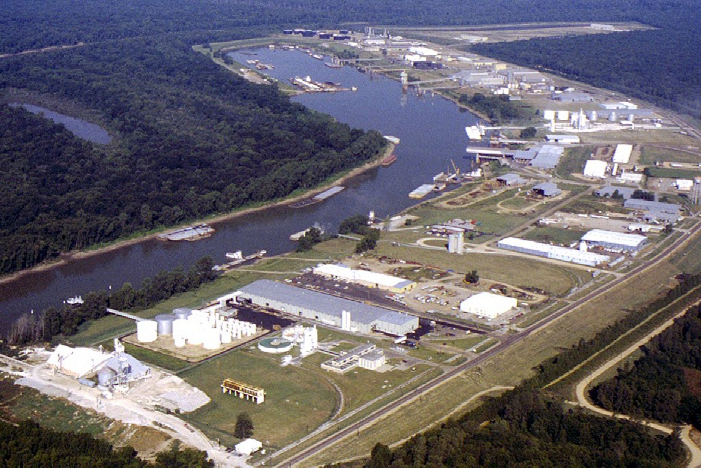
English: Aerial view of the Vicksburg Harbor, which is located on an arm of the Mississippi River at Vicksburg, Mississippi, USA. The harbor is located north of the main part of the city. View is to the west-northwest. |
|||
| 日付 | ||||
| 原典 |
U.S. Army Corps of Engineers Digital Visual Library Image page Image description page Digital Visual Library home page |
|||
| 作者 | Brad Emerson, U.S. Army Corps of Engineers | |||
| 許可 (ファイルの再利用) |
|
|||
| 場所 | Vicksburg, Mississippi, USA |
| カメラの位置 | | 以下のサービスでこの位置を確認する: オープンストリートマップ |
|---|
ファイルの履歴
過去の版のファイルを表示するには、その版の日時をクリックしてください。
| 日付と時刻 | サムネイル | 寸法 | 利用者 | コメント | |
|---|---|---|---|---|---|
| 現在の版 | 2007年4月6日 (金) 00:52 | | 1,500 × 1,000 (515キロバイト) | DanMS | {{Information | Description = {{en|Aerial view of the Vicksburg Harbor, which is located on an arm of the Mississippi River at Vicksburg, Mississippi, USA. The harbor is located north of the main part of the city. View is to the west-northwest.}} | |
ファイルの使用状況
以下のページがこのファイルを使用しています:
グローバルなファイル使用状況
以下に挙げる他のウィキがこの画像を使っています:
- fa.wikipedia.org での使用状況
- la.wikipedia.org での使用状況
- ru.wikipedia.org での使用状況
- sh.wikipedia.org での使用状況
- sr.wikipedia.org での使用状況
- uz.wikipedia.org での使用状況
- vi.wikipedia.org での使用状況
- zh.wikipedia.org での使用状況