
ファイル:Treasury Annex.JPG
このプレビューのサイズ: 800 × 551 ピクセル。 その他の解像度: 320 × 220 ピクセル | 640 × 441 ピクセル | 828 × 570 ピクセル。
元のファイル (828 × 570 ピクセル、ファイルサイズ: 109キロバイト、MIME タイプ: image/jpeg)
ウィキメディア・コモンズのファイルページにある説明を、以下に表示します。
|
| 解説 |
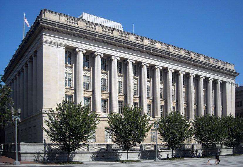
English: The Freedman's Bank Building, previously known as the United States Treasury Annex, is located at 701 Madison Place NW across the street from the Treasury Building in Washington, D.C. The Treasury Annex houses the Office of Foreign Assets Control, the Treasury Library, and the headquarters and main branch of the Treasury Department Federal Credit Union. Designed by architect Cass Gilbert, construction of the Beaux-Arts style building was completed in 1919. The building is designated a contributing property to the Lafayette Square Historic District and Fifteenth Street Financial Historic District and is listed on the District of Columbia Inventory of Historic Sites. The building was renamed in 2016 in honor of the Freedman's Savings Bank, which once stood on the site. |
| 日付 | |
| 原典 | 投稿者自身による著作物 |
| 作者 | APK |
| 許可 (ファイルの再利用) |
この作品の著作権者である私は、この作品を以下のライセンスで提供します。 このファイルはクリエイティブ・コモンズ 表示-継承 3.0 非移植ライセンスのもとに利用を許諾されています。
|
| カメラの位置 | | 以下のサービスでこの位置を確認する: オープンストリートマップ |
|---|
ファイルの履歴
過去の版のファイルを表示するには、その版の日時をクリックしてください。
| 日付と時刻 | サムネイル | 寸法 | 利用者 | コメント | |
|---|---|---|---|---|---|
| 現在の版 | 2022年4月24日 (日) 09:01 | | 828 × 570 (109キロバイト) | APK | angle |
| 2010年1月26日 (火) 07:47 |  | 3,208 × 2,209 (4.01メガバイト) | APK | {{Information |Description={{en|The Treasury Annex, located across the street from the U.S. Department of the Treasury headquarters, at 701 [[:en:Madison Place|M |
ファイルの使用状況
以下のページがこのファイルを使用しています:
グローバルなファイル使用状況
以下に挙げる他のウィキがこの画像を使っています:
- de.wikipedia.org での使用状況
- en.wikipedia.org での使用状況
- es.wikipedia.org での使用状況
- fa.wikipedia.org での使用状況
- he.wikipedia.org での使用状況
- ru.wikipedia.org での使用状況
- ru.wikinews.org での使用状況
- ur.wikipedia.org での使用状況
- www.wikidata.org での使用状況