
ファイル:The topography surrounding Sendai.jpg

元のファイル (6,330 × 5,879 ピクセル、ファイルサイズ: 4.69メガバイト、MIME タイプ: image/jpeg)
ウィキメディア・コモンズのファイルページにある説明を、以下に表示します。
|
概要
| 解説 |
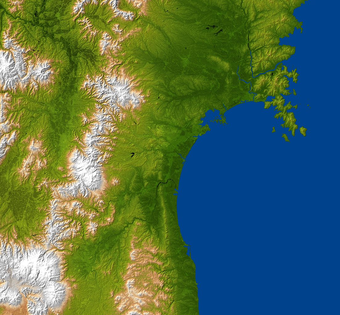
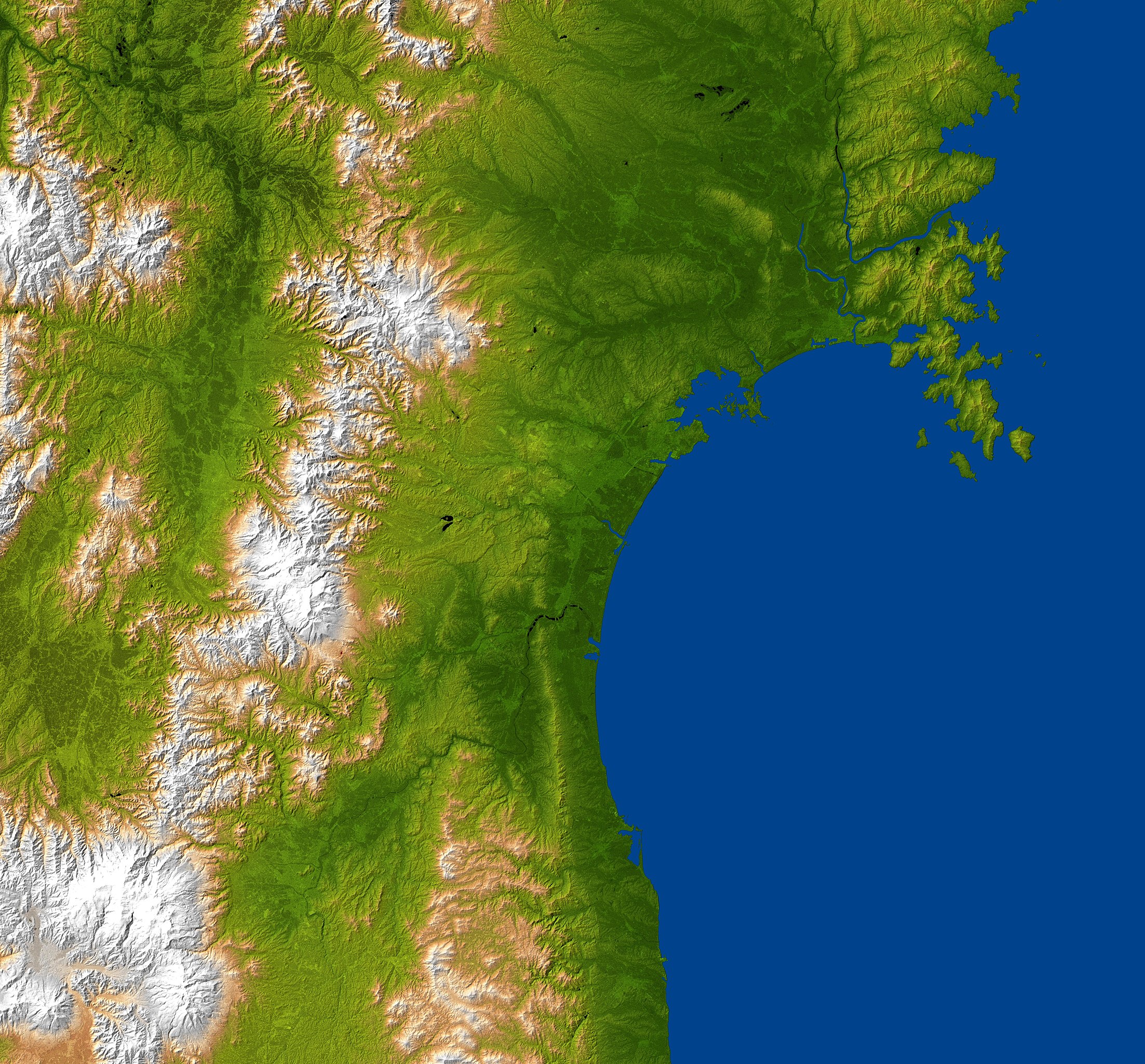
日本語: 仙台湾岸地域の地誌 English: The topography surrounding Sendai. “The city is centered in the image and lies along the coastal plain between the Ohu Mountains and the Pacific Ocean.”
This is a “combined radar image and topographic view generated with data from NASA's Shuttle Radar Topography Mission (SRTM)[1] […] This image combines a radar image acquired in February 2000 during the SRTM mission, and color-coding by topographic height using data from the same mission. […] The mission is a cooperative project between NASA, the National Geospatial-Intelligence Agency (NGA)[2] of the U.S. Department of Defense and the German[3] and Italian[4] space agencies. It is managed by NASA's Jet Propulsion Laboratory[5], Pasadena, Calif., for NASA's Science Mission Directorate, Washington, D.C.” Location: 38°15′N 140°51′E / 38.25°N 140.85°E 2011-03-11 |
| 日付 | |
| 原典 | http://photojournal.jpl.nasa.gov/catalog/PIA13912 |
| 作者 | NASA/JPL/NGA |
ライセンス
このイメージは、JPL-Caltech [6]にある 、NASAのShuttle Radar Topography Mission (SRTM)の高精細デジタル地形データを使用しています。これはアメリカ合衆国では パブリックドメインです。
|
 | |
|
|
 |
ファイルの履歴
過去の版のファイルを表示するには、その版の日時をクリックしてください。
| 日付と時刻 | サムネイル | 寸法 | 利用者 | コメント | |
|---|---|---|---|---|---|
| 現在の版 | 2011年9月3日 (土) 01:32 | | 6,330 × 5,879 (4.69メガバイト) | Dustsucker |
ファイルの使用状況
グローバルなファイル使用状況
以下に挙げる他のウィキがこの画像を使っています:
- de.wikipedia.org での使用状況
- fr.wikipedia.org での使用状況
- ko.wikipedia.org での使用状況
- ru.wikipedia.org での使用状況