
ファイル:Remote Sprint Launch Site No 2.jpg
このプレビューのサイズ: 750 × 600 ピクセル。 その他の解像度: 300 × 240 ピクセル | 601 × 480 ピクセル | 961 × 768 ピクセル | 1,280 × 1,023 ピクセル | 2,560 × 2,046 ピクセル | 4,535 × 3,625 ピクセル。
元のファイル (4,535 × 3,625 ピクセル、ファイルサイズ: 4.4メガバイト、MIME タイプ: image/jpeg)
ウィキメディア・コモンズのファイルページにある説明を、以下に表示します。
|
概要
| 解説 |
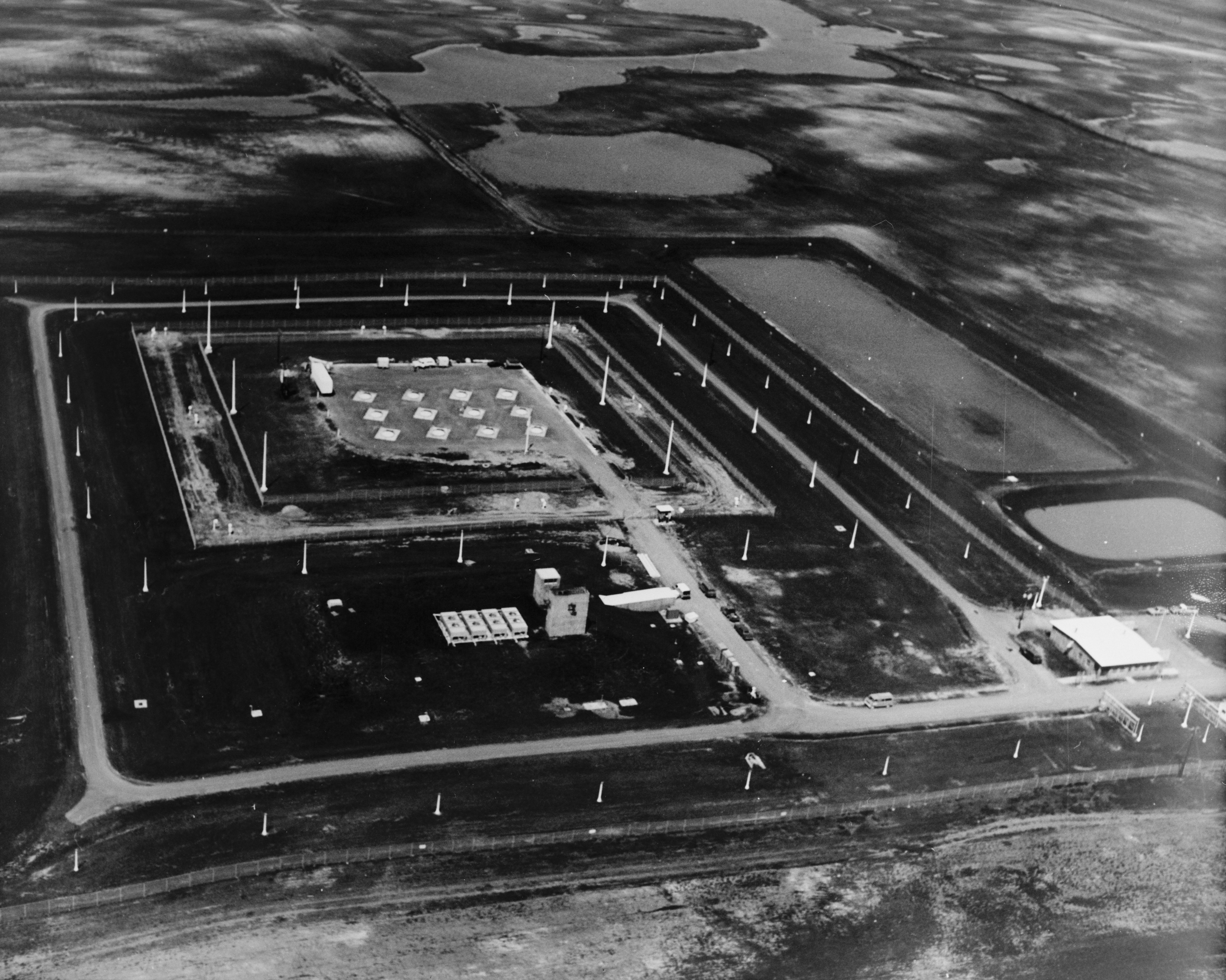
English: Stanley R. Mickelsen Safeguard Complex, Remote Sprint Launch Site No. 2, West of Mile Marker 220 on State Route 1, 6.0 mile, Nekoma vicinity, Cavalier County, ND
|
| 原典 | Library of Congress, Prints and Photograph Division, Historic American Engineering Record: HAER ND-9-X-3 |
| 作者 | 不明 |
ライセンス
| This image or media file contains material based on a work of a National Park Service employee, created as part of that person's official duties. As a work of the U.S. federal government, such work is in the public domain in the United States. See the NPS website and NPS copyright policy for more information. |
|

|
この画像はアメリカ合衆国議会図書館の印刷物・写真部門から入手できます。デジタル識別子は hhh.nd0086 です。
このタグは、添付された著作物の著作権状況を示すものではありません。通常の著作権タグも必要です。Commons:ライセンシングもご覧ください。
|
ファイルの履歴
過去の版のファイルを表示するには、その版の日時をクリックしてください。
| 日付と時刻 | サムネイル | 寸法 | 利用者 | コメント | |
|---|---|---|---|---|---|
| 現在の版 | 2009年5月2日 (土) 21:42 | | 4,535 × 3,625 (4.4メガバイト) | Cropbot | upload cropped version, operated by User:Finavon. Summary: border cropped |
| 2007年10月13日 (土) 04:20 |  | 4,827 × 3,893 (4.62メガバイト) | Dual Freq | {{Information |Description=Stanley R. Mickelsen Safeguard Complex, Remote Sprint Launch Site No. 2, West of Mile Marker 220 on State Route 1, 6.0 miles North of Langdon, ND, Nekoma vicinity, Cavalier County, ND. (HAER ND-9-X) |Source=[http://memory.loc.go |
ファイルの使用状況
以下のページがこのファイルを使用しています:
グローバルなファイル使用状況
以下に挙げる他のウィキがこの画像を使っています:
- en.wikipedia.org での使用状況
- fr.wikipedia.org での使用状況
- nl.wikipedia.org での使用状況
- ru.wikipedia.org での使用状況