
ファイル:Redwood City port aerial view.jpg

このプレビューのサイズ: 800 × 533 ピクセル。 その他の解像度: 320 × 213 ピクセル | 640 × 427 ピクセル | 1,024 × 683 ピクセル | 1,500 × 1,000 ピクセル。
元のファイル (1,500 × 1,000 ピクセル、ファイルサイズ: 853キロバイト、MIME タイプ: image/jpeg)
ウィキメディア・コモンズのファイルページにある説明を、以下に表示します。
|
概要
| カメラの位置 | | 以下のサービスでこの位置を確認する: オープンストリートマップ |
|---|
| 解説 |
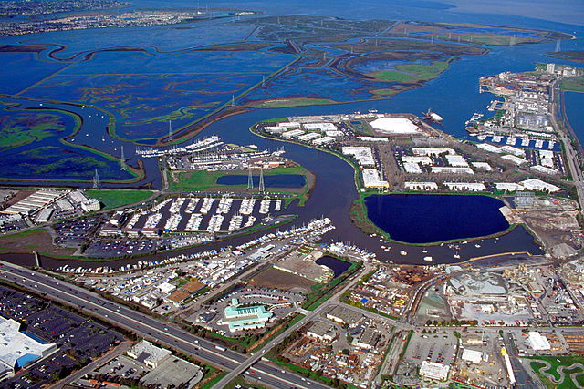
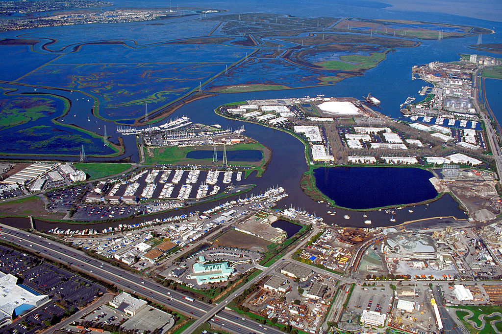
English: Aerial view of the port of Redwood City in San Mateo County, California, USA. The major deepwater port is visible at the far right in the photograph. Redwood Creek angles across the picture from lower left to upper right, forming the port and emptying into lower San Francisco Bay at the top. Corkscrew Slough winds across the wetlands of Bair Island at the top of the picture. View is to the northeast. |
|||
| 日付 | not specified or unknown | |||
| 原典 |
U.S. Army Corps of Engineers Digital Visual Library Image page Image description page Digital Visual Library home page |
|||
| 作者 | U.S. Army Corps of Engineers, photographer not specified or unknown | |||
| 許可 (ファイルの再利用) |
|
ファイルの履歴
過去の版のファイルを表示するには、その版の日時をクリックしてください。
| 日付と時刻 | サムネイル | 寸法 | 利用者 | コメント | |
|---|---|---|---|---|---|
| 現在の版 | 2007年5月5日 (土) 00:41 | | 1,500 × 1,000 (853キロバイト) | DanMS | {{Information | Description = {{en|Aerial view of the port of Redwood City in San Mateo County, California, USA. The major deepwater port is visible at the far right in the photograph. Redwood Creek angles across the picture from lower left to upper ri |
ファイルの使用状況
以下のページがこのファイルを使用しています:
グローバルなファイル使用状況
以下に挙げる他のウィキがこの画像を使っています:
- en.wikipedia.org での使用状況
- Portal:San Francisco Bay Area/Selected picture/Archive
- Portal:San Francisco Bay Area/Did you know/Archive
- Port of Redwood City
- Redwood Creek (San Mateo County)
- Portal:California/Selected picture/4
- Portal:California/Selected picture/Archives
- Portal:San Francisco Bay Area/Selected picture/61
- User:Mercurywoodrose/SFBA galleries
- Portal:San Francisco Bay Area/Did you know/52
- es.wikipedia.org での使用状況
- fi.wikipedia.org での使用状況
- ml.wikipedia.org での使用状況
- oc.wikipedia.org での使用状況
- ru.wikipedia.org での使用状況
- ur.wikipedia.org での使用状況
- www.wikidata.org での使用状況