
ファイル:Napa River Napa-Sonoma Marsh.jpg

このプレビューのサイズ: 800 × 534 ピクセル。 その他の解像度: 320 × 214 ピクセル | 640 × 427 ピクセル | 1,024 × 683 ピクセル | 1,500 × 1,001 ピクセル。
元のファイル (1,500 × 1,001 ピクセル、ファイルサイズ: 469キロバイト、MIME タイプ: image/jpeg)
ウィキメディア・コモンズのファイルページにある説明を、以下に表示します。
|
| 解説 |
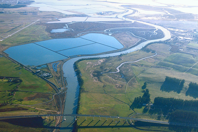
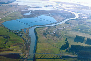
English: Aerial view of the southern end of the Napa River in Napa County, California, USA. The river empties into Napa-Sonoma Marsh (top) and then into San Pablo Bay at the northern end of San Francisco Bay. Most of this picture is located in Napa County. At the extreme top edge of the picture is the border with Solano County. View is to the south.
Coordinates: 38°13′28.91″N 122°17′45.7″W / 38.2246972°N 122.296028°W |
|||
| 場所 | Napa County, Califiornia, USA | |||
| 日付 | not specified or unknown | |||
| 原典 |
U.S. Army Corps of Engineers Digital Visual Library Image page Image description page Digital Visual Library home page |
|||
| 作者 | U.S. Army Corps of Engineers, photographer not specified or unknown | |||
| 許可 (ファイルの再利用) |
|
|||
| その他のバージョン |
.jpg)
ファイルの履歴
過去の版のファイルを表示するには、その版の日時をクリックしてください。
| 日付と時刻 | サムネイル | 寸法 | 利用者 | コメント | |
|---|---|---|---|---|---|
| 現在の版 | 2007年5月4日 (金) 02:53 | | 1,500 × 1,001 (469キロバイト) | DanMS | {{Information | Description = {{en|Aerial view of the southern end of the Napa River in Napa County, California, USA. The river empties into Napa-Sonoma Marsh (top) and then into San Pablo Bay at the northern end of San Francisco Bay. Most of this pict |
ファイルの使用状況
以下のページがこのファイルを使用しています:
グローバルなファイル使用状況
以下に挙げる他のウィキがこの画像を使っています:
- de.wikipedia.org での使用状況
- en.wikipedia.org での使用状況
- fr.wikipedia.org での使用状況
- it.wikipedia.org での使用状況
- nl.wikipedia.org での使用状況
- ru.wikipedia.org での使用状況
- www.wikidata.org での使用状況