
ファイル:Map of the Plains and Sierra Miwok territories (colored).png
このプレビューのサイズ: 786 × 599 ピクセル。 その他の解像度: 315 × 240 ピクセル | 630 × 480 ピクセル | 1,007 × 768 ピクセル | 1,280 × 976 ピクセル | 2,008 × 1,531 ピクセル。
元のファイル (2,008 × 1,531 ピクセル、ファイルサイズ: 2.18メガバイト、MIME タイプ: image/png)
ウィキメディア・コモンズのファイルページにある説明を、以下に表示します。
|
.png?uselang=ja)
.png?uselang=ja)
.png?uselang=ja&action=history)
.png)
概要
| 解説 |
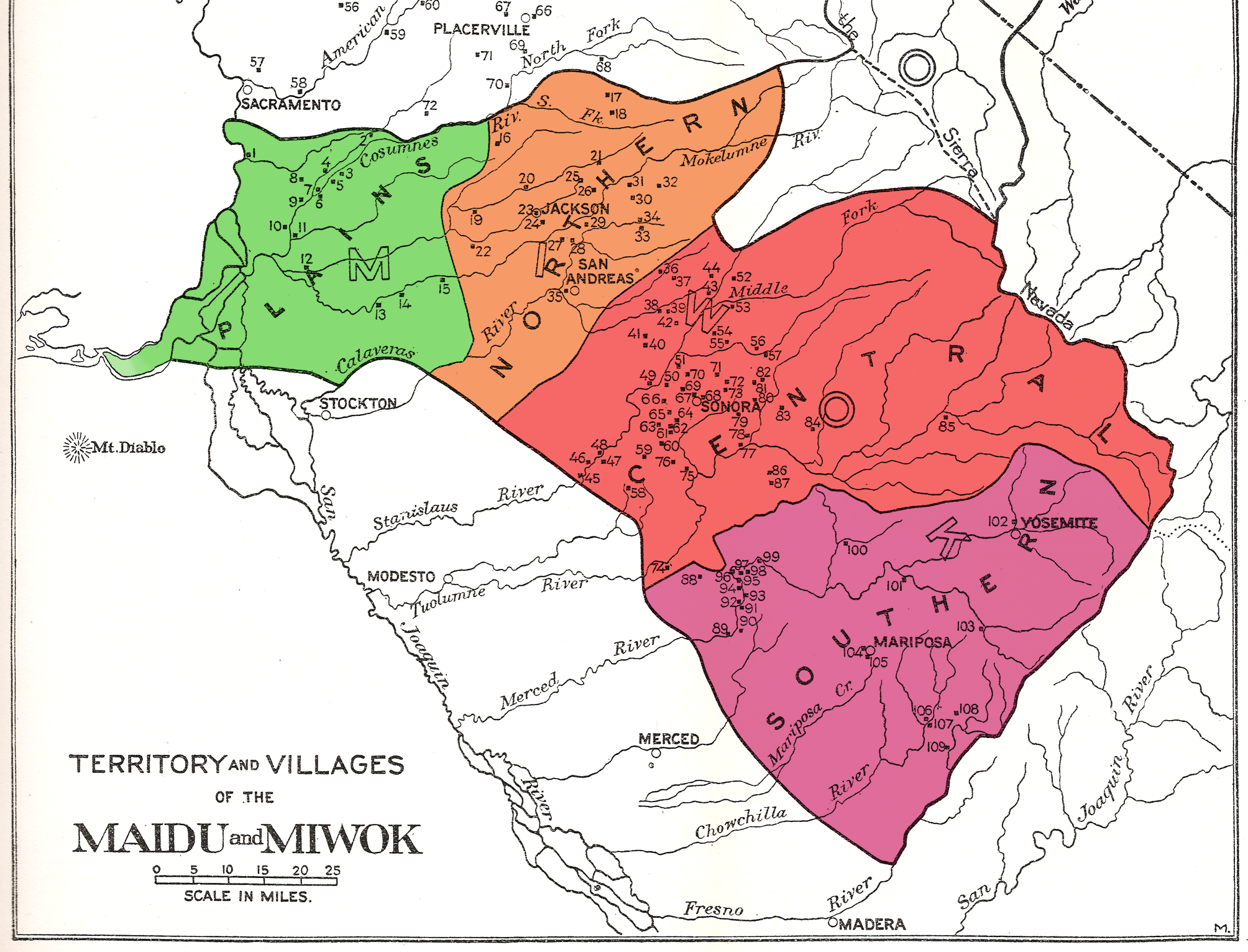
English: Map of the Plains and Sierra Miwok territories, an excerpt from the map titled "Territory and Villages of the Maidu and Miwok", taken from the Handbook of the Indians of California by Alfred L. Kroeber, published by the Bureau of American Ethnology in 1925. Edited: territories of Plains Miwok (green), Northern Sierra Miwok (orange), Central Sierra Miwok (red), and Southern Sierra Miwok (purple) indicated by color. |
| 日付 | |
| 原典 | derived from: Handbook of the Indians of California, published by the Bureau of American Ethnology 1925 |
| 作者 | Alfred L. Kroeber |
| その他のバージョン |
 |
ライセンス
このファイルは、アメリカ合衆国の連邦政府と雇用関係にある公務員がその職務上作成したアメリカ合衆国政府の著作物であり、アメリカ合衆国の著作権法上パブリックドメインに属します (17 U.S.C. §105)。
注意:このライセンスは、アメリカ合衆国政府の著作物についてのみ効力を有します。アメリカ合衆国の各州、郡、その他の地方自治体が作成した著作物に対しては適用できません。
|
 | |
| このファイルは著作権法の既知の制約(隣接権や関連する権利を含む)から自由であると特定されています。 | ||
ファイルの履歴
過去の版のファイルを表示するには、その版の日時をクリックしてください。
| 日付と時刻 | サムネイル | 寸法 | 利用者 | コメント | |
|---|---|---|---|---|---|
| 現在の版 | 2013年11月3日 (日) 16:23 | | 2,008 × 1,531 (2.18メガバイト) | DimiTalen | User created page with UploadWizard |
ファイルの使用状況
以下のページがこのファイルを使用しています:
グローバルなファイル使用状況
以下に挙げる他のウィキがこの画像を使っています:
- ca.wikipedia.org での使用状況
- en.wikipedia.org での使用状況
- es.wikipedia.org での使用状況
- he.wikipedia.org での使用状況
- nl.wikipedia.org での使用状況
.png)