
ファイル:London - John Norden's map of 1593.jpg

このプレビューのサイズ: 638 × 600 ピクセル。 その他の解像度: 255 × 240 ピクセル | 511 × 480 ピクセル | 817 × 768 ピクセル | 1,089 × 1,024 ピクセル | 2,179 × 2,048 ピクセル | 4,000 × 3,760 ピクセル。
元のファイル (4,000 × 3,760 ピクセル、ファイルサイズ: 4.01メガバイト、MIME タイプ: image/jpeg)
ウィキメディア・コモンズのファイルページにある説明を、以下に表示します。
|
| 解説 |
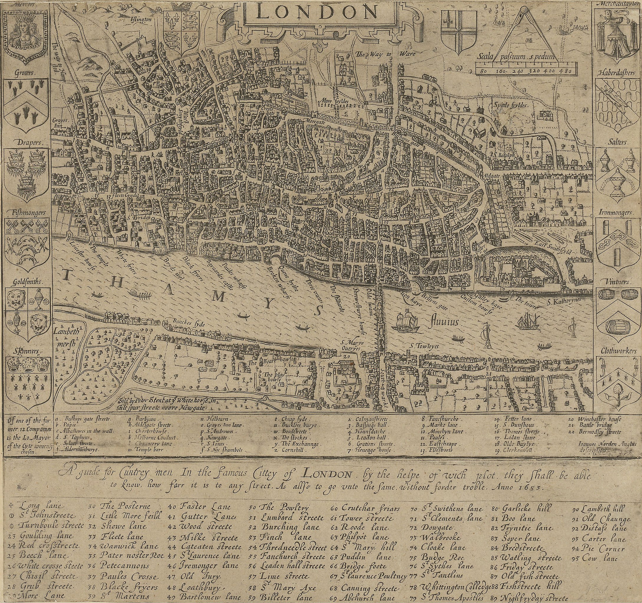
English: A guide for Cuntrey men In the famous Cittey of London. A map of London by John Norden, 1593. This copy comes from the 1653 edition of Norden's Speculum Britainiæ (Mirror of Britain), re-issued after his death.
There is only one bridge across the Thames, but parts of Southwark on the south bank of the river have been developed. The coats of arms around the edge belong to the twelve largest city guilds. These arms collectively were known as the "Great Liveries". Top right is the Merchant Tailors' arms.
|
||||
| 日付 | 1593, re-issued in 1653 | ||||
| 原典 | British Library: http://www.bl.uk/onlinegallery/onlineex/crace/a/007000000000001u00033000.html | ||||
| 作者 | John Norden | ||||
| 許可 (ファイルの再利用) |
|
||||
ファイルの履歴
過去の版のファイルを表示するには、その版の日時をクリックしてください。
| 日付と時刻 | サムネイル | 寸法 | 利用者 | コメント | |
|---|---|---|---|---|---|
| 現在の版 | 2010年2月19日 (金) 02:49 | | 4,000 × 3,760 (4.01メガバイト) | Inductiveload | much higher res version |
| 2007年5月21日 (月) 10:54 |  | 500 × 335 (43キロバイト) | Thomas Reid | {{Information |Description=John Norden's map of London in 1593. There is only one bridge across the Thames, but parts of en:Southwark on the south bank of the river have been developed. |Source=Originally from [http://en.wikipedia.org en.wikipedia]; |
ファイルの使用状況
以下のページがこのファイルを使用しています:
グローバルなファイル使用状況
以下に挙げる他のウィキがこの画像を使っています:
- ar.wikipedia.org での使用状況
- be-tarask.wikipedia.org での使用状況
- be.wikipedia.org での使用状況
- bg.wikipedia.org での使用状況
- en.wikipedia.org での使用状況
- en.wikibooks.org での使用状況
- eo.wikipedia.org での使用状況
- es.wikipedia.org での使用状況
- fa.wikipedia.org での使用状況
- ga.wikipedia.org での使用状況
- he.wikipedia.org での使用状況
- hr.wikipedia.org での使用状況
- hu.wikipedia.org での使用状況
- hy.wikipedia.org での使用状況
- it.wikipedia.org での使用状況
- kn.wikipedia.org での使用状況
- ko.wikipedia.org での使用状況
- my.wikipedia.org での使用状況
- ro.wikipedia.org での使用状況
- ru.wikipedia.org での使用状況
- sco.wikipedia.org での使用状況
- sh.wikipedia.org での使用状況
- sl.wikipedia.org での使用状況
- tum.wikipedia.org での使用状況
- uk.wikipedia.org での使用状況
- vi.wikipedia.org での使用状況
- zh.wikipedia.org での使用状況