
ファイル:Kreis-Herford-Admin-69.png
このプレビューのサイズ: 800 × 533 ピクセル。 その他の解像度: 320 × 213 ピクセル | 640 × 426 ピクセル | 1,024 × 682 ピクセル | 1,428 × 951 ピクセル。
元のファイル (1,428 × 951 ピクセル、ファイルサイズ: 250キロバイト、MIME タイプ: image/png)
ウィキメディア・コモンズのファイルページにある説明を、以下に表示します。
|
| 解説 |
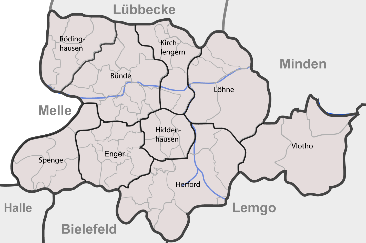
English: Communities of district of Herford as of 01-01-1969 after beeing reincorporated. |
| 日付 |
2007年10月12日 (当初のアップロード日) |
| 原典 | Based on Google Earth and Geoserver NRW |
| 作者 | Me, myself and I: de:Benutzer:TUBS |
| 許可 (ファイルの再利用) |
Use it and improve it |
| その他のバージョン | Adobe Illustator vector graphics available |
| 被写体の位置 | | 以下のサービスでこの位置を確認する: オープンストリートマップ |
|---|
ライセンス
| この著作物の著作権者である私は、この著作物における権利を放棄しパブリックドメインとします。これは全世界で適用されます。 一部の国では、これが法的に可能ではない場合があります。その場合は、次のように宣言します。 私は、あらゆる人に対して、法により必要とされている条件を除き、如何なる条件も課すことなく、あらゆる目的のためにこの著作物を使用する権利を与えます。 |
元のアップロードログ
de.wikipedia からコモンズに TUBS によって CommonsHelper を用いて移動されました。
元のファイルページはこちら。以下の利用者は全てde.wikipediaに属します。
- 2007-10-12 23:09 TUBS 1428×951× (256120 bytes) == Beschreibung, Quelle == {{Information |Beschreibung = Maps of [[Kreis Herford]] (Germany) series. Shows communities in [[Kreis Herford|district of Herford]] as of 01-01-1969 after beeing reincorporated. |Quelle = Based on Google Earth and Geoserver NR
- 2007-10-11 11:21 TUBS 1940×1301× (392616 bytes) {{Information |Beschreibung = |Quelle = |Urheber = |Datum = |Genehmigung = |Andere Versionen = |Anmerkungen = }}
- 2007-10-11 11:12 TUBS 598×844× (100160 bytes) == Beschreibung, Quelle == {{Information |Beschreibung = Maps of [[Kreis Herford]] (Germany) series. Shows districts (Ãmter) and communities (Gemeinden, Städte) in rural and urban (Stadt- und Landkreis) district of Herford as of 12-31-1969 |Quelle = Bas
ファイルの履歴
過去の版のファイルを表示するには、その版の日時をクリックしてください。
| 日付と時刻 | サムネイル | 寸法 | 利用者 | コメント | |
|---|---|---|---|---|---|
| 現在の版 | 2008年12月27日 (土) 14:12 | | 1,428 × 951 (250キロバイト) | File Upload Bot (Magnus Manske) | {{BotMoveToCommons|de.wikipedia}} {{Information |Description={{de|Maps of de:Kreis Herford (Germany) series. Shows communities in district of Herford as of 01-01-1969 after beeing reincorporated as a new district.}} |Source=Tr |
ファイルの使用状況
以下のページがこのファイルを使用しています:
グローバルなファイル使用状況
以下に挙げる他のウィキがこの画像を使っています:
- de.wikipedia.org での使用状況