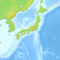
ファイル:Japan relief location map with side map of the Ryukyu Islands.jpg

このプレビューのサイズ: 664 × 600 ピクセル。 その他の解像度: 266 × 240 ピクセル | 531 × 480 ピクセル | 850 × 768 ピクセル | 1,133 × 1,024 ピクセル | 2,497 × 2,256 ピクセル。
元のファイル (2,497 × 2,256 ピクセル、ファイルサイズ: 2.25メガバイト、MIME タイプ: image/jpeg)
ファイルの履歴
過去の版のファイルを表示するには、その版の日時をクリックしてください。
| 日付と時刻 | サムネイル | 寸法 | 利用者 | コメント | |
|---|---|---|---|---|---|
| 現在の版 | 2022年3月9日 (水) 21:18 |  | 2,497 × 2,256 (2.25メガバイト) | Sting | == {{int:filedesc}} == {{Location|37|56|24|N|138|45|18|E|scale:10000000}} {{Information |description={{en|Blank relief location map of {{W|Japan}}, with the main islands on the main map and the {{W|Ryukyu Islands}}, aka Nansei Islands, on a secondary map.}} {{fr|Carte physique vierge du {{Wf|Japon}} destinée à la géolocalisation avec les îles principales sur la carte principale et l’{{Wf|archipel Nansei}} sur une carte secondaire.}} *Equirectangular projection; WGS84 datum *Scale: 1:3,060,000... |
ファイルの使用状況
グローバルなファイル使用状況
以下に挙げる他のウィキがこの画像を使っています:
- fr.wikipedia.org での使用状況
- Chiba
- Hiroshima
- Kagoshima
- Kyoto
- Mont Fuji
- Nagasaki
- Osaka
- Sapporo
- Seto
- Shinjuku
- Shibuya
- Yokohama
- Nara
- Sendai
- Fukui
- Minamata
- Yokosuka
- Saga (Saga)
- Nikkō
- Nagoya
- Matsuyama (Ehime)
- Imabari
- Tanabe (Wakayama)
- Kumamoto
- Fukuoka
- Fukushima (Fukushima)
- Jeux olympiques d'hiver de 1972
- Jeux olympiques d'hiver de 1998
- Centrale nucléaire de Mihama
- Bataille de Tsushima
- Mito
- Nagano
- Naha
- Izu
- Kamakura
- Hitachiōmiya
- Shizuoka
- Kobe
- Baie de Tokyo
- Zushi
- Détroit de La Pérouse
- Himeji
- Ōita
- Ise (Mie)
- Kokura
- Aomori
- Tottori
- Takatsuki
- Kitakyūshū
- Kōchi
このファイルのグローバル使用状況を表示する。


