
ファイル:Greenlee County Incorporated and Unincorporated areas.svg

この SVG ファイルのこの PNG プレビューのサイズ: 240 × 600 ピクセル. その他の解像度: 96 × 240 ピクセル | 192 × 480 ピクセル | 307 × 768 ピクセル | 409 × 1,024 ピクセル | 819 × 2,048 ピクセル | 400 × 1,000 ピクセル。
元のファイル (SVG ファイル、400 × 1,000 ピクセル、ファイルサイズ: 21キロバイト)
ウィキメディア・コモンズのファイルページにある説明を、以下に表示します。
|
概要
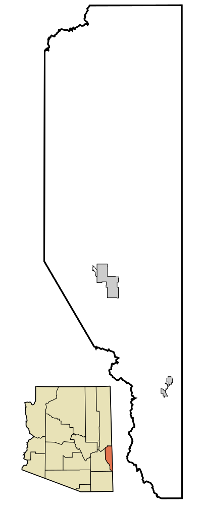
| 解説 | This map shows the incorporated areas and unincorporated areas in Greenlee County, Arizona. Incorporated cities are shown in gray and unincorporated communities or CDPs are shown in white. Data for the borders and locations are based on maps from the US Census Bureau TIGER Map Server. I created this map in Inkscape. |
| 日付 | |
| 原典 | My own work, based on public domain information |
| 作者 | Ixnayonthetimmay |
| その他のバージョン | See Maps of Greenlee County for other versions of this image. |
| SVG 開発 |
ライセンス
| この著作物の著作権者である私は、この著作物における権利を放棄しパブリックドメインとします。これは全世界で適用されます。 一部の国では、これが法的に可能ではない場合があります。その場合は、次のように宣言します。 私は、あらゆる人に対して、法により必要とされている条件を除き、如何なる条件も課すことなく、あらゆる目的のためにこの著作物を使用する権利を与えます。 |
ファイルの履歴
過去の版のファイルを表示するには、その版の日時をクリックしてください。
| 日付と時刻 | サムネイル | 寸法 | 利用者 | コメント | |
|---|---|---|---|---|---|
| 現在の版 | 2014年10月12日 (日) 03:31 | 400 × 1,000 (21キロバイト) | Wereldburger758 | Valid SVG now. | |
| 2007年3月6日 (火) 19:10 | 400 × 1,000 (76キロバイト) | Ixnayonthetimmay | {{Information |Description=This map shows the incorporated areas and unincorporated areas in Greenlee County, Arizona. Incorporated cities are shown in gray | ||
| 2007年3月6日 (火) 19:08 | 400 × 1,000 (76キロバイト) | Ixnayonthetimmay | {{Information |Description=This map shows the incorporated areas and unincorporated areas in Greenlee County, Arizona. Incorporated cities are shown in gray | ||
| 2007年3月6日 (火) 03:19 | 400 × 1,000 (46キロバイト) | Ixnayonthetimmay | {{Information |Description=This map shows the incorporated areas and unincorporated areas in Greenlee County, Arizona. Incorporated cities are shown in gray |
ファイルの使用状況
以下のページがこのファイルを使用しています:
グローバルなファイル使用状況
以下に挙げる他のウィキがこの画像を使っています:
- en.wikipedia.org での使用状況
- nl.wikipedia.org での使用状況