
ファイル:George Mayo Map.png
高解像度版はありません。
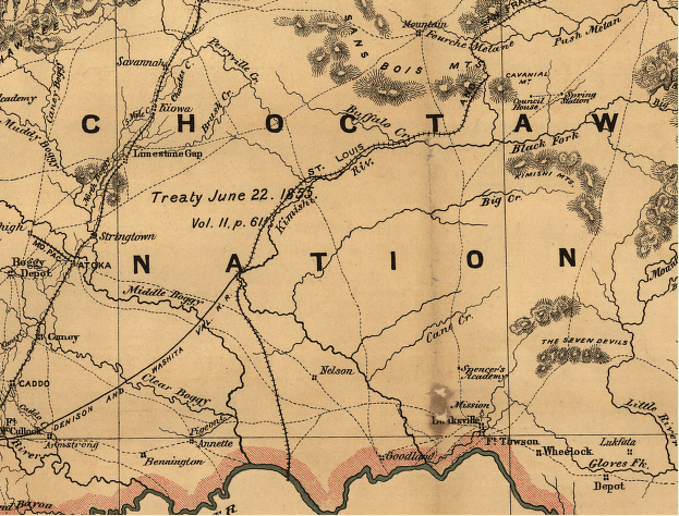
George_Mayo_Map.png (623 × 474 ピクセル、ファイルサイズ: 525キロバイト、MIME タイプ: image/png)
ウィキメディア・コモンズのファイルページにある説明を、以下に表示します。
|
概要
| 解説 |
English: Indian territory: compiled from the official records of the records of the General Land Office and other sources under supervision of Geo. U. Mayo. |
||
| 日付 | |||
| 原典 |
|
||
| 作者 | George U. Mayo, General Land Office (U.S. Government agency). |

ライセンス
このファイルは、アメリカ合衆国の連邦政府と雇用関係にある公務員がその職務上作成したアメリカ合衆国政府の著作物であり、アメリカ合衆国の著作権法上パブリックドメインに属します (17 U.S.C. §105)。
注意:このライセンスは、アメリカ合衆国政府の著作物についてのみ効力を有します。アメリカ合衆国の各州、郡、その他の地方自治体が作成した著作物に対しては適用できません。
|
 | |
| このファイルは著作権法の既知の制約(隣接権や関連する権利を含む)から自由であると特定されています。 | ||
元のアップロードログ
元のファイルページはこちら。以下の利用者は全てen.wikipediaに属します。
- 2010-01-01 20:27 Oklahombre 623×474× (537527 bytes) {{Information |Description = Indian territory: compiled from the official records of the records of the General Land Office and other sources under supervision of Geo. U. Mayo. |Source = Library of Congress. http://memory.loc.gov/cgi-bin/que
ファイルの履歴
過去の版のファイルを表示するには、その版の日時をクリックしてください。
| 日付と時刻 | サムネイル | 寸法 | 利用者 | コメント | |
|---|---|---|---|---|---|
| 現在の版 | 2010年6月4日 (金) 23:27 | | 623 × 474 (525キロバイト) | File Upload Bot (Magnus Manske) | {{BotMoveToCommons|en.wikipedia|year={{subst:CURRENTYEAR}}|month={{subst:CURRENTMONTHNAME}}|day={{subst:CURRENTDAY}}}} {{Information |Description={{en|Indian territory: compiled from the official records of the records of the General Land Office and othe |
ファイルの使用状況
以下のページがこのファイルを使用しています:
グローバルなファイル使用状況
以下に挙げる他のウィキがこの画像を使っています:
- ca.wikipedia.org での使用状況
- en.wikipedia.org での使用状況
- zh.wikipedia.org での使用状況